Helping Haiti
What can you do to help if you’re too busy? Text "Haiti" to 90999, and you’ll be billed $10 as a donation to the Red Cross.
GeoEye-1 spacecraft captured this image:
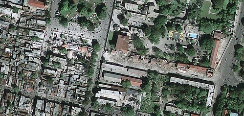
This half-meter resolution satellite image shows Port-au-Prince, Haiti after a 7.0-magnitude earthquake struck the area on Jan. 12, 2010. The image clearly shows extensive damage, roads covered with debris from collapsed structures, and people crowded in the streets and public places such as sports fields and stadiums. The white-colored National Palace shows damage along the roof line. The image was taken by the GeoEye-1 satellite from 423 miles in space at 10:27 a.m. EST on Jan. 13, 2010 as it moved from north to south over the Caribbean at a speed of four miles per second.
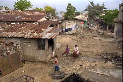
Here’s a little "Bible-thumping" effort in Haiti worth watching, if only to see how people live…
Real Hope For Haiti from Corrigan Clay on Vimeo.
;