Archive for the ‘Observation’ Category

Welcome Back Horowitz

Thursday, July 16th, 2009

While I was away earlier this month, Andy Pasztor wrote a piece in the WSJ on former SES AMERICOM CEO Ed Horowitz teaming up with former International Launch Services CEO Mark Albrecht to form U.S. Space:

A clutch of former Pentagon brass is helping to start a company that offers a new service: satellites intended solely for military communications that would be built, launched and owned by private investors.

The new company, called U.S. Space LLC, attempts to meet a need that the U.S. military has struggled to fill. As U.S. forces deploy to out-of-the-way regions, the Pentagon frequently needs more satellite capacity for communications and distribution of video surveillance than it can get its hands on.

The military’s own satellites are expensive, and often take too long to deploy to satisfy fast-changing battlefield needs. Meanwhile, the military hasn’t always been able to lease sufficient bandwith on traditional commercial satellites, particularly in remote areas such as Afghanistan.

The new company intends to build and launch relatively small and inexpensive commercial satellites that would be optimized for military use and leased only to military customers, according to Mark Albrecht, the company’s chairman and co-founder.

Backers said the price of the satellites would be held down by keeping them small, modular and relatively basic, without tailoring them for special needs and piling on bells and whistles.

"This is absolutely responsive" to the Pentagon’s needs for quickly supplementing current capacity wherever it’s needed, said Mr. Albrecht, a former head of Lockheed Martin Corp.’s international rocket business.

The company’s board members count three former Air Force generals, including retired Lt. Gen. Michael Hamel, who until recently served as the military’s top uniformed space-acquisition official; retired Major General James Armor, a former space policy maker; retired Major General Craig Weston, who is also the president and chief executive of U.S. Space. The company’s backers include firms headed by former Attorney General John Ashcroft and former Defense Secretary William Cohen.

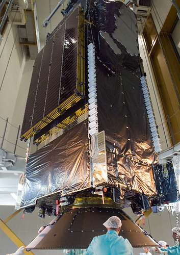
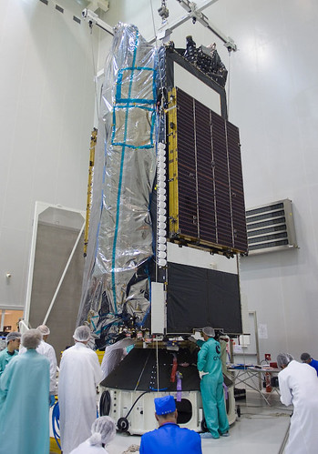
Each proposed high-altitude satellite is envisioned to cost less than half of the roughly $350 million price tag for building and launching a large, top-of-the-line commercial satellite. The Pentagon and various national-security customers already lease significant commercial capacity, often at expensive spot rates that by some estimates amount to more than $800 million annually.

In addition to being less costly, the venture aims to be more flexible because the in-orbit locations and transmission frequencies specifically will be intended for military uses.

The U.S. Space models are intended to be ready for service in roughly three years, versus a decade or more in development for most Pentagon satellites.

The project is risky, partly because no firm financing or contracts to supply capacity have been signed. The Pentagon is notorious for balking at long-term satellite leasing arrangements.

But military brass "have really endorsed" the commercial approach and "encouraged us to continue the discussions," said Edward Horowitz, a U.S. Space co-founder and former president of the U.S. unit of global satellite-services giant SES Global.

Industrial firms backing the venture include a group of second-tier aerospace contractors led by Orbital Sciences Corp., which is in line to build the satellites and launch them with a beefed-up version of its Minotaur rockets.

Ed was the inspiration and force behind this blog, and Mark was at helm of ILS when they began publishing their launch blogs. They will surely impact the commercial space business.


Broadband Stimulus in Space

Wednesday, July 15th, 2009


Terrestar-1 was launched a couple of weeks ago. In-orbit testing is going well, and the antenna is up. Wish we could say the same about the Solaris Mobile bird.

As we’ve blogged before, the company behind it has an interesting propostion: a diverse path for communicating via smartphone.  No signal? No problem: connect via satellite.

More interesting is they’ll be one of many satcom-based communications companies going after some of the US$7.2 billion set aside for broadband, as reported by the Wall Street Journal:

 The launch is significant because it could make the case to policymakers, who may have government grants or business to offer, that satellite Internet service is a viable alternative to cable or cellular hookups.

The sheer size of TerreStar’s satellite, which has a 60-foot antenna, will ensure that military personnel, emergency responders, and rural customers are always connected, said TerreStar President Jeff Epstein.

TerreStar has developed a smart phone that operates both on its satellite network and a traditional cellular network. The company has secured a roaming agreement with AT&T Inc. (T), and it could pursue similar agreements with other wireless carriers.

"Off the network grid, you can make calls via the satellite," Epstein said. "It’s a redundant path."

TerreStar will be among the first satellite carriers to offer Internet speeds that are comparable to high-speed WiFi or cellular broadband. That could make the company eligible for some of the $7.2 billion in economic stimulus money for high-speed Internet connections in unserved and rural areas.

Right now, government officials and industry analysts say satellite Internet service is too spotty and slow to be a good candidate for the government money.

The advantage of satellite service, however, is that it can cover much wider swaths of the country than other types of connections.

With a robust network, satellite could become the ideal method to deliver high-speed Internet to sparsely populated areas, a top priority of President Barack Obama.

But TerreStar’s Internet service rollout might be too late for an economic stimulus subsidy. By law, the government Internet grant money must be distributed by the end of September 2010, which means grant makers will start allocating the last round of funds sometime next spring.

Before TerreStar can start selling voice and data service, it has to test its network in orbit. Epstein said he wants to complete that testing by the end of the year.

SkyTerra Communications Inc. (SKYT) has similar plans to offer mobile Internet services. It announced earlier this month that it will launch one of two next-generation satellites in the first half of 2010.

Both SkyTerra and TerreStar have agreements with Qualcomm Inc. (QCOM) and Infineon Technologies AG (IFNNY) to develop more models of regular-size satellite-cellular devices.

More power to them!

Here’s the launch video, courtesy of Space Systems/Loral


ICESAT, Baby!

Wednesday, July 8th, 2009


Does Vanila Ice care about "global warming?" He probably does. As do many others, adding drama to real science.

NASA’s been at it, too, but only now are we talking about a dramatic change in the Arctic ice. The spacecraft, ICESat, uses laser light to measure the Earth’s ice:

ICESat is designed to observe seasonal and interannual variations in surface elevation that are caused by variations in precipitation (snowfall) and surface melting. These data will be used in energy-balance models and to test the results of atmospheric circulation models used to predict climate-induced changes. ICESat should detect changes in mass balance expected for each 1 degree change in polar temperatures (depends on sensitivity estimate). ICESat measurements are essential for making reliable assessments of whether future changes in ice volume will add to the sea level rise, which is already occurring due to the warming and thermal expansion of the oceans and worldwide melting of small glaciers, or whether the ice sheets might grow and absorb a significant part of the predicted sea level rise.

Now comes the drama, from the Great White North, via Canada.com:

Arctic sea ice thinned dramatically between the winters of 2004 and 2008, with thin seasonal ice replacing thick older ice as the dominant type for the first time on record, data from a NASA Earth-orbiting spacecraft has revealed.

Calling it the most comprehensive survey to date, scientists from NASA and the University of Washington say the information provides "further evidence for the rapid, ongoing transformation of the Arctic’s ice cover."

"The thickness and volume of the ice cover is continuing to decline, making the ice more vulnerable to continued shrinkage," NASA research team leader Ron Kwok said. "Our data will help scientists better understand how fast the volume of Arctic ice is decreasing and how soon we might see a nearly ice-free Arctic in the summer."

Using measurements from NASA’s Ice, Cloud and Land elevation satellite — ICESat — scientists found that overall Arctic sea ice thinned nearly 18 centimetres a year for a total of 72 centimetres over four years.

The data also shows that the total area covered by the thicker, older "multi-year" ice that has survived one or more summers shrank by 42 per cent.

Kwok said ICESat allows scientists to monitor ice thickness and volume changes over the entire Arctic Ocean for the first time.

 Check out the video…


500 Spot Beams

Wednesday, June 24th, 2009


Awesome: Arianespace is in final preparations for launching the world’s largest communications satellite ever.  The spacecraft was mated with the launcher yesterday. The launch is scheduled for 1 July 2009. Their stock price could use a little "launch," too.

The ensuing satcom smartphone, running Windows Mobile, will be offered by AT&T, according to Computerworld:

The carrier will resell satellite service and phones from TerreStar Networks, a startup that is set to have its first satellite launched on July 1. TerreStar is developing hybrid satellite/cellular handsets designed to be about the same size as a conventional smartphone.

TerreStar’s satellite will sit 22,000 miles above North America and provide service across the U.S. and Canada, including Alaska, Hawaii, Puerto Rico and the U.S. Virgin Islands. Using licensed 2GHz radio spectrum, it will provide voice service as well as data at approximately 64K bits per second, said TerreStar Chief Technology Officer Dennis Matheson.

AT&T will resell that service in a hybrid offering, aimed initially at local, state and federal governments, Matheson said. The carrier will also resell the handsets, though not initially in its retail stores. The handsets will switch between satellite and 3G (third-generation) coverage as users roam in and out of cellular coverage areas. TerreStar is still working on a resale deal with a Canadian carrier.

Satellite phones have the advantage of working essentially anywhere across a region of the world, but the market has been limited by large handsets and high prices for devices and service. TerreStar is taking advantage of SDR (software-defined radio) chips coming from Infineon and Qualcomm to integrate satellite capability into the same processors that handle cellular connectivity. This will help the company match the size of other smartphones and eventually bring the cost of its handsets down to that of a BlackBerry, Matheson said. Qualcomm’s work should lead to a satellite and CDMA (Code-Division Multiple Access) phone, which might allow for a future hybrid service from Verizon or Sprint Nextel.

The spacecraft itself is very cool — with 500 spot beams and a beam forming technology developed by HNS:

Dennis Matheson, TerreStar Networks CTO said, “The design, manufacture and delivery of TerreStar-1 has been a team effort. We have relied on our colleagues at Space Systems/Loral for their experience and support in delivering the integrated satellite and ground system that makes our new services possible. We now look forward to a flawless launch by our partner Arianespace.”

“It has been a pleasure working with TerreStar Networks on this challenging project,” said John Celli, president and chief operating officer at Space Systems/Loral.  “With its 18-meter unfurlable reflector and extraordinarily powerful S-Band feed array, TerreStar-1 was designed to provide next generation capability for mobile devices.”

Ideally suited to provide critical services to government, emergency responders, rural communities and commercial users, the satellite uses 2 GHz spectrum to provide voice, data and video communications to satellite/terrestrial mobile devices the size of a typical smart phone.  Space Systems/Loral, working with Hughes Network Systems, has developed a two-way ground based beam forming technology that enables the satellite to reallocate resources based on demand, thereby maximizing capacity.

TerreStar-1 is based on SS/L’s 1300 space-proven platform, which provides the flexibility to support a broad range of applications and technology advances. The satellite will be capable of generating over five hundred spot beams covering the Continental U.S., Canada, Alaska, Hawaii, Puerto Rico, and the U.S. Virgin Islands.

Arianespace will probably webcast the launch (expect a media advisory in a few days). Terrestar’s annoying us with registration on their "Countdown to Communicate" site. Yeah, I registered and I’m still waiting for my e-mail confirmation. If it doesn’t arrive in seconds, you lost me.

Overall, they seem to be doing things rights. With Dean Olmstead on their Board, would you expect anything less?

WBMSAT Satellite Industry News Bits for June 19, 2009

Friday, June 19th, 2009


Space Systems/Loral awarded Intelsat contract for Intelsat-19 and Intelsat-20, to be among the most powerful FSS satellites ever built.
[SatNews – 06/18/2009]


Lunar Reconnaissance Orbiter and Lunar Crater Observation and Sensing Satellite probes paired together atop Atlas V rocket; successfully launched Thursday, June 18.
[SatNews – 06/18/2009]


SES AMERICOM-NEW SKIES completes multi-year agreement with Teleport Access Services to provide three transponders on NSS-11 to distribute at many as 50 Chinese television channels to cable households in Taiwan.
[SatNews – 06/18/2009]


Satellite-based upgrade of air-traffic management under development by the U.S. Federal Aviation Administration for four years is to ascertain aircraft positions more accurately and provide severe weather information to cockpits.
[Bloomberg – 06/18/2009]


Thuraya appoints Teknikkom Electronic as National Service Provider in Malaysia.
[SatNews – 06/18/2009]


Boeing transfers control of the second Wideband Global Satcom satellite to the Air Force.
[Defense Systems – 06/18/2009]


MTN, a SeaMobile company, and ERZIA, announce project to build teleport in Santander, North Spain to provide services in X-, C-, and Ku-bands.
[SatNews – 06/18/2009]


Spacecom announces that National Geographic will launch its newest channel, National Geographic Wild, in Romania over the AMOS-3 satellite.
[SatNews – 06/18/2009]


Thales Alenia Space and HISPASAT sign contract with Thales Alenia Space Espana for development and supply of REDSAT advanced communication payload for AG1, a GEO mission.
[SatNews – 06/18/2009]


Iridium and Cambridge Consultants win 2009 GTB Innovation Award for excellence in Wireless Network Infrastructure Innovation.
[SatNews – 06/18/2009]


Fulcrum Maritime Systems offers Long-Range Identification and Tracking services using Iridium satellite network.
[SatNews – 06/18/2009]


European Space Agency signs agreement with Thales Alenia Space to develop atmospheric reentry demonstrator Intermediate eXperimental Vehicle.
[SatNews – 06/18/2009]


NASA Lunar Reconnaissance Orbiter to use Israeli technology to link various components of the satellite and pass data between them.
[Jerusalem Post – 06/17/2009]


NASA postpones launch of STS-127 due to Hydrogen leak; next available date for launch is July 11.
[SatNews – 06/17/2009]


Arianespace  selected by ST-2 Satellite Ventures of Singapore to launch new telecommunications satellite ST-2, and by Asia Broadcast Satellite to launch ABS-2.
[SatNews – 08/17/2009]


Inmarsat launches BGAN X-Stream service in Asia-Pacific region.
[Satellite Today – 06/17/2009]


Open Range selects Israeli WiMax equipment supplier Alvarion as it builds out WiMax delivery to remote areas using Globalstar’s hybrid satellite broadband network .
[Telephony online – 06/17/2009]


G6 provides continental United States wide voice and data satellite communications to Global Medic medical companies for all U.S. military services except Coast Guard.
[DVIDS – 06/17/2009]


NAB asks Congress to preserve localism in satellite rewrite, to ensure advertisers continue to be able to target certain audiences.
[SmartBrief – 06/17/2009]


Digital Britain report outlines plans for UK’s digital transition, with three-year National Plan to improve Digital Participation, promising universal Access to broadband services by 2012.
[Department for Culture, Media, and Sport – 06/16/25009]


Eutelsat welcomes Digital Britain report, stating that the Universal Service Commitment to deliver 2Mbps broadband service to all U.K. residents by 2021 can be delivered today using existing satellite technology.
[SatNews – 06/16/2009]


Hughes Network Systems plans launch of next-generation 100 Gbps throughput Ka band satellite using IPoS standard in 2012 to expand broadband network service across North America.
[Market Watch – 06/16/2009]


DARPA awards contract for phase 2 of Fast Access Spacecraft Testbed satellite power generation and propulsion program to Boeing.
[Satellite Today – 06/16/2009]


Research report on China’s VSAT market states that China’s VSAT market achieved stable development in 2008, with satellite companies facing new opportunities and obtaining rapid growth.
[BusinessWire – 06/16/2009]


Satellite operators pledge not to exploit analog loophole to import distant network affiliate signals into local markets.
[Broadcasting & Cable – 06/16/2009]


NAB looks at satellite  companies’ proposal to share costs of getting local-into-local into all 212 markets.
[Broadcasting & Cable – 06/16/2009]


Expand Networks WAN optimization technology selected by IPSTAR to enhance its satellite based managed service offering.
[Market Watch – 06/16/2009]


Avanti plans large Ka band satellites to fill broadband gaps in the UK at speeds up to 2 Mbps on the Hylas satellite and the capability of greater speeds on the follow-on Hercules satellites.
[BBC News – 06/15/2009]


Gilat announces new multi-star VSAT networking solution, NetEdge.
[Globe Newswire – 06/15/2009]


Number of free-to-air satellite TV channels in the Middle East grows 30% in 18 months.
[Satelllite Today – 06/15/2009]


Eurovision incorporates new Ku-band capacity on Eutelsat W2A into global network, and C-band capacity for Africa coverage.
[PR Newswire – 06/15/2009]


$257 billion spent on space last year, with two-thirds coming from the private sector.
[ieee spectrum – June 2009]


Planetary geologists speculate that the moon’s polar craters may hold billions of tons of hydrogen, fueling the concept of mining the moon.
[ieee spectrum – June 2009]


WBMSAT PS – Satellite Communications Consulting Services 


TerreStar Launch Slips

Wednesday, June 10th, 2009


Last month, Eutelsat reported an on-orbit anomaly to its W2A spacecraft’s S-band payload. Although disclosure of this type is material to a  firm’s financial performance, most spacecraft bus and/or payload anomalies are shared with other operators.

Unlike the business side, spacecraft engineering departments know what their counterparts are up to — especially when it comes to anomalies. On-orbit anomalies? Everybody knows about them almost instantly, although it may not become public information for weeks or months.

For those designing/building payloads on the ground, this is absolutely essential information. Make changes now, or "pfft," you’re done. That’s why the TerreStar-1’s launch is slipping a few weeks:

…the launch of TerreStar-1 has been rescheduled for a July 7-12, 2009 window to permit additional time to ensure that an on-orbit anomaly that occurred recently on another operator’s satellite has no bearing on the flight worthiness of TerreStar-1.

"While our vendors have assured us that TerreStar-1 is ready to launch, we believe this short delay may provide a window for additional data to verify that TerreStar-1, including its 18 meter reflector, is unaffected by the anomaly reported by another operator’s S Band satellite," Dennis Matheson, CTO of TerreStar said.

Arianespace, TerreStar-1’s launch services provider, has agreed to this updated launch schedule.

"Throughout the construction of TerreStar-1 we have emphasized quality and certainty over speed. Today’s revised launch schedule is another example of our commitment to eliminate unnecessary risks when we can," said Jeffrey Epstein, President of TerreStar. 

The Eutelsat W2A anomaly prompted a terse statement from Solaris Mobile, the payload’s beneficiary:

Solaris Mobile and its shareholders Eutelsat Communications and SES Astra announce that the current evaluation of the in-orbit tests of the S-band payload on the W2A satellite launched on April 3 indicate an anomaly which requires further tests.

Additional analysis is consequently planned with the satellite’s prime contractor, Thales Alenia Space, in order to identify the cause of the anomaly and to fully assess the extent of the Sband payload’s capability to provide mobile satellite services to the European marketplace.

Solaris Mobile remains confident of its ability to meet the commitments made according to the European Selection and Authorisation Process, under which it has applied for S-band spectrum to provide these services. The company is evaluating a range of options to compensate for this situation and expects to make further announcements in due course.

Ask The Satellites

Thursday, June 4th, 2009

Here’s the latest infrared image of the Atlantic Ocean region that includes the path of AF447:


France is asking the U.S. DoD for help in finding clues:

France has also asked Washington to scan data from its spy satellites and electronic intelligence facilities for clues.

US Air Force Defense Support Program (DSP) missile warning satellite data, collected early 1 June over the central Atlantic, will be examined to see if a breakup or impact of a crashing aircraft was captured.

Experts say two or three Northrop Grumman DSPs constantly scan that region of the Earth with powerful infrared telescopes. The satellites, based in geosynchronous orbit at nearly 23,000 miles in altitude, are designed to detect the heat from the launch of land or sea based ballistic missiles.

Each satellite carries a 6,000 element mercury-cadmium-telluride detector which is capable of discriminating not only missile launches but other thermal phenomenon such as lightning, meteorites and aircraft that are flying on afterburner or on fire.

Other systems being tapped for data will include two new Space Based Infrared System (SBIRS) sensors onboard two National Reconnaissance Office spacecraft in highly elliptical orbits. Unlike DSPs, the new SBIRS satellites are yet to provide continual coverage of all areas of Earth. It remains to be seen if a SBIRS system was pointing in the area of the crash.

SIGINT (signal intelligence) "eavesdropping" spacecraft data will also be examined for unusual static or other transmissions which may have been picked up coming from the stricken aircraft.

Penguin Surveillence

Wednesday, June 3rd, 2009


Holy Satellite, Batman! It’s the Penguin!

No, not really, citizens. I wish this story was as entertaining as the Batman TV series from the 1960s.  The story here handed the British press a fantastic story. Note the great lead in the piece from The Times:

 It may be the king of the species but the personal hygiene of emperor penguins is far from regal. Vast expanses of penguin droppings that are visible from space are helping scientists pinpoint the whereabouts of penguin colonies in Antarctica.

Using satellite images, British scientists were able to locate penguin communities by the reddish brown patches, known as guano, left by the birds on the sea ice. They say the results of the study will help them to monitor the emperor penguin population in the face of climate change.

Emperors, which have white bellies, black backs and distinctive golden ear patches, are the largest members of the penguin family. They can grow to 122cm (4ft) tall and weigh around 30kg (5st) as adults.

“The ice gets pretty dirty and it’s the guano stains that we can see,” said Peter Fretwell of the British Antarctic Survey (BAS), who led the study.


The video clip from the Associated Press was just as tasteful, and informative…


Other editors had a field day with this one.

Polar penguin’s poo pinpointed in space pics (Tech Herald)

Scientists hit pay dirt with penguin droppings (Sydney Morning Herald)

Satellite snoops on penguin poop to track colonies (AFP)

Penguin poo patches seen from space (The Press Association)


GAO on GPS to USAF: WTF?

Wednesday, May 20th, 2009


The GAO’s report on the state of the GPS system is causing some alarm among those in the satellite navigation and geolocation community:

 It is uncertain whether the Air Force will be able to acquire new satellites in time to maintain current GPS service without interruption. If not, some military operations and some civilian users could be adversely affected. (1) In recent years, the Air Force has struggled to successfully build GPS satellites within cost and schedule goals; it encountered significant technical problems that still threaten its delivery schedule; and it struggled with a different contractor. As a result, the current IIF satellite program has overrun its original cost estimate by about $870 million and the launch of its first satellite has been delayed to November 2009–almost 3 years late. (2) Further, while the Air Force is structuring the new GPS IIIA program to prevent mistakes made on the IIF program, the Air Force is aiming to deploy the next generation of GPS satellites 3 years faster than the IIF satellites. GAO’s analysis found that this schedule is optimistic, given the program’s late start, past trends in space acquisitions, and challenges facing the new contractor. Of particular concern is leadership for GPS acquisition, as GAO and other studies have found the lack of a single point of authority for space programs and frequent turnover in program managers have hampered requirements setting, funding stability, and resource allocation. (3) If the Air Force does not meet its schedule goals for development of GPS IIIA satellites, there will be an increased likelihood that in 2010, as old satellites begin to fail, the overall GPS constellation will fall below the number of satellites required to provide the level of GPS service that the U.S. government commits to. Such a gap in capability could have wide-ranging impacts on all GPS users, though there are measures the Air Force and others can take to plan for and minimize these impacts. In addition to risks facing the acquisition of new GPS satellites, the Air Force has not been fully successful in synchronizing the acquisition and development of the next generation of GPS satellites with the ground control and user equipment, thereby delaying the ability of military users to fully utilize new GPS satellite capabilities. Diffuse leadership has been a contributing factor, given that there is no single authority responsible for synchronizing all procurements and fielding related to GPS, and funding has been diverted from ground programs to pay for problems in the space segment. DOD and others involved in ensuring GPS can serve communities beyond the military have taken prudent steps to manage requirements and coordinate among the many organizations involved with GPS. However, GAO identified challenges to ensuring civilian requirements and ensuring GPS compatibility with other new, potentially competing global space-based positioning, navigation, and timing systems.

Cost overruns and a diminishing number of spacecraft engineers are likely the root causes.

Satellite News Bits

Monday, May 11th, 2009

All your satcom news is mine, via Bill McDonald:

TacSat 3 launch scrubbed May 7 due to bad weather in Wallops Island area.
[Satnews – 05/08/2009]

Russia successfully places Express AM44 satellite, named after A.S. Popov, into operation at 11 West within the Russian Satellite Communications Company satellite constellation.
[Satnews – 05/07/2009]

Pathfinder Space Tracking and Surveillance System (STSS) Advance Technology Risk Reduction (ATRR) satellite successfully launched from Vandenberg AFB by the Missile3 Defense Agency, supported by NASA and commercial firm United Launch Alliance.
[Satnews – 05/07/2009]

Planned acquisition of DataPath by Rockwell Collins receives approval of stockholders.
[Satnews – 05/07/2009]

El Corte Ingles will distribute Eutelsat’s Tooway satellite broadband service to retail customers in Spain.
[Satellite Today – 05/07/2009]

Space Systems/Loral  is selected to provide new communication s satellite, AsiaSat 5C, to Asia Satellite Telecommunications Company Limited.
[Satnews – 05/07/2009]

TacSat-3 is  scheduled for May 7 launch from Wallops Island; features 3 revolutionary trials including Raytheon’s advance imaging spectrometer, Air Force avionics experiment, and Office of Naval Research’s satellite communications package.
[NASA – 05/06/2009]

DirecTV merger with John Malone’s Liberty Entertainment results in simplification of DirecTV’s ownership, setting the stage for future deals.
[Satnews – 05/06/2009]

KVH debuts TracPhone FB150, 10.5" in diameter and 12" high, to offer small, cost effective broadband internet package for maritime applications, suited for boats as small as 40 ft.
[TMC Net – 05/06/2009]

C2SAT, actively working to establish a new presence in China covering local production facilities and product sales, is rewarded by largest single order to date, seven C2SAT 2.4m C-band antennas within six months.
[Satnews – 05/06/2009]

HD DTH satellite service to be offered in Phillipines by the Phillippine Long Distance Telephone Company and MediaQuest.
[Satellite Today – 05/06/2009]

Echo Satellite, offering satellite communications "hotspots" enabling wireless coverage for multiple users in any non-line-of-sight environment, changes name to SatMax in response to request from EchoStar Corp.
[Houston Business Journal – 05/05/2009]

Spacenet Inc. provides transportable satellite communications solutions to Erie Insurance for mobile claim centers.
[Globe Newswire – 05/05/2009]

Australian government’s national high-speed national broadband strategy, "Ruddnet", focusing on 100mbps fiber connectivity to 90% of the population, and 12 mbps satellite connectivity to the rest, divides the nation.
[The Australian – 05/05/2009]

NASA officials lobby for extension of shuttle program to close gap between shuttle program and debuting of the Ares/Orion manned flight capability.
[R&D magazine – 05/04/2009]

U.S. military to launch experimental tactical satellite to demonstrate inexpensive user-friendly space technologies.
[Space.com – 05/04/2009]

AT&T CruiseCast car satellite system for in-car video, currently offering 22 channels, is soft-launched at select retail outlets.
[twice-com – 05/04/2009]

Giga-Com delivers satellite broadcast solutions to Kuwaiti government.
[Satellite Today – 05/04/2009]

French Airline installs Panasonic satellite in-flight entertainment system.
[Satellite Today – 05/04/2009]

Australian satellite company Codan acquires Locus Microwave.
[Satellite Today – 05/04/2009]

KVH announces promotion to make it easier for "big dish" maritime users to "move down" to the KVH "mini-VSAT" broadband service using the TracPhone V7(R) hardware.
[PR Newswire – 05/04/2009]

China Electronics Technology Group chief engineer states that China will be able to provide free global navigation and positioning services by 2020 with its own constellation of satellites named "Compass."
[Satnews – 05/04/2009]

Abu Dhabi or Dubai targeted to be host of new spaceport for space tourism in talks between Virgin Galactic and parties in the UAE.
[The National – May 3, 2009]

SatMagazine interviews Rob Bednarek, President and CEO of SES AMERICOM-NEW SKIES.
[SatMagazine, May 2009]

Finding the Next Generation Aerospace workers for the U.S. Satellite Industry (a crisis in looming in the workforce).
[SatMagazine feature – May 2009}

SatMagazine interviews Charlie Maloney, GOES N-P Program Manager for Boeing Space and Intelligence Systems, responsible for final systems test and launch preparations for next generation GOES satellites.
[SatMagazine – May 2009]

SatMagazine interviews Dr. Jesus Villasenor of M.I.T. and Mr. Luke Volpe of Dynamics Research Corp., about NASA’s HETE mission.
[SatMagazine – May 2009]

NSR Report – Supervisory, Control and Data Acquisition (SCADA) as well as Machine-to-Machine (M2M) services largely recession-proof; satellite platforms providing reliable ubiquitous communications to widely separated areas becoming increasingly important in these vertical markets.
[NSR Report – May 2009]

C2SAT – technology for the future – 4 axis antenna designed to increase reliability, precision, and accuracy of maritime terminal tracking of satellites for all vessels.
[SatMagazine feature – May 2009]