Archive for July, 2009

Good One

Tuesday, July 14th, 2009


Nice launch from Omelek Island by SpaceX this morning of the Malaysian Razaksat aboard the Falcon I rocket (Flight V). The news summary, via Bernama:

RazakSAT, Malaysia’s second remote sensing satellite, blasted off into space at 11.35 am Malaysian time from Kwajalein Atoll in the Pacific Ocean’s Marshall Islands.

Twenty minutes into launch, the 180kg satellite entered the Near Equatorial Orbit (NEqO) to become the world’s first remote sensing satellite launched into the NEqO, the Ministry of Science, Technology and Innovation said in a statement here Tuesday.

The launch at Omelek Island using Space Exploration Technologies (SpaceX)’s launcher Falcon 1 went smoothly after a four hour delay due to the need to fulfill some technical requirements.

The ministry said that one-and-a-half hours into the launch, initial contact was established by the National Space Agency at Sungei Lang in Banting with Razaksat.

Science, Technology and Innovation Minister Datuk Dr Maximus Ongkili and officials from the ministry and agency Astronautic Technology (M) Sdn Bhd were in Guam to witness the launch via webcasting.

Simultaneously, the ministry officials led by Deputy Minister Fadillah Yusof watched the launch and held a teleconference with the group in Guam via webcasting at the National Space Agency in Banting, Selangor.

There was an air of jubilance when the satellite, named after Malaysia’s second prime minister Tun Abdul Razak Hussein, blasted into space after a drizzle and strong wind at the launch site.

Dr Ongkili said the launch was historical not only for Malaysia but the world. The satellite will orbit the NEqO at an altitude of nominal 685km.

"I congratulate ATSB for building Malaysia’s own RazakSAT 1Malaysia World First NEqO Satellite," Dr Ongkili said.

RazakSAT carries a high resolution camera that can take images from space for different applications to benefit not only Malaysia, but countries along the equatorial region.

The orbital location will enable an increased frequency of image observation, and the images can be applied to precision farming, landscape mapping, forest biomass, marine spatial planning, disaster mitigation, urban and road network planning.

Dr Ongkili said that while other satellites operate on polar orbit (Sun Synchronous Orbit), the RazakSAT® operates at NEqO and will cover 70 percent of the oceans, where weather phenomena such as La Nina originate.

"This will allow scientists to study and monitor various critical factors that will contribute significantly to science," he said.

Several countries in Asia, the African continent and Latin America have expressed interest in utilising the images captured by RazakSAT, he said.

Malaysia, he said, would also be offering the data to contribute to the field of knowledge to benefit societies all over the equatorial region.

Remote Sensing Malaysia, an agency within the ministry, would be responsible for receiving the data from RazakSAT and developing its applications, Dr Ongkili said.

RazakSAT is a continuation of the TiungSAT-1 programme, the country’s first remote sensing satellite launched in 2000. However, RazakSAT is a fully functional satellite in monitoring the earth’s surface and environment.

Dr Ongkili is confident the achievement would propel and inspire the ministry’s agencies and Malaysians at large to continue to strive to be innovative and creative, particularly as the country celebrates the Year of Creativity and Innovation next year.

"We aim to make a mark for Malaysia in the world of science and innovation, not just by exploring the borderless world but to go beyond, into space," he added.

He also announced that SpaceX has agreed to launch the two micro-satellites CubeSAT and InnoSAT, meant for educational purposes, next year on Falcon 9.

CubeSAT was developed by ATSB while InnoSAT by three local universities, namely Universiti Sains Malaysia, Universiti Teknologi Malaysia and Universiti Malaysia Perlis.

Dr Ongkili attributed the success of RazakSAt to the national leaders – former prime ministers Tun Mahathir Mohamad and Tun Abdullah Ahmad Badawi as well as current Prime Minister Datuk Seri Najib Tun Razak – for their unwavering support, confidence and visionary leadership in innovating RazakSAT.

The RazakSAT® satellite will be operated through its ground segment in Malaysia, consisting of a Mission Control Station (MCS) and Image Receiving and Processing Station (IRPS).

SpaceFlightNow.com has a better quote:

"We nailed the orbit to well within target parameters, pretty much a bullseye," Elon Musk, founder and CEO of SpaceX. 


Today being Bastille Day, can’t help to reference Steve Martin’s role as Inspector Clouseau: "Good one." Here’s the trailer, in French:


DIY Friday: Satellite Dish Bird Feeder

Friday, July 10th, 2009


Here’s a simple project I might try with my old reflector and mount: a bird thing. Via Instructables:

Have you ever wondered how many unused satellite dishes are floating around aimlessly out there? After being disconnected, they seem to have no apparent function other than occupying valuable storage space and being mostly ugly? The object of this exercise is to offer a simple way to make an environmentally friendly use of one of the thousands of satellite dishes that have found their way into the landfills, attics and garages of those who have had their service disconnected.

The satellite companies typically require the user to return the receiver but to leave the dish and its hardware behind. For those who have access to the removal of this unsightly hardware, here is a garden friendly way to put it to use as a free, rugged, and weather resistant birdbath. Keep in mind that if you plan to install it on a tree you will have to fiddle around a bit to find a level spot to secure it and you may even need to use wooden blocks or shims in extreme cases. The idea is to keep it reasonably level to allow water to seek its own level in a more or less uniform way.

We’ve had many projects for old dishes on this blog (wifi, cantenna, gazebo, solar cooker), but I like this one for its simplicity and subtle geek appeal.

 
This Satellite Dish is for the BirdsMore DIY How To Projects

ICESAT, Baby!

Wednesday, July 8th, 2009


Does Vanila Ice care about "global warming?" He probably does. As do many others, adding drama to real science.

NASA’s been at it, too, but only now are we talking about a dramatic change in the Arctic ice. The spacecraft, ICESat, uses laser light to measure the Earth’s ice:

ICESat is designed to observe seasonal and interannual variations in surface elevation that are caused by variations in precipitation (snowfall) and surface melting. These data will be used in energy-balance models and to test the results of atmospheric circulation models used to predict climate-induced changes. ICESat should detect changes in mass balance expected for each 1 degree change in polar temperatures (depends on sensitivity estimate). ICESat measurements are essential for making reliable assessments of whether future changes in ice volume will add to the sea level rise, which is already occurring due to the warming and thermal expansion of the oceans and worldwide melting of small glaciers, or whether the ice sheets might grow and absorb a significant part of the predicted sea level rise.

Now comes the drama, from the Great White North, via Canada.com:

Arctic sea ice thinned dramatically between the winters of 2004 and 2008, with thin seasonal ice replacing thick older ice as the dominant type for the first time on record, data from a NASA Earth-orbiting spacecraft has revealed.

Calling it the most comprehensive survey to date, scientists from NASA and the University of Washington say the information provides "further evidence for the rapid, ongoing transformation of the Arctic’s ice cover."

"The thickness and volume of the ice cover is continuing to decline, making the ice more vulnerable to continued shrinkage," NASA research team leader Ron Kwok said. "Our data will help scientists better understand how fast the volume of Arctic ice is decreasing and how soon we might see a nearly ice-free Arctic in the summer."

Using measurements from NASA’s Ice, Cloud and Land elevation satellite — ICESat — scientists found that overall Arctic sea ice thinned nearly 18 centimetres a year for a total of 72 centimetres over four years.

The data also shows that the total area covered by the thicker, older "multi-year" ice that has survived one or more summers shrank by 42 per cent.

Kwok said ICESat allows scientists to monitor ice thickness and volume changes over the entire Arctic Ocean for the first time.

 Check out the video…


Listen to Lester

Tuesday, July 7th, 2009


The National Academies’ Space Studies Board’s objectives were to…

  • review the history of U.S. space policy and propose a broad policy basis for 21st century leadership in space;
  • examine the balance and interfaces between fundamental scientific research in space, human space exploration, robotic exploration, earth observations, and applications of space technology and civil space systems for societal benefits;
  • assess the role that commercial space companies could play in fulfilling national space goals and the role of the government in facilitating the emergence and success of commercial space companies; and
  • highlight options for government attention to address and potentially resolve problems that might prevent achieving key national goals.

The Board, led by Lester Lyles, published their recommendations, seven in all:

  1. Emphasis should be placed on aligning space program capabilities with current high-priority national imperatives, including those where space is not traditionally considered. The U.S. civil space program has long demonstrated a capacity to effectively serve U.S. national interests.
  2. NASA and NOAA should lead the formation of an international satellite-observing architecture capable of monitoring global climate change and its consequences and support the research needed to interpret and understand the data in time for meaningful policy decisions.
  3. NASA, in cooperation with other agencies and international partners, should continue to lead a program of scientific exploration and discovery.
  4. NASA should revitalize its advanced technology development program by establishing a DARPA-like organization within NASA as a priority mission area to support preeminent civil, national security (if dual-use), and commercial space programs.
  5. The government, under White House leadership, should pursue international cooperation in space proactively as a means to advance U.S. strategic leadership and meet national and mutual international goals.
  6. NASA should be on the leading edge of actively pursuing human spaceflight, to extend the human experience into new frontiers, challenge technology, bring global prestige, and excite the public’s imagination.
  7. The President of the United States should task senior executive-branch officials to align agency and department strategies; identify gaps or shortfalls in policy coverage, policy implementation, and in resource allocation; and identify new opportunities for space-based endeavors that will help to address the goals of both the U.S. civil and national security space programs.


Mr. Lyles is also on the U.S. Human Space Flight Plans committee, so this report will surely influence their direction. My friend Leroy Chiao is on that committee, too. How cool is that?


Brave Ulysses

Monday, July 6th, 2009


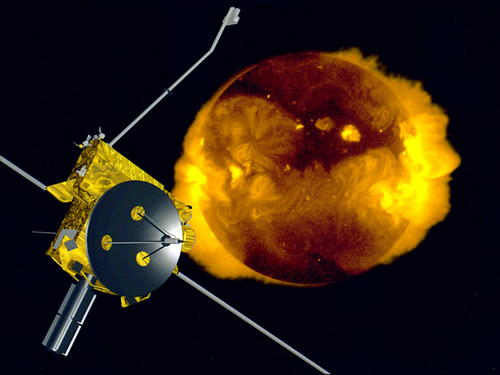
The Ulysses mission came to a close last week. It was launched aboard the space shuttle Discovery in 1990 and planned to last five years. Good show!

From the joint NASA/ESA statement:

When it began in 1977, the Out-of-Ecliptic mission (as Ulysses was then called) represented the first major joint undertaking by ESA and NASA. It was also the first ESA scientific mission to have such a high percentage of non-European lead scientists, with many of the nine investigations under US responsibility. Undoubtedly, Ulysses stands out as an excellent example of international collaboration in space.

The scientific harvest has been extraordinarily rich, with many discoveries, some anticipated, and others completely unexpected. For example, the measurements made by the instruments on board Ulysses have completely changed our view of the Sun’s magnetic influence on the charged particles that populate the space in which our satellites and astronauts have to operate, leading in turn to new models of how the Sun’s magnetic field is carried out into space by the solar wind. The breadth of scientific investigations made possible by Ulysses is truly amazing, extending from the study of processes occurring within the Sun itself to the properties of our local interstellar neighbourhood. Data from Ulysses have even been used to shed light on questions of fundamental cosmological importance.

Check out the ESA archives for details.  And their anniversary video…


Satellite Industry News Bits for July 3, 2009

Friday, July 3rd, 2009


DigitalGlobe’s WorldView-2 satellite to be launched from Vandenberg Air Force Base on October 9.
[Satellite Today – 07/03/2009]

EchoStar wins stay of contempt order in TiVo case in a U.S. Federal Court of Appeals.
[Satellite Today – 07/03/2009]

Global handset navigatikon subscribers to reach 26 million by 2010 according to ABI Research report.
[Satellite Today – 07/03/2009]

Globalstar completes financing of $738m to fund its next-generation satellite system.
[Satellite Today – 07/02/2009]

SES places five year 650 million euro bond, the company’s first since 2006.
[Satellite Today – 07/02/2009]

Satcom Direct successfully sends and receives satcom datalink (AFIS/ACARS) messages between onboard flight and ground stations over the Inmarsat-4 satellite constellation.
[TMCnet – 07/02/2009]

Solaris Mobile discovers issues with W2A S-band payload and files insurance claim.
[Satellite Today – 07/02/2009]

VSD acquires Television Direct to Sailors program from SES Americom subsidiary Americom Government Services.
[Satellite Today – 07/02/2009]

Viasat awarded $21m contract for Multifuncional Information Distribution System terminals from U.S. Space and Naval Warfare Systems Command in San Diego.
[Satellite Today – 07/02/2009]

MEASAT-3a successfully relocated to 91.4 degree orbital slot in preparation for in-orbit testing.
[SatNews – 07/01/2009]

Sirius FM-5 performing maneuvers successfully following June 30 launch from Baikonur on Proton Breeze M launch vehicle.
[SatNews – 07/01/2009]

IDL Corp., an Iridium Global Service Provider, develops multi-channel satellite communications interface that can act as emergency communication system.
[TMCnet – 07/01/2009]

World’s largest communications satellite, TerreStar-1, successfully launched from Kourou – to be used for mobile communications; Terrestar has roaming agreement with AT&T.
[San Francisco Chronicle – 07/01/2009]

Koreasat-2 satellite sale to be sold to Asia Broadcast Satellite by KT Corporation subject to U.S. governmental approval.
[SatNews – 07/01/2009]

BSkyB signs transponder deal with SES Astra for 24 transponders at 28.2 degrees east on a long-term basis.
[Satellite Today – 07/01/2009]

Inmarsat FleetBroadband 150 service, designed to handle IP data, goes live on Inmarsat-4 fleet; hardware providers need to increase working hours to keep up with equipment demands.
[BusinessWire – 07/01/2009]

Globecomm Systems promotes Keith Hall to President and Chief Operating Officer.
[newsday.com – 07/01/2009]

Sea Launch gets approval of bankruptcy judge to continue operations as it restructures under Chapter 11 bankruptcy.
[Satellite Today – 06/30/2009]

This 4th of July weekend, the International Space Station will appear as the brightest star at dawn and dusk to most of U.S. – see http://spaceflight.nasa.gov/realdata/sightings for a schedule when it can be seen from your area.
[SatNews – 06/30/2009]

Vancouver, Canada based telecommunications Telus Corp. adds satellite television to its suite of services, contracting to sell Bell’s TV service in British Columbia and Alberta.
[Vancouver Sun – 06/30/09]

Worth of DigitalGlobe satellite imagery emphasized by contract signed with National Geospatial Intelligence Agency through March 31, 2010 for $12.5m per month.
[SatNews – 06/30/2009]

Wavestream receives orders in excess of $50m from General Dynamics for solid-state power amplifiers for U.S. Army satellite communications terminals.
[Fox Business – 06/30/2009]

Eutelsat Communications launches new service, FRANSAT, enabling satellite access from metropolitan France to all French free Digital Terrestrial Television channels.
[TMCnet – 06/30/2009]

Iridium to begin offering new satellite communications service in Japan for ships at 10-20% less than its previous service, 50 times faster at 128 kbps.
[TMCnet – 06/30/2009]

Historic Ulysses space mission to receive last command from earth and turn transmitter off on June 30, after 18.6 years in space.
[SatNews – 06/29/2009]

Orbital Sciences and the Mid-Atlantic Regional Spaceport break ground at NASA’s Wallops Flight Facility for launch facilities for the Taurus II space launch vehicle.
[SatNews – 06/29/2009]

Thales Alenia wins Russia satellite contract worth about 250 million euros to supply communications satellites.
[Reuters – 06/29/1009]

First signal successfully received from GOES-O satellite, launched to complete coverage of Western Hemisphere.
[aero-news.net – 06/29/2009]

Iran jams foreign satellite news in attempt to isolate Iranian public.
[SatNews – 06/29/2009]

Pacific Teleports becomes Pactel international.
[SatNews – 06/29/2009]

SpaceX gets new round of financing from Steve Jurvetson and his DFJ partners.
[SatNews – 06/29/2009]

European Space Agency plans to build 35m antenna south of Malargue in Mendoza province, Argentina as part of the ESA Tracking network.
[SatNews – 06/29/2009]

SES AMERICOM-NEW SKIES signs multi-year agreement to deliver Retro TV content on two transponders of AMC-3.
[SatNews – 06/29/2009]

Companies such as Iridium benefit as Maritime regulations like SOLAS and GMDSS are increasing demand for satellite-based solutions on all seas around the globe, but will satellite companies be able to support the increase from low data rate to high data rate?
[NSR Report – June 2009]

WBMSAT PS – Satellite Communications Consulting Services