Google Maps is about to get even better
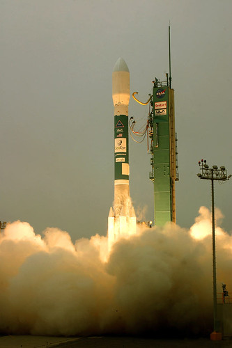
The GeoEye-1 satellite – the world’s highest resolution, commercial Earth-imaging satellite – was launched on Saturday.

You’ll soon be able to check out the satellite’s images for yourself:
ars technica In return for undisclosed terms, Google got two considerations: its logo on the side of the launch vehicle, and exclusive use of the mapping images that the satellite produces.
The satellite maker, General Dynamics Advanced Information Systems, says the GeoEye-1 cost $500 Million to build and launch and its imaging services could be sold for anything from environmental mapping to agriculture and defense. Funding for the project came from commercial satellite company GeoEye and the Defense Department’s National Geospacial-Intelligence Agency