Archive for the ‘Observation’ Category

Putin’s “Mafia in Space” Episode

Thursday, October 29th, 2015

Did Russia’s boss of bosses just bully his way through space? Reports of Russian FSB-owned spacecraft Luch/Olymp-K1 being moved to Intelsat 901’s 18.1-deg. West orbital location came to light earlier this month in a detailed report by Brian Weeden in The Space Review. Since Putin owns them, the Russian story — typically full of lies — was parroted by the BBC as “U.S. anxiety.”

Not true.

Was the old KGB club looking to intercept the Palestine Al Yawm feed? Probably not.

The spacecraft is being portrayed as a data-relay Luch payload, but it has much more — including special laser capabilities. It is a military spacecraft with multiple missions, including RPO, destroying space assets and providing satcom links to the Russian navy.

If the Luch/Olymp spacecraft came with 10 km of Intelsat’s, that’s cause for concern. Putin and his criminal state doesn’t care about anyone or any entity, and the Russians are testing the world order to see whether anyone’s able to respond with force.

Ukrainian Engines Help Vega Launch

Tuesday, June 23rd, 2015

Regardless of the final outcome regarding Sea-Launch and Boeing’s mess (Boeing Co. et al. v. KB Yuzhnoye et al., case number 13-cv-00730, in the U.S. District Court for the Central District of California), Ukrainian rocket engines are a good alternative to Russian RD-180’s.

The Arianespace Vega launch yesterday (#VV05) was powered by Yuzhnoye’s RD-843 engines, which are good for LEO/sun-synch orbits and earth observation missions. Their technical reliability — combined with Ukrainian honesty — makes them viable alternatives. In fact, they should be encouraged to join the ESA, too!


Russian Lie of the Week: That Wasn’t Our Spy Satellite

Tuesday, September 23rd, 2014

“One can only guess about the condition representatives of the so-called American Meteor Society were in when they identified a luminescent phenomenon high up in the sky as a Russian military satellite,” said the spokesman, Igor Konashenkov.

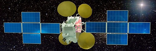
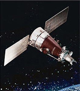
NBC News reported a fireball over Colorado was actually a Russian spy satellite (Kosmos 2495, a Kobalt-M spacecraft) used for reconnaissance.

Russian propaganda is speculating it was actually a threatening “flying Nazi wing” or something and the Kosmos 2495 did some counter-measures and shot the bitch down with a laser beam.

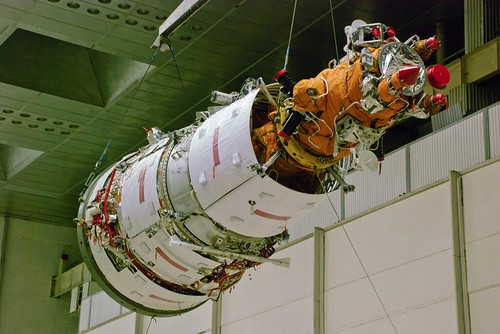
The technology is astounding: it weighs 6,700 kg, uses film to record images, then sends canisters back by dropping them somewhere over Russian territory. This particular one was launch in May, so it coincides with its end-of-life. However, instead of burning up upon re-entry over Orenburg, Russia, parts or all of it burned up over Colorado. Just another case of “Russian precision?” Yeah, right.

Anatoly Zak presented a balanced account of what may have happened:

According to a space flight historian Jonathan McDowell, Kosmos-2495 was deorbited on Sept. 2, 2014, and its descent module landed around 18:18 GMT after a 119-day mission. The reentry was confirmed by a likely sighting of the spacecraft over Kazakhstan, not far from the border with the Russian region of Orenburg, where Russian military satellites would normally land. However a yet another reentry was observed by multiple witnesses the following evening over the western United States. According to McDowell, the ground track of the mysterious object over the US closely matched that of Kosmos-2495, if only the satellite or its fragment was able to make additional six revolutions around the Earth after its projected landing in Russia and then reenter over the US state of Colorado around 04:33 GMT on September 3.

The sightings over the US could be explained by an aborted firing of the braking engine onboard the spacecraft that caused one of its parts, such as the descent module, to reenter over Russia, while another part, such as the service module to stay in orbit for several hours and then make an uncontrolled plunge into the atmosphere over the US due to air friction, McDowell said.

It shouldn’t come as a surprise the Russian military is using space technology first used in the early 1980’s, with alleged 0.3m resolution, however.

Putin’s Russia is run by criminals, drunks and KGB-bred barbarians who have no regard for human life or for telling the truth.

Here’s a more-recent follow-up from the Daily Camera in Boulder:

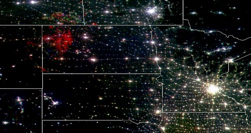
Witnesses across the Front Range and in several neighboring states reported the object streaking across the sky and breaking into several pieces around 10:30 p.m. on Sept. 2.

While some initially speculated it was a meteor, a meteor would have burned too quickly to be seen over such a vast area, said Mike Hankey, the American Meteor Society’s operations manager.

He added that fragments from the object were even big enough to show up as a weather event on radar just east of Cheyenne, Wyo.

The object probably was a piece of Russia’s Cosmos 2495 reconnaissance satellite, launched in May, said Charles Vick, an aerospace analyst with military information website Globalsecurity.org.

Cosmos 2495 was designed to shoot reconnaissance photos and send the film back to Earth in capsules.

It delivered film to Russia as intended, but some pieces of the craft remained in orbit until falling over the Rockies, Vick said.

The U.S. Strategic Command, responsible for American nuclear warfighting forces, confirmed that Cosmos 2495 re-entered the atmosphere and was removed from the U.S. satellite catalog Sept. 3.

Jonathan McDowell, an astronomer with the Harvard-Smithsonian Center for Astrophysics, estimates that there are 98 operating spy satellites in orbit, launched by at least six nations.

Of those, 37 are from the United States, 30 from China and just three from Russia, he said. Many of those satellites are old, and probably half are in full operation, McDowell said.

A Russian Defense Ministry spokesman told the ITAR-TASS news agency Sept. 9 their military satellites were operating normally,


SpaceX Falcon-9 Feeds The Reefer

Monday, July 14th, 2014

Congrats to ORBCOMM, providers of ReeferTrak and other fine services, on their launch this morning…

Thanks to SpaceX for bolting a rocketcam to the fuselage!


Air Quality Improvement

Friday, June 27th, 2014

NASA spacecraft show an improvement in air quality. That’s a good thing!

Jersey and Long Island didn’t change much, however.

This video is good for kids, too.


Summer Sun in Thule

Monday, May 19th, 2014

Ah, summer in Greenland. Temparatures in the mid-20’s F and the sun is out — all day. Time to go out and take a stroll.

Let’s verify what Cryosat-2 sees from space. No need to be alarmed. Just follow the little yellow rope back to where you came from.

Meanwhile, on the other side, Antarctica is losing ice at an alarming rate! Read this abstract from Geophysical Research Letters and see what all the fuss is about…

We use 3 years of Cryosat-2 radar altimeter data to develop the first comprehensive assessment of Antarctic ice sheet elevation change. This new dataset provides near-continuous (96%) coverage of the entire continent, extending to within 215 kilometres of the South Pole and leading to a fivefold increase in the sampling of coastal regions where the vast majority of all ice losses occur. Between 2010 and 2013, West Antarctica, East Antarctica, and the Antarctic Peninsula changed in mass by −134 ± 27, −3 ± 36, and −23 ± 18 Gt yr−1 respectively. In West Antarctica, signals of imbalance are present in areas that were poorly surveyed by past missions, contributing additional losses that bring altimeter observations closer to estimates based on other geodetic techniques. However, the average rate of ice thinning in West Antarctica has also continued to rise, and mass losses from this sector are now 31% greater than over the period 2005–2011.

The ESA’s been tracking this for some time and getting something done before summer vacations hit in Europe is an honored tradition.


Sochi From Space

Tuesday, February 11th, 2014

The view of Sochi from the ISS, via NBC. Dayime image below…


Hiding From Satellites

Monday, November 4th, 2013

spysat

We’ve been fans of DLR’s Heavens Above site for years, a site that predicts when orbiting spacecraft are expected to be seen from Earth. Iridium flares are especially fun to predict to impress your friends.

Now we have s spacecraft prediction app of a more topical “spying” nature: SpyMeSat, a $2 app that predicts flyovers by observation satellites. Via SlashGear

SpyMeSat was created by Orbit Logic, Inc., which specializes in supplying software to the aerospace and intelligence communities. The app, which was released last week, gets its data from organizations like NORAD, but it doesn’t use any classified information. In other words, any terrorists or human rights abusers looking to hide from satellites already can access the info through other data sources. The app’s chief purpose is to gather all that data into one cheap app.

“We were careful to only include satellites that are unclassified and whose orbits are published by NORAD,” Orbit Logic president Alex Herz said. “Even the sensor data — resolution, etc. — was taken only from the websites published by the satellite operators. So everything SpyMeSat is using is open and public.”

The app is accurate to 16 meters. You can set SpyMeSat to give you alerts for any location, track satellites even when they’re not overhead, call up resolution specs for each model, and learn about their various on-board sensors. Satellite models in the database are owned and operated by either public or private bodies, including the GeoEye, France’s SPOT-5, India’s CartoSat-2A, DigitalGlobe WorldView, and RADARSAT-2 of Canada.

It may save you some embarrassment.

gmap_scary_w


All Fracked Up and No Place to Go

Friday, September 6th, 2013
bakken frackin

SkyTruth’s view of the Bakken from space. The red stuff at the upper left is rig lighting and flaring from oil and gas drillers working the Bakken Shale. The bright area on the right is the city of Minneapolis.

The folks over at SkyTruth are doing a really good job, using existing observation spacecraft and they’re ready to send up a balloon to document what other ways frackers are polluting.

I missed this coverage over the summer…

Thanks to that and lots of other people, they’ve met their funding goal on indiegogo. The project…

SkyTruth is teaming up with Space for All  for a skytruthing mission over the massive Bakken shale oil and gas fields in western North Dakota.  We’re planning to launch a sensor package from the ground to the edge of space tethered to a high altitude balloon rig, courtesy of Space for All.  We will combine on the ground observations with detections from the balloon rig and measurements we are making from space to measure the amount of natural gas flaring there.  This will help us test the accuracy of our satellite-based flaring detections so we can do a better job of monitoring and reporting on the amount of environmentally damaging (and unnecessary and wasteful) flaringthat happens in the Bakken and elsewhere in the world.  The more good data we can collect on when, where, and how much, the more we can help groups that are working to reduce and eliminate it. This is what we mean by skytruthing – using remote sensing and mapping to understand and change the world.

Read more about the Bakken and oil shale fracking in this great piece by National Geographic: The New Oil Landscape


Watch their video pitch…

Hat tip to Motherboard.


Delta IV Heavy: NROL-65

Wednesday, August 28th, 2013

Always nice to see a Delta launcher go. Extra nice to see a heavy go!

The payload is for the NRO, so we can only speculate as to what it was for. As reported by the L.A. Times

Although little is publicly known about what exactly the rocket will be carrying into space, analysts say it is probably a $1-billion high-powered spy satellite capable of snapping pictures detailed enough to distinguish the make and model of an automobile hundreds of miles below.

If this is a LEO spacecraft, it’s probably on the big side, given the Delta IV Heavy’s capability.