Archive for the ‘Observation’ Category

GOES-12: Ten Years in 3 minutes

Tuesday, August 20th, 2013

Great job by NOAA in putting this video together, marking the retirement of the GOES-12 spacecraft.

NOAA’s GOES-12 satellite was decommissioned on August 16th, 2013 after 3,788 days in service. From April 2003 — May 2010, GOES-12 served as GOES East, providing “eye in the sky” monitoring for such memorable events as the 2005 Atlantic hurricane season and the series of blizzards during the winter of 2009-2010. After suffering thruster control issues, GOES-12 was taken out of normal service and moved to provide greater coverage of the Southern Hemisphere as the first-ever GOES South. During that time it provided enhanced severe weather monitoring for South America.

This animation shows one image from each day of the satellite’s life — a total of 3,641 full disk visible images.


Blowing Aladin

Thursday, April 18th, 2013

Instruments on the ground or attached to weather balloons give us wind velocity measurements, helping us predict weather changes and forecasting. And they do a pretty good job with it. Anybody with a radio, TV or Internet device can avail themselves of the weather forecast. Or a newspaper. Remember those?

Although I appreciate being able to know what the weather will be like after tomorrow or next week, I long for the days when we would simply look toward the sky, feel the wind and/or humidity and make an experienced guess on the next day’s weather. Winds from the south and we’ll get rain. Chilly wind from the northwest indicates a change toward colder days ahead.

If the wind makes a difference on the ground, think about what it would mean if we were able to use an instrument in space. Enter the ESA’s Aeolus mission, which includes the Aladin UV laser instrument.

The Aeolus satellite will carry a single, but complex, instrument that will probe the atmosphere to profile the world’s winds. Reliable and timely wind profiles are urgently needed by meteorologists to improve weather forecasts. In the long term, they will also contribute to climate research.

Aeolus carries a pioneering instrument called Aladin that uses laser light scattering and the Doppler effect to gather data on wind.

The laser generates high-energy UV light, which is beamed towards Earth through a telescope. As the light travels down through the atmosphere, it bounces off molecules of gas, particles of dust and droplets of water.

By comparing the shift in frequency of the received light from the transmitted light caused by the Doppler effect, the motion of the molecules in the atmosphere can be measured, revealing wind velocity.

The laser transmitter is being developed by Selex-ES in Italy.

It has been a very long and difficult undertaking – forging new technologies in many areas such as optics, opto-electronics, precision mechanics and thermo-mechanical design.

Recent tests show all this effort has not been in vain.

Throughout three consecutive weeks, the laser transmitter remained perfectly stable at full energy, producing a total of 90 million UV laser shots.

Considering that each shot is 5 MW, peaking at an intensity similar to that of a lightning strike and that this is repeated 50 times a second – the stress on the optical components that shape and guide the laser beam is tremendous.

Predicting weather and climate changes using a space-based UV laser. Cool.


Secret Hexagon Rescue Mission

Friday, August 17th, 2012

It still amazes me how many resources went into spy satellites in the 60’s and 70’s. Designing, building, launching and operating — all under super-secret conditions — using transistor radio era technology must have been mind-boggling for the non-scientists. And film. They used film to get the images they needed. And how did they get the film back to earth? Why, drop the huge canister in the ocean, of course!

Recent news about the declassification of rescue mission in 1972 to retrieve a canister that dropped into the ocean without a parachute. Imagine that: the rescue mission was classified!

High Tech Finds The Old Tech

Tuesday, March 20th, 2012

None of us have on this planet long enough to remember a house or dwelling being reduced to a dirt mound. You rely on your forebears to pass along knowledge of what used to be where, and you might find it. What happens once it’s forgotten? Could be lost forever.

Satellites to the rescue!

Enter Bjoern H. Menzea of Harvard and Jason A. Ura of MIT, an anthropologist and computer scientist, respectively, who have collaborated on “Mapping patterns of long-term settlement in Northern Mesopotamia at a large scale,” published in the Proceeding of the National Academy of Sciences of the United States of America. Using satellite images, they’ve uncovered thousands of previously-unknown settlements. Here’s the abstract:

The landscapes of the Near East show both the first settlements and the longest trajectories of settlement systems. Mounding is a characteristic property of these settlement sites, resulting from millennia of continuing settlement activity at distinguished places. So far, however, this defining feature of ancient settlements has not received much attention, or even been the subject of systematic evaluation. We propose a remote sensing approach for comprehensively mapping the pattern of human settlement at large scale and establish the largest archaeological record for a landscape in Mesopotamia, mapping about 14,000 settlement sites—spanning eight millennia—at 15-m resolution in a 23,000-km2 area in northeastern Syria. To map both low- and high-mounded places—the latter of which are often referred to as “tells”—we develop a strategy for detecting anthrosols in time series of multispectral satellite images and measure the volume of settlement sites in a digital elevation model. Using this volume as a proxy to continued occupation, we find a dependency of the long-term attractiveness of a site on local water availability, but also a strong relation to the relevance within a basin-wide exchange network that we can infer from our record and third millennium B.C. intersite routes visible on the ground until recent times. We believe it is possible to establish a nearly comprehensive map of human settlements in the fluvial plains of northern Mesopotamia and beyond, and site volume may be a key quantity to uncover long-term trends in human settlement activity from such a record.

That’s pretty awesome work. New science is magic!


WBMSAT Satellite Industry News Bits 02/18/2012

Sunday, February 19th, 2012

Falcone’s telecom troubles mount, as the Harbinger Fund investments in LightSquared jeopardize investors’ value and a group of investors sues in federal court.
[Wall Street Journal – 02/18/2012]

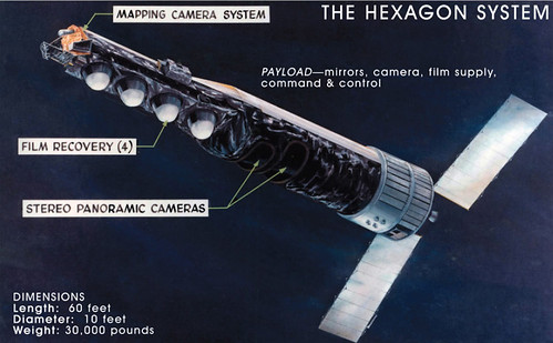
Latest Pentagon spending plans scale back push to use commercial satellites to supplement the military’s communication and space efforts.
[Wall Street Journal – 02/17/2012]

Second attempt to launch Atlas V rocket with first MUOS satellite is scrubbed due to weather conditions.
[Central Florida News – 02/17/2012]

U.S. bankruptcy court approves TerreStar reorganization plan; Dish Network prepared to close previously approved acquisitions of TerreStar and DBSD upon FCC approval of license transfers.
[Satellite Today – 02/17/2012]

Eutelsat and ViaSat receive Industry Innovators Awards from the Society of Satellite Professionals International for development and launch of their High Throughput broadband Satellites, KA-SAT and ViaSat-1.
[Sacramento Bee – 02/17/2012]

General Dynamics demonstrates first MUOS satellite-based communications on JTRS HMS Radio.
[Market Watch – 02/17/2012]

NSR free webinar coming February 22 – Military budget cuts and troop drawdowns: What’s the impact on commercial satcoms?
[NSR – 02/17/2012]

NASA selects 33 small “cubesat” satellites to fly as auxiliary payloads aboard rockets.
[SatNews – 02/17/2012]

Global Satellite USA launches Iridium Pilot, Iridium’s second-generation maritime broadband platform.
[SatNews 02/17/2012]

Satlink expands the reach of God’s Leaning Channel into Asia on the ABS1 satellite at 75 degrees East.
[SatNews – 02/17/2012]

United States, in review of future satellite needs, examines opportunities to increase international collaboration and orders from commercial providers, U.S. Air Force official says.
[Fox Business – 02/16/2012]

SES-4 successfully performs post-launch maneuvers.
[Market Watch – 02/16/2012]

Media Networks Latin American signs long-term capacity deal with SES fior multiple transponders on AMC-4 to launch new DTH wholesale pay TV service.
[SatNews – 02/16/2012]

LightSquared may be looking to Department of Defense to save its LTE network; FCC still believes satellite spectrum can be used for wireless buildout but will tread more carefully next time.
[Washington Post – 02/16/2012]

Avanti partner STM buys Ka band capacity on HYLAS 1 to enable launch of Enterprise services in Spain.
[Proactive Investors – 02/15/2012]

Comtech EF Data wins Industry Innovators Award from Society of Satellite Professionals International for MetaCarrier technology that adds carrier ID information to a reference carrier using spread spectrum technology.
[Market Watch – 02/15/2012]

Officials eye changes to GPS receivers, but move comes too late for LightSquared.
[Nextgov – 02/15/2012]

NSR reports that FCC statement all but negates years of work from both the FCC and the mobile satellite industry.
[SatNews – 02/15/2012]

Swiss to build clean-up satellites to attack the space junk issue.
[R&D Magazine – 02/15/2012]

ORBIT Communication Systems and Milano Teleport receive orders for complete C-band VSAT solution for supertankers of one of worlds leading shipping companies based in Greece.
[SatNews – 02/15/2012]

Newly announced Intellian t80W maritime satellite TV antenna system uses WorldView LNB that automatically switches polarization and frequency according to satellite tracking onto, and satellite control system intelligence and dual antenna system that allows seamless reception of TV programs on a global basis.
[SatNews – 02/15/2012]

Harris CapRock Communications signs contract to provide telecommunications systems and infrastructure for Chevron’s Big Foot platform project in the Gulf of Mexico.
[SatNews – 02/15/2012]

IO Sat one of first customers providing services on Spacecom’s AMOS-5 satellite.
[SatNews – 02/15/2012]

NASA budget request includes funding for again launching astronauts, further exploration into space, and continuing research, providing jobs and technology that will boost the economy.
[SatNews – 02/13/2012]

Google applies for FCC licenses for “antenna farm” in Kansas that hint at possible super head-end for capturing satellite television signals for over-fiber distribution.
[Kansas City Star – 02/14/2012]

FCC bars use of satellite spectrum terrestrially for broadband networks, sending LightSquared back to Square One.
[New York Times – 02/14/2012]

Gilat develops customized solution for O3b Networks’ satellite network.
[Globes – 02/14/2012]

Xplornet Communications’ 4G broadband satellite service on ViaSat-1 goes live over Canada.
[Digital Journal – 02/14/2012]

Global Telesat Corp. launches E-Commerce mobile satellite solutions portal on worldwide web.
[Market Watch – 02/14/2012]

ORBIT awarded services contract from U.S. Air Force to install service communication management systems on KC-135 Stratotankers.
[Market Watch – 02/14/2012]

UtiliSat to offer end-to-end managed network services to U.S. government agencies under new GSA custom SATCOM solutions small business contract.
[Market Watch – 02/14/2012]

FAB Express Trucking selects VeriWise(TM) satellite tracking systems to manage dry van fleet.
[Market Watch – 02/14/2012]

Obama budget targets LightSquared.
[Nextgov – 02/13/2011]

YAHSAT begins transmission of High TV 3D.
[Satellite Today – 02/13/2012]

ViaSat phases out WildBlue brand for new Exede service on ViaSat 1.
[Satellite Today – 02/13/2012]

Spectacular view from International Space Station includes lights of hundreds of cities plus massive Aurora Borealis on the horizon.
[SatNews – 02/13/2012]

WBMSAT satellite communications consulting services


Tanks! Thanks to DigitalGlobe

Tuesday, February 14th, 2012

Our friends at DigitalGlobe Inc., providers of satellite imagery via the Worldview spacecraft, have released photos of Syrian tanks surrounding residential neighborhoods. Via WaPo

Stephen Wood, director of DigitalGlobe’s analysis center, said the photos show tanks, armored personnel carriers and other armored vehicles in the southern part of the city, some of them near apartment buildings.

The satellite images show an increase in the level of army activity in and around Homs from the previous 24 hours, Wood said.

Fighting in Homs has reportedly killed hundreds of people over the past week from bombardments followed by soldiers’ advances. The battle there is part of the Syrian government’s attempts to suppress an 11-month-old uprising against the rule of President Bashar Assad.

Wood said no battle damage was visible in the photos taken Friday, but previous images captured by the company’s satellites did show the effects of fighting.

And this report from Al Jazeera furthers the news…

Good job getting the images out. It’s good for business, especially if you consider there’s growth in the earth observation sector, according to Euroconsult.

Check out their Flickr photostream. Very cool.


Yes, MASTER?

Wednesday, December 14th, 2011

There’s no shortage of DoD acronyms. There was that hosted payload on one of the SES spacecraft, CHIRP (Commercially Hosted Infrared Payload). The topper is now MASTER: Modular Architecture for Signal-processing, Tracking and Exploitation Research program. Yeah, seems a bit of a stretch. It comes to us via the rocket scientists at Northrup Grumman:

MASTER supports the government ground processing effort for the Air Force’s Commercially Hosted IR Payload (CHIRP) program’s on-orbit period. An experimental CHIRP sensor is hosted on a commercial SES satellite operating in geosynchronous orbit over the United States. The SES satellite was successfully launched on Sept. 21 from French Guiana.

“MASTER provides an important sensor-agnostic ground processing capability for our customer,” said Ron Alford, Northrop Grumman’s director, sensor exploitation systems and Colorado campuses. “The architecture utilizes an enterprise approach with an open architecture and plug-and-play components. In future data processing systems, measurable cost savings can be enjoyed by using the MASTER architecture to provide common processing capabilities across sensor types and system constellations without the need for customized processing chains.”

“This approach not only reduces costs, but facilitates new missions, new sensor/data providers and the participation of third parties in specialized processing algorithms for new and changing missions,” Alford said.

The enterprise architecture developed for the MASTER program can be used by multiple types of sensors without the redundant cost of redeveloping the ground mission processing software, but currently is prototyped against Overhead Persistent Infrared (OPIR) sensors.

MASTER has been successful in integrating and using algorithms provided by outside third parties as well as processing data from multiple operational OPIR sensors and new experimental simulated data. The MASTER architecture has also enabled innovative parallel data processing with multiple plug-and-play algorithms, along with significant advances in star and static-source line-of-site correction methods.

The MASTER contract is a follow-on effort to the Alternative Infrared Satellite System program, begun in 2006 and renamed Third Generation Infrared Surveillance as a technology maturation program. MASTER has been focused on developing an open, plug-and-play, sensor-agnostic processing architecture for the government to use in evaluating whole earth-staring array sensors.

Yes, you read that right: “earth-staring array sensors.” Our favorite is AFRTS (Armed Forces Radio & Television Services). Pronounced as you would expect.


Chinese Hacking Space

Thursday, October 27th, 2011

Spitsbergen! Somebody in China decided to hack a couple of observation spacecraft via the Svalbard Earth Station in Norway. The scoop, via Bloomberg BusinessWeek

Computer hackers, possibly from the Chinese military, interfered with two U.S. government satellites four times in 2007 and 2008 through a ground station in Norway, according to a congressional commission.
The intrusions on the satellites, used for earth climate and terrain observation, underscore the potential danger posed by hackers, according to excerpts from the final draft of the annual report by the U.S.-China Economic and Security Review Commission. The report is scheduled to be released next month.
“Such interference poses numerous potential threats, particularly if achieved against satellites with more sensitive functions,” according to the draft. “Access to a satellite‘s controls could allow an attacker to damage or destroy the satellite. An attacker could also deny or degrade as well as forge or otherwise manipulate the satellite’s transmission.”
A Landsat-7 earth observation satellite system experienced 12 or more minutes of interference in October 2007 and July 2008, according to the report.
Hackers interfered with a Terra AM-1 earth observation satellite twice, for two minutes in June 2008 and nine minutes in October that year, the draft says, citing a closed-door U.S. Air Force briefing.
The draft report doesn’t elaborate on the nature of the hackers’ interference with the satellites.


One Night in Wallops

Thursday, June 30th, 2011

Excellent launch video of the ORS-1 spacecraft from Wallops Island in Virginia. The news, via the USAF:

An Air Force team successfully launched the first Operationally Responsive Space prototype satellite aboard a Minotaur I launch vehicle at 11:09 p.m. EDT June 29 from the NASA Wallops Flight Facility on Wallops Island, Va. ORS-1 deployed 12 minutes after launch.

This marks a great achievement by the Space and Missile Systems Center’s Space Development and Test Directorate, the Operationally Responsive Space Office and their contractor teams, according to Col. Carol Welsch, the directorate’s acting director and the ORS-1 mission director. ORS-1 is the Operationally Responsive Space Office’s first operational prototype satellite and represents the potential of low-cost, tactically focused satellites designed to provide critical battlespace awareness capabilities to the joint warfighter.

“Words cannot express how proud I am of the entire ORS-1 team,” she said. “The men and women of the Space Development and Test Directorate, the Operationally Responsive Space Office, and our industry partners of Goodrich, ATK, and Orbital have all worked tirelessly to move forward on the concept of a responsive space capability designed to support the warfighter. Their teamwork and dedication is simply inspiring.”

Rapidly developing and fielding ORS-1 is an important step to demonstrating the possibilities to meet emerging and persistent warfighter needs in operationally relevant timelines, Colonel Welsch said.

“Our team was able to develop, integrate, test and launch this system in just over 30 months which is a remarkable achievement,” she said.

ORS-1 was initiated as a result of a requirement to the ORS office from the commander of U.S. Strategic Command to support U.S. Central Command.

Built by ATK in 16 months! In Maryland, no less.

Bioluminescence and Chlorophyll Fluorescence

Wednesday, June 8th, 2011

One of many interesting, fantastic details of the film “Avatar” was the bioluminescent plants — and the inter-networked biosystems on Pandora.

Why am I thinking about this? NASA just released details of maps illustrating land plant fluorescence, based on the work of several scientists who published “First observations of global and seasonal terrestrial chlorophyll fluorescence from space.” The abstract:

Remote sensing of terrestrial vegetation fluorescence from space is of interest because it can potentially provide global coverage of the functional status of vegetation. For example, fluorescence observations may provide a means to detect vegetation stress before chlorophyll reductions take place. Although there have been many measurements of fluorescence from ground- and airborne-based instruments, there has been scant information available from satellites. In this work, we use high-spectral resolution data from the Thermal And Near-infrared Sensor for carbon Observation – Fourier Transform Spectrometer (TANSO-FTS) on the Japanese Greenhouse gases Observing SATellite (GOSAT) that is in a sun-synchronous orbit with an equator crossing time near 13:00 LT. We use filling-in of the potassium (K) I solar Fraunhofer line near 770 nm to derive chlorophyll fluorescence and related parameters such as the fluorescence yield at that wavelength. We map these parameters globally for two months (July and December 2009) and show a full seasonal cycle for several different locations, including two in the Amazonia region. We also compare the derived fluorescence information with that provided by the MODIS Enhanced Vegetation Index (EVI). These comparisons show that for several areas these two indices exhibit different seasonality and/or relative intensity variations, and that changes in fluorescence frequently lead those seen in the EVI for those regions. The derived fluorescence therefore provides information that is related to, but independent of the reflectance.

Real science is never too far from science fiction, is it?

That reminds me: I should water the garden.