Launch-a-Rama!
Thursday, June 8th, 2006Five– count ’em, five— satellite launches are set to take place from Baikonur Cosmodrome over a two week period this month.
As always, we’ll bring you more coverage as the birds get ready to fly.
Five– count ’em, five— satellite launches are set to take place from Baikonur Cosmodrome over a two week period this month.
As always, we’ll bring you more coverage as the birds get ready to fly.
Last month we wrote about the launch of the CloudSat and Calipso satellites. Now reports are coming back that the first images from Cloudsat are giving scientists a completely new view of the clouds:

"We’re seeing the atmosphere as we’ve never seen it before," says Deborah Vane, CloudSat deputy principal investigator at NASA’s Jet Propulsion Laboratory in Pasadena, California, US. "We’re no longer looking at clouds like images on a flat piece of paper, but instead we’re peering into the clouds and seeing their layered complexity…."
CloudSat’s Cloud Profiling Radar, the first millimetre-wavelength radar, underwent tests in late May and was formally activated on 2 June.
"All major cloud system types were observed, and the radar demonstrated its ability to penetrate through almost all but the heaviest rainfall," says Graeme Stephens, CloudSat principal investigator and atmospheric scientist at Colorado State University, US.
The first image is a cross-section of a warm storm front above the Norwegian Sea taken on 20 May. In the image, red represents highly reflective particles such as raindrops, ice crystals or snowflakes. Blue represents thinner cirrus clouds.
The radar also provided a look at a night snow storm near Antarctica. The long winter nights make traditional remote sensing difficult in the polar regions and CloudSat is the first satellite able to detect snowfall from space.
A third image shows tall thunderstorm clouds over east Africa.
The results are still preliminary, but the mission team aims to release validated science data within nine months.
CloudSat is part of the A-Train, a constellation of five satellites that fly right behind one another, measuring the same swath of Earth.
The picture above is "CloudSat’s first image, of a warm front storm over the Norwegian Sea, was obtained on May 20, 2006. In this horizontal cross-section of clouds, warm air is seen rising over colder air as the satellite travels from right to left. The red colors are indicative of highly reflective particles such as water droplets (or rain) or larger ice crystals (or snow), while the blue indicates thinner clouds (such as cirrus). The flat green/blue lines across the bottom represent the ground signal. The vertical scale on the CloudSat Cloud Profiling Radar image is approximately 30 kilometers (19 miles). The blue line below the Cloud Profiling Radar image indicates that the data were taken over water."
For more information on Cloudsat, visit the NASA CloudSat website.
" Is the day near when you will get music on your BlackBerry and e-mail on your iPod?"
That’s the question swirling around the blogosphere after the Globe and Mail published a report this weekend claiming that senior executives at Intel have recommended that Research in Motion, Ltd. — makers of the uniquitous Blackberry — team up with Apple to work on a new product.
The rumors began when analyst Peter Misek — who last year predicted the Intel/RIM collaboration– speculated on the partnership and argued that, in the least, the idea looks good on paper.
Stan Beer over at ITWire shoots the whole thing down:
One thing I do know, however, is that Apple is a hardware company that likes to control its own hardware. Another thing I know is that just three weeks ago we ran a substantiated story on this very site that outlined details of Apple working on its own iPod 3G mobile phone with Japanese company Softbank. As the story relates, Softbank president, Masayoshi Son and Apple CEO, Steve Jobs have met and reached an agreement to release a 3G iPhone for the Japanese market sometime in 2006.
The idea of Apple bringing its own iPod mobile phone to market appears to be more in line with the company’s culture than forming a joint venture with another hardware company that plays in a totally different market space. Apple is a company that does not like to share its brand and it likes to develop its own technology. Neither of those two philosophies appears to fit a Blackberry partnership.
What do you think? Is there an AppleBerry in your future? Or is the idea just another Ipod urban myth, like the Ipod that fell to Earth?
It has nothing to do with Wes Craven and is not nearly as scary as it sounds: new details have been released about the Jason-2 (Joint Altimetry Satellite Oceanography Network) satellite set to be launched from Vandenberg AFB in October 2008. In a demonstration of international cooperation in global warming research, the Japan Aerospace Exploration Agency is working with the French company CNES on the project:
The science objectives of Jason-2/OSTM are to extend the time series of ocean surface topography measurements to: a) obtain a continuous record of observations (with the previous missions), b) to determine the variability of ocean circulation at decadal time scales from combined data record with T/P and Jason, c) improve the measure of the time-averaged ocean circulation, d) improve the measure of global sea-level change, and e) improve open ocean tide models.
The mission objectives call for the provision of the same measurement accuracy of Jason (3.3 cm) with a goal of achieving 2.5 cm, and to maintain the stability of the global mean sea level measurement with a drift less than 1 mm/year over the life of the mission. The overall goal is to better understand the forces behind global changes of climate and to predict seasonal anomalies in weather patterns; this is vital to understand the physics of the ocean.
Jason-2 is scheduled to join Jason-1 in the same orbit with a 10 day repeat observation cycle. Both satellites will pass within minutes of each other over the same ocean surface, thus enabling verification and cross-calibration of the collected data. Together, they will provide a vital contribution to the expanding network of global ocean observations and their application in meteorology, operational oceanography and climate monitoring.
Forget hurricane season. The really big storms to watch this summer are out of this world.
Specifically, they’re on Jupiter, where the Great Red Spot– a massive, centuries-old storm of 350 mph winds that is twice as big as the Earth — and Oval BA, aka "Red Jr.," — a six-year-old storm that is "only" the size of one Measly earth — are expected to brush against each other on or about the Fourth of July. Fireworks may fly, Space.com reports:
"There won’t be a head-on collision," [says Amy Simon-Miller, an astronomer at Goddard Space Flight Center in Maryland.] "The Great Red Spot is not going to ‘eat’ Oval BA or anything like that."
However, the storms’ outer bands are expected to pass close to one another and it’s anybody’s guess what will happen when they do.
This isn’t the first time that such an encounter has happened. In fact, the two storms typically pass each other every two years or so. Similar encounters happened in 2002 and 2004, but they were very anti-climactic. Aside from some "roughing" around the edges, both storms came out unscathed.
This time might be different, however, said Simon-Miller. Red Jr. could revert to its original color and change from red to white. From 2000 to 2005, Red Jr. was actually white and no different form the many other small "white ovals" circling the planet.
But in 2006, astronomers noticed a change: a red vortex formed inside the storm, the same color as the powerful Great Red Spot. Scientists believe the color change was a sign that the storm was intensifying.
Scientists think the Great Red Spot could push Oval BA toward a southern jet stream on the planet during their upcoming encounter. The jet stream blows against Oval BA’s counterclockwise rotation and could slow its spin, possibly changing the storm’s color back to white.
The color of the Great Red Spot itself is a mystery. According to one popular theory, the storm dredges up material from deep inside Jupiter’s atmosphere, lofting it above the highest clouds where ultraviolet rays from the Sun turn color-changing compounds, called "chromophores," red.
We’ve written before about scientists using satellites to track climate change and uncover Mayan ruins. Now scientists and activists are using satellites for another purpose– to spot human rights abuses:
Satellite images captured under a pioneering program of the American Association for the Advancement of Science (AAAS) provide powerful evidence that the government of Zimbabwe has destroyed an entire settlement and relocated thousands of residents as part of a campaign against political opponents.
The images, analyzed by the AAAS staff, show two views of the settlement of Porta Farm, located just west of the Zimbabwean capital of Harare. The first, an archived image from June 2002, shows an intact settlement with more than 850 homes and other buildings; an estimated 6,000 to 10,000 people lived in Porta Farm at the time. The second photo, taken by satellite on 6 April this year, shows that the settlement has been leveled.
The pictures were released Wednesday 31 May as central evidence in a report compiled by the international secretariat of Amnesty International in London and Zimbabwe Lawyers for Human Rights (ZLHR), based in Harare. The report, “Shattered Lives: The Case of Porta Farm,” views the destruction of the settlement and the forced relocation of its residents as emblematic of a broad campaign by the government of President Robert Mugabe to repress political opposition.
(Via Kottke.)
Consider this your mid-week 70s flashback. Science Daily reports that the two Voyager spacecraft are still sending back useful data to NASA scientists nearly 30 years after their launch — and they’re providing clues to better understanding both the heliosphere and the direction of our solar system through local space:
The heliosphere, generated by the Sun, is sort of the cocoon in which the solar system rides. It has been suspected for several years that it is not spherical but more egg shaped. Voyager 1 recently reached one edge and it is estimated it will pass into interstellar space at about 12.4 billion miles from the Sun.
It was recently announced that Voyager 2 has reached its more southerly edge, sooner than expected. It is now believed it will reach interstellar space at about 10.5 billion miles. This reveals that the heliosphere is not a sphere after all, but is more of a comet shape.
According to Cal Tech’s Ed Stone, the former director of NASA’s Jet Propulsion Laboratory and a Voyager chief scientist, the shape of the bubble is determined by what is pressing on the solar system from the outside, meaning the shape and force of interstellar gases. That is one explanation. Another put forth by Walter Cruttenden of the Binary Research Institute is that local gases are fairly uniform and the shape derives from the trajectory of the solar system through local space — possibly in its orbit around a companion star. While this latter explanation is far more speculative, it is not unlikely that local interstellar gases are relatively homogeneous and therefore the shape of the heliosphere may be at least partially due to motion of the solar system.
Amazingly, both Voyager spacecraft are expected to remain active for several more decades. Which is more than can be said for many other artifacts of the 70s.
Via Google Maps Mania comes this very cool mashup:
South Florida newspaper Florida Today has built a Google Maps mashup of space launch sites at Kennedy Space Center and Cape Canaveral. It includes a database of every launch since the dawn of the space age, shuttle and rocket launch video and images, and video tours inside facilities people usually don’t get a chance to see guided by its space reporters. It also has an enhanced 3D Google Earth version you can download as well
The standard 2-D tour is interesting, but if you want an amazing tour experience you’ll want a (warning: highly addictive) copy of Google Earth (available here) to view the mashup.
In either version, you can click on various launch pads and browse photos, videos, and a database of launches, and generally while away a good part of a Tuesday at work.
 We’ve launched a new gizmo here at the Really Rocket Science blog– free countdown ringtones for your mobile phone.
The idea for the ringtone came from Andrew Tytla, Marketing Communications Manager at SES AMERICOM and Jim Lewis of CCI Florida, who suggested it to International Launch Services. (CCI Florida produces all launch video broadcast for Cape Canaveral.)
While in the studio for the ASTRA 1KR launch in April, Don Spencer (PDF) sat down and recorded a clean “countdown” for the ringtone, which was later combined with a dramatic Atlas rocket liftoff.
If you have witnessed the broadcast of an Atlas launch, you have heard Don Spencer’s voice. He’s known as the “Voice of Atlas.”
Now you can download the ringtone for free and have the “Voice of Atlas” tell you when you’ve got an incoming call.
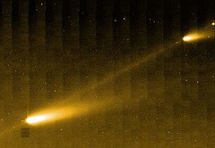 Some of you may be familiar with a rumor that’s been circulating various apocalyptic astronomy blogs: that fragments of the comet 73P/Schwassmann-Wachmann will impact the Atlantic Ocean this Thursday, thus ruining the Memorial Day weekend plans for millions of people (but perhaps leading to a bounceback for Posiedon’s flagging box office receipts).
Phil Plait over at the Bad Astronomy Blog has been busy debunking the myth, pointing out that, among other things, the closest the disintegrating comet is coming to earth is, oh, about 5.5 million miles.
Hardly the makings of a disaster film, much less a reason to cancel a trip to the Jersey Shore.
In any case — if you want to have a clever astronomical answer to the watercooler question of "what are you doing for Memorial Day weekend?", Phil has a collection of blog posts he’s written on the topic. And the photos he’s collected of the comet are worth checking out.