Archive for May, 2007

The ‘Rocket Docket’ for EchoStar

Thursday, May 31st, 2007

If this post’s title doesn’t confuse you, EchoStar’s legal battles sure will.

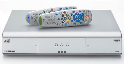
While other Cable and Satellite operators that use DVR technology (including Time Warner, Comcast, and DirectTV) settled with Forgent Networks, which owns a patent on a specific DVR-playback technology, EchoStar didn’t back down. And, last week, EchoStar won:

A team of Morrison & Foerster attorneys and their co-counsel have won dismissal of a patent infringement case brought against client EchoStar Communication Corp. after a Texas jury took just over an hour to find the plaintiff’s patent invalid. It was only the second time on record that a jury in the Eastern District of Texas had handed down a defense win in a patent case by finding the patent at issue invalid.

The court ruled that Forgent’s patent claims against EchoStar were all invalid as anticipated, obvious, and lacking proper written description. The jury instructions describe the legal parameters for "obviousness," but Forgent’s CEO, Richard Snyder, summarizes it best in his company’s recent earnings call: "The outcome of many of these events relating to intellectual property are complex and uncertain."

"Complex" is right. For clarification I turn to Wikipedia: "The inventive step and non-obviousness reflect a same general patentability requirement present in most patent laws, according to which an invention should be sufficiently inventive, i.e. non-obvious, in order to be patented." It appears Forgent’s computer controlled video system that allows playback during recording is not valid for a patent as it is an obvious extension of existing technology. If we have any lawyers in our community, please weigh-in.


By not settling, EchoStar took a big risk. The company faced the prospect of over $200 million in damages if it lost and it’s legal arena was daunting. The Denver Post describes the case’s context:

EchoStar’s hard-line approach isn’t surprising, given its history. The company is known as being litigious, and only rarely does it back down from a legal fight. Founder Charlie Ergen bet the company on a lawsuit in 1997, when he sued Rupert Murdoch’s News Corp. for $5 billion over a failed merger of satellite-TV operations. News Corp. settled.

Drapkin and others called the Forgent verdict an unusual outcome in the Eastern District of Texas, known as the "Rocket Docket" for the speed with which patent cases are handled.

"It’s rare that a defendant would win a jury case in that district … particularly a large company," said Kirstin Stoll-DeBell, of Merchant & Gould in Denver, who represented a client there who settled a patent case. "I think jurors down there are biased against corporate America."

Where does this leave other cases in the DVR-patent war, mainly the TiVo/EchoStar saga which is currently pending in the Federal Circuit Court of Appeals? (Until it considers the case, the court gave EchoStar a stay on an earlier injunction that would force it to turn-off all of its customers’ DVR capabilities.) To be true to this post’s theme, I would have to say…well…unclear.

EchoStar and TiVo both see the light after this Texas ruling and a recent regulatory review of TiVo’s patents. Last week, as part of an ongoing lawsuit filed by TiVo against EchoStar, the U.S. Patent and Trademark Office reviewed 61 of TiVo’s patents and ruled that most (as many as 59), but not all, were valid.

EchoStar spins this their way:

"We are pleased that the United States Patent and Trademark Office yesterday rejected many of TiVo’s patent claims as invalid. That re-examination ruling, together with the favorable decision from the Court of Appeals earlier this month…are steps in the right direction as we prepare our response to TiVo’s recently filed injunction motion,"

TiVo’s CEO, Tom Rogers, argues that their case against EchoStar is:

moving closer to resolution at the Federal Circuit Court of Appeals. AT&T recently attempted to file an Amicus brief [which was denied] supporting EchoStar which speaks to how others perceive the importance of this case. We are actually pleased with EchoStar’s recent victory in another patent case, the Forgent litigation. I say pleased because EchoStar cited as a key defense one of TiVo’s important patents.

Still a little confused? Me too. We will keep you updated as this legal mess unravels in the courts.

SumbandilaSat Launch via Submarine Scrubbed

Wednesday, May 30th, 2007


South Africa’s SumbandilaSat, an 81-kg LEO (low-earth orbit) observation/imagery satellite, which was to launch via a Russian submarine in the Barents Sea, has been postponed. The story, via Engineering News (South Africa):

The launch of South Africa’s first government satellite from a Russian submarine next month has been postponed indefinitely, an official said on Tuesday.

"It has been postponed because official documentation still needs to be arranged to issue a decree for the launch," said Nhlanhla Nyide, spokesman for the Department of Science and Technology.

"They are currently working on the process … We will hear from them when they have set a new date for launch," Nyide said.

He told said no additional costs will be incurred and South Africa’s nascent space programme would not be affected because of the cancellation of the launch, which was to have taken place in the Barents Sea near Norway.

The R26-million satellite, intended to orbit some 500 km (310 miles) above earth and have a life-span of three years and longer, would carry high-resolution imaging cameras.

The images from the South African-built satellite would be used across a wide array of applications, from agriculture to land use and infrastructure mapping.

South Africa has pledged millions of rands to build its astronomy and space sector, with the construction of the South African Large Telescope creating a hub for astronomy research in southern Africa.

In July 2006 cabinet approved the establishment of a South African Space Agency as an institutional vehicle to look at space science and technology.


This would have been a cool launch. Back in December, 2006, the satellite was handed off to Russia:

South Africa’s low-earth-orbiting microsatellite, SumbandilaSat, left for Russia on Thursday, ahead of its launch into space off a submarine in early 2007.

The 81-kg SumbandilaSat will generate satellite imagery through its remote sensing camera at 6,25 m ground sampling distance.

Upon arrival in Russia, SumbandilaSat will be taken to the Russian naval base at Murmansk, where the Russian navy will integrate it with a launch rocket. The satellite will then be transported to a submarine at Severemorsk, just off the Russian coast, where it will be launched into space.

The launch window period is between April and May and is strongly dependent on weather conditions at the time. Once in orbit, SumbandilaSat will pass over South Africa mid-morning and mid-evening, at an average orbit altitude of 500 km.

In addition to its earth observation and communications payloads, SumbandilaSat carries five experimental payloads, which will present the scientific community with exciting results in low frequency radio waves, radiation, software defined radio, forced vibrating string and radio amateur transponders.

Speaking at the hand-over ceremony, in Stellenbosch, Science and Technology Minister Mosibudi Mangena said that the development of SumbandilaSat offered South Africa a number of competitive advantages and would support decision-making in natural resource management and sustainable development. He added that the images yielded by the satellite would be used in various applications, which had direct benefits to societies, such as flood and fire disaster management; enhancing food security through crop yield estimation; ensuring better human and animal health through enabling the prediction of the outbreaks of diseases; better monitoring of land cover and use; as well improved capabilities for water resource management.

The actual construction of the SumbandilaSat had been completed at the end of September and had been followed by a battery of trials, including functional testing, space environmental testing, vibration testing and burn-in testing, designed to establish the satellite’s readiness prior to a flight acceptance review.

“The environmental-testing phase determined SumbandilaSat’s ability to withstand extreme variance in temperatures, while the vibration tests verified its ability to endure the shocks it will undergo as it is launched into space. The burn-in testing phase comprised the actual and continual running of the satellite and its systems in order to confirm that all components are fully functional,” the Department of Science and Technology (DST) said.

Sunspace project manager for SumbandilaSat Harry van der Heyden said that the review presentation included an introduction to the hardware produced, as well as the ground support equipment developed for the satellite. “We also conducted demonstrations to illustrate how the satellite communicates with the ground support equipment.”

The birth of SumbandilaSat was initiated by the DST and was given life by numerous stakeholders, including the University of Stellenbosch, Sunspace, the South African Space Council, the Departments of Foreign Affairs, Trade & Industry, and Communications, as well as the Centre for Scientific and Industrial Research.

The launch of SumbandilaSat is envisaged to strengthen South Africa’s technological capability and innovation in space science and technology, as well as reinforce the country’s role in national, regional and international space initiatives.

This is but one aspect of a budding interest in space, as evidenced by South Africa’s National Astrophysics and Space Science Programme. The first "space age school" was established in 2003.

Here’s a clip of U.S. Trident missiles being launched from a sub:


Joint C3I Shows Skillz

Tuesday, May 29th, 2007


No, the title of this post isn’t referring to a new rap group. Joint C3I stands for "Joint Command, Control, Communications and Intelligence," and Raytheon Company recently demonstrated its Joint Battlefield Integration capability with a "real-time hardware in-the-loop" demonstration of Joint C3I:

 The… demonstration pushed required battlefield situational awareness to a new level by using existing and future communications infrastructures to enable real-time warfighter response at both strategic and tactical command levels. Using Raytheon’s Joint Fires (JFires) tool, which brings its own unique warfighting capability, commanders will now be able to view a single integrated picture by integrating tactical command and control with intelligence systems using satellite communications links. Open architecture and net-enabled products were key contributors bringing this capability forward….

The backbone technology that enables this capability is Raytheon’s TCN(R) (Tactical Component Network) software. Systems integrated for the demonstration included the U.S. Navy’s Zumwalt Total Ship Computing Environment, Raytheon’s JFires sensor networking environment, a satellite communications link, the U.S. Air Force’s Distributed Common Ground System, and Deep Siren, a submarine tactical paging system. Raytheon officials conducting the demonstration said that other sensor systems will also be integrated into Joint C3I.

Global connectivity is achieved using advanced extremely high frequency satellite communications with bandwidth to support video streaming, still images and intelligence, surveillance and reconnaissance data among geographically dispersed terminals.

Solypsis has a flash animation that gives you more information about one TCN (Tactical Component Network), while this document from the Navy Department Library explains the Navy’s view of network-centric warfare:

The concept of network-centric warfare (NCW) is a key element of the Department of Defense’s (DOD’s) transformation effort.1 NCW focuses on using computers, highspeed data links, and networking software to link military personnel, platforms, and formations into highly integrated local and wide-area networks. Within these networks, personnel will share large amounts of critical information on a rapid and continuous basis. DOD believes that NCW will dramatically improve combat capability and efficiency.

While we’re on the subject of the Navy, this weekend marks the 20th Navy Fleet Week in New York. Among the events (opens in PDF) are the chance to speak with developers of the latest Navy/Marine Corps technologies; the chance to take a virtual tour of a battle zone; and (this one we’re looking forward to) the opportunity learn to weld pipes in a virtual shipyard using the Office of Naval Research´s virtual reality training systems.

And who knows, learning to weld pipes might come in handy for our DIY Friday series.

DIY Friday: Tech Grilling

Friday, May 25th, 2007

Memorial Day Weekend Edition

In preparation for this weekend’s festivities, we bring you three Do-It-Yourself BBQ ideas—from the useful to the absurd.

Can-in-Can Grill

Originally designed as an efficient wood stove for developing countries (see: Vesto Stove), one DIY’er pulls together a similar version using household trash: 2 empty paint cans of differing sizes and a handful of rivets.

The complete step-by-step directions for this high-efficiency BBQ are here but the process is remarkably simple.

  1. Find two paint cans, one slightly smaller than the other—providing enough space to create an air chamber that will pre-heat the incoming air to increase the efficiency of the fire.
  2. Drill vent holes on the sides.
  3. Construct a top that the small can can be mounted to, allowing for an air chamber below the smaller can but within the larger can. This is done by taking the larger can’s lid, cutting out an inner circle about an inch smaller than the dimensions of the smaller can, then folding-in the excess material to attach the smaller can to.

A grill with an IP-Address

Rock’s BBQ has developed a piece of hardware that will monitor the temperature of your grill or smoker, including a probe to monitor the temperature of your meat. The hardware connects to fan that can throttle the temperature to your desired level. But what if you are slow smoking a pork leg for 17 hours and need to go to work?

Simple: monitor the BBQ "vitals" on the Internet. The "Stroker" has a built-in ethernet connection and web server that lets you control your grill from anywhere you have Internet access (see: large image).

Since this is DIY-Friday, try connecting the Stroker to a homemade smoker built from an inexpensive terracotta flower pot. Directions on building the pot-smoker are here and you can learn how to get your pot "online" here.

Now for the absurd: a USB BBQ

For the nerdiest of carnivores: by connecting 30 USB cords to a hotplate you can grill without ever needing to leave your desk or cubicle! The complete directions are in Japanese but you can read the translated page. And if you can stomach it, check out the video.

Tagging an Asteroid — how hard can it be?

Thursday, May 24th, 2007

So a massive asteroid is coming our way… And, yes, I’m serious. As SatNews Daily reminds us this morning, in just 22 years, Apophis-99942 will be at its closest distance to the Earth (in about 200 years).

At its worst, the asteroid—identified as Apofiz-99942—should smash into the Earth by 2036. At the least, it should wipe out practically all civilian and military satellites in geostationary orbit, which is about 42,000km above the planet. […] Apofiz (spelled Apophis in the West) will pass the Earth at a distance of 30,000 to 40,000 km. Whatever happens, the Earth will suffer from the effects of the close encounter with this asteroid.

Before we start to panic, the odds of a 2036 collision are very small—about 1 in 24,000. But scientists want to know more. That’s why the California-based non-governmental group, The Planetary Society, has launched the "Apophis Mission Design Competition." The contest offers $50,000 in prize money for the winner who designs a mission to "tag" the asteroid. So far, more than 100 teams and individuals from 25 nations are developing plans.

You may be wondering: how will tagging the asteroid help?image of Apophis in orbit

Tagging may be necessary to track Apophis accurately enough to determine whether it will impact Earth, and thus help decide whether to mount a deflection mission to alter its orbit. Apophis is a Near Earth object (NEO) some 400 meters in size. If Apophis passes through a several hundred-meter wide "keyhole" in 2029, it will impact Earth in 2036. While current estimates rate the probability of impact as very low, Apophis is being used as an example to enable design of a broader type of mission to any potentially dangerous asteroid. Very precise tracking may be needed to determine the probability of a collision. Such precise tracking could require "tagging" the asteroid, perhaps with a beacon, transponder, reflector — or some other method. Exactly how an asteroid could best be tagged is not yet known, nor is it obvious.

What if we find out that the worst case scenario is taking shape? While NASA currently has no plans to study methods of asteroid deflection, Russia has made some claims:

Russia, however, has said it is prepared to repel asteroids to save the Earth. Viktor Remishevsky, deputy head of the Russian Federal Space Agency (Roscosmos) was reported to have said that if necessary, Russia’s rocket-manufacturing complex can create the means in space to repulse asteroids threatening Earth. He also noted that saving the Earth from the threat of asteroids demands international cooperation.

Rest easy. We have at least 22 years to figure it out.

Comet Crushed Clovis Culture?

Thursday, May 24th, 2007

There is something oddly compelling about doomsday scenarios in which an asteroid or comet tumbles to earth and destroys an entire civilization. Maybe it is the religious element or the “hero that saves the world” drama we see in movies (there are a lot of flicks out there).

So what better place to discuss a sexy topic like this than the beach paradise of Acapulco?


This week, geologists will convene at the American Geophysical Union’s Joint Meeting in Acapulco to discuss a controversial new theory: that an extraterrestrial impact, possibly a comet, impacted North America nearly 13,000 years ago, setting off a 1,000-year-long cold spell and wiping out entire species.

The BBC summarizes the evidence:

The evidence comes from layers of sediment at more than 20 sites across North America.

These sediments contain exotic materials: tiny spheres of glass and carbon, ultra-small specks of diamond – called nanodiamond – and amounts of the rare element iridium that are too high to have come from Earth.

All, they argue, point to the explosion 12,900 years ago of an extraterrestrial object up to 5km across.

No crater remains, possibly because the Laurentide Ice Sheet, which blanketed thousands of sq km of North America during the last Ice Age, was thick enough to mask the impact.

Another possibility is that it exploded in the air.

Researchers have for some time proposed that a reversal in the world’s ocean currents and a corresponding global cooling was responsible for the rapid geological change that led to the extinction of multiple species of animals and the end of the Clovis Culture. A comet could explain the shift:

According to the new idea, the comet would have caused widespread melting of the North American ice sheet. The waters would have poured into the Atlantic, disrupting its currents. This, they say, could have caused the 1,000 year-long Younger Dryas cold spell, which also affected Asia and Europe.

This geological rap session may be just sexy enough to keep the scientists from laying on the beach all-day.

BP Hits Oil Off Angola

Wednesday, May 23rd, 2007

Offshore Magazine reports that BP has hit deepwater oil off the coast of Angola:

Sociedade Nacional de Combustíveis de Angola (Sonangol) and BP Exploration (Angola) Ltd. have hit oil with the Cordelia discovery in ultra deepwater block 31 offshore Angola. Cordelia is BP’s fourteenth discovery drilled in block 31.

GlobalSantaFe’s Jack Ryan drillship drilled the Cordelia well in 2,308 m (7,572 ft) water depth 371 km (230.5 mi) northwest of Luanda. The well reached a TVD of 4,040 m (13,255 ft). Cordelia lies 3.5 km (2 mi) to the southeast of the recently announced Miranda discovery. The well tested at an operationally restricted flow rate of 2,063 b/d of oil.

Sonangol is concessionaire of block 31. BP Exploration (Angola) Ltd. operates the block with 26.67% interest. Partners include Esso Exploration and Production Angola (Block 31) Ltd. with 25% interest, Sonangol E.P. with 20% interest, Statoil Angola A.S. with 13.33% interest, Marathon International Petroleum Angola Block 31 Ltd. with 10% interest, and Total subsidiary TEPA (Block 31) Ltd. with the remaining 5%.

The capital city, Luanda, is booming.

Full-Time Uplinking for Cable Channels

Tuesday, May 22nd, 2007

The list of cable channels keeps growing and they all need to find a way to get it to the top 100 cable systems. Since 1976, the best way to get your cable channel distributed is by satellite — it is the technology that made HBO and CNN what they are today.

First step is to secure a lease on a C-band satellite that cable systems are already "looking at" (have a downlink antenna assigned to it). CED Magazine’s series of wall charts include the annual "Orbital Arc Chart" (link launches PDF), which shows you a snapshot of all the cable channels and which satellites they’re on. Want more detail? Check Lyngsat for each satellite’s ladder chart.

Getting space segment in a high-value "cable neighborhood" is not cheap. For a start-up, viable alternatives to going it alone include origination and uplink centers such as Comcast Media Center (CMC) in Colorado and Crawford Communications in Georgia. 

CMC uplinks the entire HITS ("headend in the sky") platform, which carries a ton of channels.

Broadcast Newsroom just ran a piece on Crawford setting a record for new channel uplinks: 14 new channels so far this year. overall, they uplink 135 full time cable channels. I like their new video tour:


Rubidium Clock Marks Year In Orbit

Tuesday, May 22nd, 2007

Physorg reports on the rubidium clocks being tested for ESA’s Galileo satellite system, which, when fully deployed in the early years of the next decade, will be the first civilian positioning system to offer global coverage:

GIOVE-A, the first Galileo in-orbit validation element, was launched on 28 December 2005. One of its two rubidium clocks was switched on for the first time on 10 January 2006 and Galileo signals were transmitted two days later.

The timekeeping of the clocks on the Galileo spacecraft will play an important role in determining the overall accuracy of the system, so evaluation of their performance is a crucial part of the Galileo in-orbit verification process.

The orbit of GIOVE-A is precisely measured by a network of 10 ground-based laser ranging stations, to provide orbital data independent of the navigation data. The navigation signals broadcast from GIOVE-A, and from the GPS spacecraft constellation, are received by the world-wide network of 13 Galileo experimental sensor stations belonging to the GIOVE Mission Segment.

The technique used to characterise clock performance is known as Orbit Determination and Time Synchronisation (ODTS). ODTS is a statistical method which takes the Galileo and GPS data, together with the laser ranging data, and calculates spacecraft orbits, clock times, the effects of the Earth’s atmosphere on the radio signals and the delays in the receiving systems. The precision of the calculations is so great that even the tiny orbit disturbances caused by the pressure of sunlight shining on the satellites is taken into account…. 

The measured performance of the clocks meets the specification over short and medium timescales. A few ‘jumps’ in clock frequency have been observed, which impact the long term accuracy. Such frequency changes are a well known phenomenon in rubidium clock technology but their cause is not yet well understood. Their effect on GPS performance has already been analysed and corrective measures proposed. The Galileo team are ground testing a number of improvements to the clock design which are intended to minimise both the occurrence and size of the jumps. 

(It ain’t pretty, but it’s accurate!)

The ESA website offers further explanation about the accuracy of the rubidium clock:

The Galileo satellites will carry two types of clocks: Rubidium atomic clocks and Hydrogen atomic clocks. The stability of the Rubidium clock is so good that it would lose only 3 seconds in 1 million years, while the Hydrogen maser is even more stable and it would lose only 1 second in 3 million years. However this kind of stability is really needed since an error of only a few nanoseconds (billionths of a second) on the Galileo measurements would produce a positioning error of meters which would not be acceptable.

For those who really want to get into the complexities of such atomic clocks, check out this page from Harvard’s Department of Physics. In addition to details about the frequencies used by atomic masers (hey, no one said this wasn’t rocket science!) the page features a downloadable poster illustrating N-resonances and atomic clocks.

Surf’s Up

Monday, May 21st, 2007

First, let’s set the mood. (Click the button to play .)

Next, let’s set the scene.


That’s right — it’s Monday, and we don’t feel like working, so we’re going to fantasize for a bit about surfing and the freedom of the endless summer that is almost upon us.

This idle day dreaming, to be clear, is prompted by this news report of a series of huge waves that struck Reunion Island in the Indian Ocean (as well as parts of Indonesia, the Maldives, Thailand and Western Australia) on Saturday.

There was no official warning about the freakish waves that killed at least one person, damaged hundreds of homes and displaced thousands of people across Indonesia. Homes and fishing boats were also damaged in Thailand and the Maldives.

Weather officials said the waves were the result of an accumulation of winds in one spot on the ocean, but were looking at why they were so intense.

How do weather officials know where the waves originated? Why, through satellite observation, of course:

The origin and movement of waves reaching up to 11 metres that devastated France’s Reunion Island in the Indian Ocean on Saturday evening have been detected with ESA’s Envisat satellite.

The waves that thrashed the southern port of Saint Pierre, leaving two fishermen missing, causing several piers to collapse and flooding several homes and businesses, originated south of Cape Town, South Africa, and travelled northeast for nearly 4000 km over a period of three days before slamming into Reunion Island.

Dr Bertrand Chapron of IFREMER, the French Research Institute for Exploitation of the Sea, and Dr Fabrice Collard of France’s BOOST Technologies in Brest located and tracked the swells using standard processed Synthetic Aperture Radar (SAR) ESA products…

Chapron and Collard are working on a project that will make data for global swells available to scientists and users by the end of the year as a demonstration. The products will be useful for weather centres to complement the accuracy of their sea forecast models.

Envisat is equipped with an advanced version of the SAR instrument, Advanced Synthetic Aperture Radar (ASAR), flown on the ERS-1 and ERS-2 missions. Its wave mode acquires 10 by 5 km small images, or ‘imagettes’, of the sea surface every 100 km along the satellite orbit. These small ‘imagettes’, which depict the individual wave heights, are then mathematically transformed into averaged-out breakdowns of wave energy and direction, called ocean-wave spectra, which ESA makes available to scientists and weather centres.

A typical SAR satellite images a swath of 400 km, enough to capture complete ‘mesoscale’ phenomena such as tropical storms. While optical satellite images show the swirling cloud-tops of a hurricane, a SAR image pierces through the clouds to show the sea surface roughness and its modulation through the combination of wind wave and currents….

As part of the Global Monitoring for Environment and Security (GMES), a joint initiative of the European Commission and ESA, the space agency has undertaken the development of Sentinel-1, a European polar-orbiting satellite system for the continuation of SAR operational applications. The Sentinel-1 SAR instrument will have a dedicated wave mode allowing the Near Real Time tracking and forecasting of swell for European users. 

No need to wait for the Europeans to get their act fully together, however. Thanks to publicly-available information from the U.S. Navy’s Fleet Numerical Meteorology and Oceanography Center, surfers can already plan their vacations according to where the waves are, dude. Using the WaveWatch III model, FNMOC provides computer-generated models of global wave height and direction (such as this global model).

Proving, as we well know as we sit at our desks this morning daydreaming, that the surf’s up, dude. Somewhere.