iPod-from-Space Mystery Unfolds?

After getting some comments from our readers on the iPod-from-Space post, concerning the accuracy of the dates in the Terrabyte screenshot, we dropped an email to TerraServers to see if we could get any further answers. Here’s what they sent us:

You can’t get the whole planet shot all in one day, so it is made up of various collection dates in 1999. When you have a large date range over a big mosaic like this, the company that took it will often just give the month or year taken. In cases like this, to specify a date, we use the first of the month or first of the year. So, all of the 1/1/1999 pictures would be made up of shots taken during 1999 or possibly some in 1998 or 2000. They’d probably go with the year with the majority. This 15m satellite mosaic covers most or all of the earth’s surface and is the last full collection that we know of. That’s partly because one of the Landsat satellites failed or crashed a couple of years back. It is the main baseline imagery that us and the rest of the major imagery sites use to show basic coverage worldwide. That’s why you’ll see the same picture between us because it’s all coming from the same original imagery.

I was able to pick off the coordinates from the image at full size on Flickr and get to it on our site. My best guess from looking at the area just north of it is that it’s part of a strip mining operation. The “screen” of the iPod might be a big holding pond or quarry pond

 Anywhere from 1998 to 2000, huh? Strip mine? Quarry pond? Sounds feasible, given the original post, but still doesn’t nail down an absolute date. So perhaps it still remains a mystery.
iPod From Space Falls to Earth

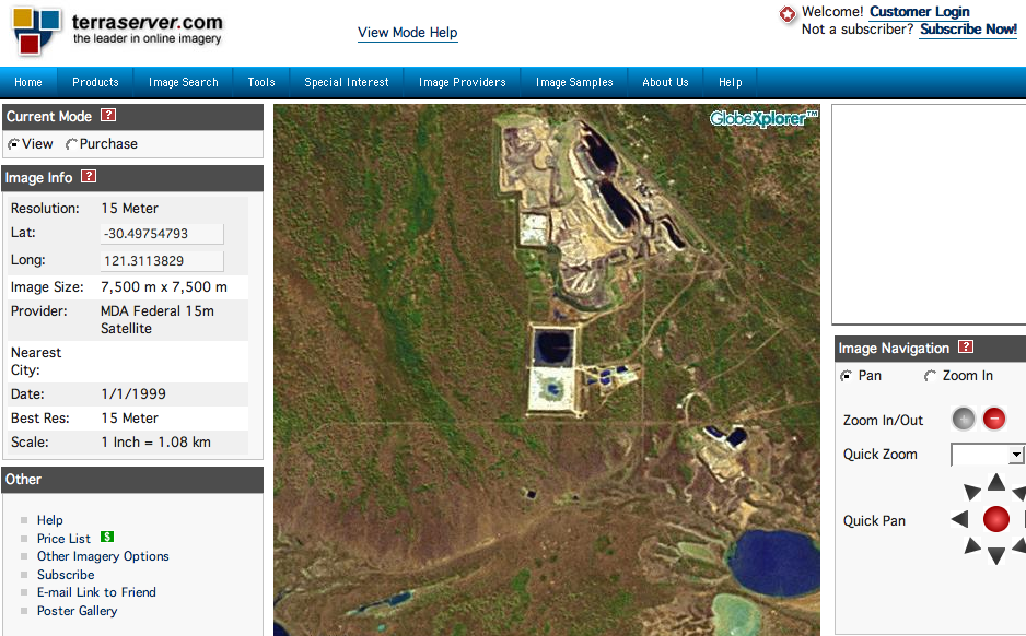
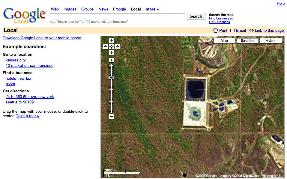
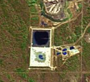
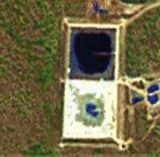
It was fun while it lasted, huh? We saw the Gizmodo post yesterday, about the iPod advertisement that’s viewable from space, and filed it away for future reference. Turns out that, after rocketing around the blogosphere, it’s probably not what it looks like. Some intrepid bloggers noted that the Terrabyte satellite image for that location on January 1, 1999 — before the iPod launched — looks the same  as it does Google Earth today.

We’ve got both images. Care to guess which is which?


It gets better. The Terabyte server’s been rather busy, so when we got a chance we grabbed a screenshot of the whole page. (Note the date.)


terrabyte1999

And we grabbed a shot of Google Earth as well. 


googleearth

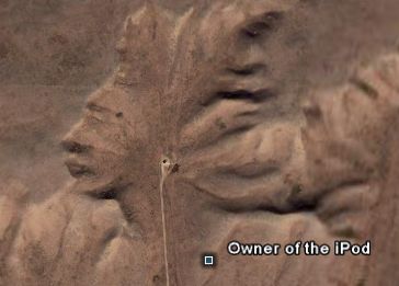
And fun would it bit of snark? The author of the the original post suggests he knows the identity of the legendary space-iPod’s owner.

It is just me? Do things not always look like what they are when seen from space? Or is am I seeing ancient Egyptian royalty here? 

So, is there anything else that looks like an iPod from space? How many can you find?

NASA & Sweden in Moonbase Race?

The history book on the shelf,
Is always repeating itself…

Abba – “Waterloo” 

We’ve already been to the moon (unless you believe that the whole thing was done on a movie lot), but it looks like we’re going to stay a while the next time we go back. There just one question. Who’s gonna get there first? I experienced a little brain tickle this morning when I saw the news item that NASA is quietly planning a moonbase

For the first time since 1972, the United States is planning to fly to the moon, but instead of a quick, Apollo-like visit, astronauts intend to build a permanent base and live there while they prepare what may be the most ambitious undertaking in history — putting human beings on Mars.

It sounded vaguely familiar, and not because the presdient announced a plan to return to the moon a couple of years ago. I felt that brain tickle because I remembered hearing just a week or so ago that someone else was planning to do the same thing.

A quick search through my bookmarks, and I had the answer. In the race to colonize the moon, NASA has at least one competitor: Sweden.

The proof comes in the form of the innocent-looking SMART-Centre which, according to various reports, has assembled a consortium of more than 50 partners – including Japan’s Shimizu Corporation, US NASA contractor Orbitech and the UK’s Cranfield University – to turn the centre’s Dr. Niklas Järvstråt’s dreams of extraterrestrial conquest into reality.
 You won’t find much about a moonbase at the SMART-Center homepage. For that you’ll have to dig into their projects for the vision statement.

We have already taken the one small step for mankind and landed on the moon. We have seen it, we have conquered it, we have explored it – but our presence has not been sustained. For the benefit of mankind, the survival of our natural resources on Earth and for the proliferation of space exploration, it is now time for the next logical step – an international lunar colony. A colony where men, women and children can live without the need of a continuous supply of materials and technology from Earth; a self-supporting colony where the great circle of life can be sustained in its entirety by lunar raw materials and where all life-sustaining products will be manufactured in situ.

The Swedes have some other big plans in mind beyond moon — including exploring Mars, asteroids, other solar systems, etc., and trying their hand at world peace — but will it be more than they can handle? Then again, as the article linked above notes, NASA has its hands full with emptying its already-tapped-out pocketbook for space shuttle repairs, with a 2020 back-to-the-moon deadline looming over it. The Swedes have a deadline for lunar construction and immigration to happen sometime between 2018 and 2024.

So, it’s not a question of if human beings will return to the moon, but a matter of when and under which flag. Anyone care to lay bets?

New Falcon 1 Rocket Destroyed on Maiden Voyage

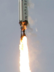
An engine fire destroyed Space-X’s Falcon 1 rocket on its maiden voyage today, according to reports.

Close up of Falcon 1 Engine Fire The International Reporter has early details:

The US vehicle, developed by the Space Exploration Technologies Corp, was destroyed soon after take-off from the Marshall Islands in the Pacific Ocean. The vision of Elon Musk, co-founder of the electronic payment system PayPal, the Falcon was designed to cut the cost of current satellite launches.

An onboard camera appeared to show the rocket rolling out of control shortly before the video signal was lost….

The rocket was attempting to carry a 19.5kg satellite to a low-Earth orbit of 450km. The satellite, FalconSat-2, was built by US Air Force Academy cadets to investigate the phenomenon known as "space weather".

Elon Musk has additional details on the Space-X blog

The good news is that all vehicle systems, including the main engine, thrust vector control, structures, avionics, software, guidance algorithm, etc. were picture perfect.  Falcon’s trajectory was within 0.2 degrees of nominal during powered flight. 


However, at T+25s, a fuel leak of currently unknown origin caused a fire around the top of the main engine that cut into the first stage helium pneumatic system.  On high resolution imagery, the fire is clearly visible within seconds after liftoff.  Once the pneumatic pressure decayed below a critical value, the spring return safety function of the pre-valves forced them closed, shutting down the main engine at T+29s. 
 

It does not appear as though the first stage insulation played a negative role, nor are any other vehicle anomalies apparent from either the telemetry or imaging.  Falcon was executing perfectly on all fronts until fire impaired the first stage pneumatic system.
 

Our plan at this point is to analyze data and debris to be certain that the above preliminary analysis is correct and then isolate and address all possible causes for the fuel leak.  In addition, we will do another ground up systems review of the entire vehicle to flush out any other potential issues.
 
The company says it is too soon to determine when the next flight will take place. 


Making MobTV Work

I’ve decided to try my hand at coining a new phrase: mobTV. I figure if mobile blogging can become "moblogging", then mobile television can become "mobTV." Besides, as I’m learning more about it and writing more about it I’m going to need a more efficient way to refer to it if I want to keep up, given the way its spreading and the number of terms I have to learn. 

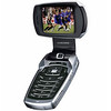
Since my last post on the mobTV taking off in Korea, it looks like mobTV is coming to China next, if Radioscope has its way.  And on a pretty cool looking phone, if you ask me.

Samsung MobTV PhoneRadioscape has won contracts to supply five more Digital Multimedia Broadcast (DMB) and Enhanced Packet Mode (EPM) transmission systems for mobile TV operators in China, bringing the total to nine in the past few months.

 The company says the contracts are the fruits of at least two years of courting Chinese authorities about its DAB-based mobile TV technology and helping them evaluate the most appropriate technologies for the service, and choosing between DMB, DVB-H and DMB-T.

From there it gets interesting. Qualcomm announced last year that it was bringing mobTV to the states via a  technology called MediaFLO, which Verzion also adopted late last year. For the curious, Mobile Content News has video of MediaFLO in action. (Found via Engadget, and I believe that’s Shrek on the small screen.)  The question is, can it work? The experts aren’t  exactly in agreement. Depending on who you ask, MediaFLO and another technology called DVB-H are doomed because EV-DO already gets the job done and new networks are too expensive to build and support, or DVB-H will be the de facto standard once spectrum allocation problems are solved.

Got all that? Good, because I’m about to add some French to the mix. Alcatel just announced that it’s overcome the spectrum allocation issue by using a satellite frequency.

With the help of satellites, Alcatel aims to overcome a key hurdle in rolling out broadcast television services over mobile phones: the lack of available spectrum. 

The French telecommunications-equipment manufacturer proposes using the widely available S-Band frequency reserved for satellites to transmit broadcast signals both terrestrially and via satellite to mobile phones based on the DVB-H (digital video broadcasting – handheld) standard, instead of the UHF band. 

… The Alcatel proposal calls for equipping base stations with S-Band repeaters and, in addition, using satellites capable of transmitting in the S-Band to deliver content to 3G (third-generation) phones enabled with DVB-H technology in three different ways: base-station streaming, base-station broadcasting and satellite broadcasting.

The article also does a good job of explaining the drawbacks of the three delivery systems. Streaming offers unlimited channels and great indoor coverage, but only for a limited number of users on a network. Broadcast matches it on indoor coverage, and supports unlimited users, but only 27 channels. Satellite matches them on channels and user support, but falls short on indoor coverage. Alcatel claims the answer is an "intelligent content-management system" that seamlessly chooses the right delivery system. 

Leave it to the French to come up with an elegant solution. I just hope it works well enough to eventually get picked up in the U.S. It would be great to catch up on Desperate Housewives reruns on the subway, and get all the way up the street to my office without losing the signal.

No More Dial-Up to the Outer Planets

It may be surprising to many people, but when NASA scientists receive data back from distant probes, their experience is akin to downloading "Bohemian Rhapsody" (or, pick your own epic-length song) on 56K. Which is to say, there’s a lot of waiting involved. But that could change:

 Researchers at the Massachusetts Institute for Technology have developed a tiny light detector that could one day boost interplanetary communications to broadband speeds.

Images from Mars, like this computerized one of a canyon, are transmitted at a data rate of 128,000 bits per second.

The work could permit the transmission of color video between astronauts and satellites and scientists on Earth across interplanetary distances, something that is not practical with current technologies.

The new light detector improves detection efficiency to 57% at a wavelength of 1,550 nanometers — the same wavelength used by optical fibers on Earth to carry broadband signals to homes and offices. Currently, light detectors only absorb about 20% of the light they receive.

"It can take hours with the existing wireless radio frequency technology to get useful scientific information back from Mars to Earth," said study team member Karl Berggren from the Massachusetts Institute of Technology. "But an optical link can do that thousands of times faster."

The work is detailed in the Jan. 23 issue of the journal Optics Express


Hunting for Stars, Through the Light

This is a great effort:

Join thousands of other students, families, and educators by participating in GLOBE at Night – an international event designed to observe and record the visible stars as a means of measuring light pollution in a given location. Participation is open to anyone – anywhere in the world – who can get outside and look skyward during the week of March 22-29, 2006! There is no cost to participate in GLOBE at Night. Help us reach our goal of 5000 observations from around the world!

 The National Optical Astronomy Observatory, which is sponsoring the event, also has a cool online tool that allows you to witness the changes in the night sky that result from light pollution.

For more information, download the GLOBE Family Activity Packet PDF (in English and Spanish) or subscribe to the GLOBE email list. 

Robots on the Road

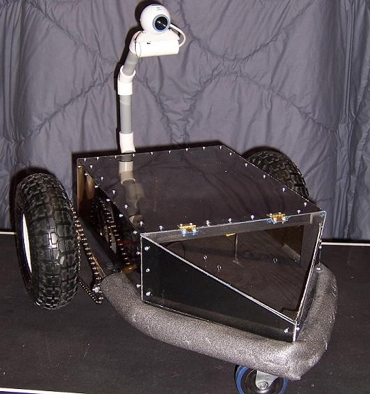
Here’s another post about people building the darndest things. On March 28th, thanks to the folks at Darpanet, you’ll be able to watch a dozen driverless vehicles — created by people ranging from entreprenuers to students and hobbyists — attempt to successfully navigate 130 miles of Mojave desert terrain on NOVA’s The Great Robot Race. NOVA’s companion site features background on the dozen teams competing for the $2 million prize, as well as videos of their vehicles, and a preview of the upcoming show. 

Sounds impressive, and you can bet that with $2 million at stake a lot of time and resources went into building these prototypes. However, my favorite robot vehicle of the day won’t qualify for the competition. It’s a wi-fi rover I found via Make  magazine, built at a cost of $103 by a high school student who won second place in a local science fair with his creation.


He’s got plans to add GPS, and other neat gadgets. After building a robot on just over $100, I wonder what this kid could do with even a fraction of the Great Robot Race prize money.

The (Private) Race for Space

We’ve written before about the incipient space tourism industry; yesterday the AP released a story that summarizes the gathering momentum of what was, not too long ago, a "sleepy industry":

Two years after the first privately financed space flight jump-started a sleepy industry, more than a dozen companies are developing rocket planes to ferry ordinary rich people out of the atmosphere.

Several private companies will begin building their prototype vehicles this summer with plans to test fly them as early as next year. If all goes well, the first tourist could hitch a galactic joy ride late next year or 2008 – pending approval by federal regulators….

"This time, it’s personal. This space race is about getting ‘us’ into space," said space historian Andrew Chaikin.

For now, commercial space travel remains an exclusive club.

Over the past few years, three tourists have paid a reported $20 million each to ride aboard a Russian rocket to the orbiting international space station.

Instead of days in space, the commercial spaceships under development will only reach suborbital space, a region about 60 miles up that is generally considered the beginning of the rest of the universe. Since the private spaceships lack the speed to go into orbit around Earth, the flights are essentially up and down experiences – lasting about two hours with up to five minutes of weightlessness.

The article includes a summary of the major contenders in the space-tourism arena:

The biggest name is Virgin Galactic, a space tourism firm founded by British billionaire tycoon Richard Branson. Branson has partnered with Burt Rutan, whose SpaceShipOne in 2004 became the first private manned craft to reach space, to build a fleet of suborbital commercial spaceships called SpaceShipTwo….

_Oklahoma-based Rocketplane Kistler is one of Virgin Galactic’s biggest competitors. Rocketplane Kistler, whose main investor is American businessman George French, hopes to start test flights next January and fly commercially by next summer. French owns several businesses including a space education company in Wisconsin….

_Space Adventures, a Virginia-based space travel agency best known for brokering three tourists to the international space station, is the latest entrant.

Last month, Space Adventures announced a partnership with members of the Ansari family – the major funders of the $10 million X Prize won by SpaceShipOne – to develop Russian-designed suborbital rockets that would launch from a proposed spaceport in the United Arab Emirates by 2008.

You can check out Rocketplane here and Virgin Galactic here.

Maps in Greater Detail

Wired has a good article out today on how the next-generation of commercial imaging satellites is going to change, er, the way we view the world– or at least the details of our view:

Critics of overhead imagery services like Google Earth and Microsoft Virtual Earth generally fall into two categories: government agencies who say the services show too much, and users who lament they can’t see more.

As the next generation of commercial imaging satellites moves closer to launch, the first camp may be out of luck.

Forthcoming features such as enhanced zoom capabilities, higher-resolution views and faster updates of stock imagery will reveal far more detail of Earth’s surface than anything visible on a computer screen today. While satellite imagery won’t be real-time, or capable of distinguishing individuals, it will be good enough to pinpoint ground-level details too blurry to identify using today’s technology.

"We’re just starting," said Matthew M. O’Connell, CEO of GeoEye (formerly Orbimage), which plans to launch a satellite in early 2007 that can show images of objects as small as 1.3 feet across. "At that resolution, we can literally count the manhole covers in Manhattan."

Just a few years ago, the idea of zooming in from a PC screen to any point on Earth would have seemed like the stuff of fantasy. Now that it’s reality, satellite and aerial mapping applications are drawing millions of addicted users. Hardly a week goes by without news of some strange or scandalous finding: Last week amateur astronomer Emilio González of Spain used Google Earth to find what might be a previously unknown impact crater in Chad.


Read the whole story here