Archive for the ‘Satellite TV’ Category

Volcanoes

Tuesday, May 20th, 2008

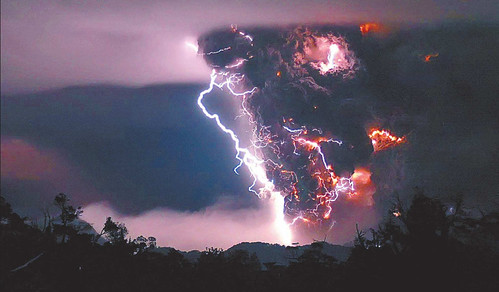
Earlier this month a volcanic eruption in Chile wowed the world, and produced one of the most magnificent natural images ever.

The eruption actually came from a volcanic caldera, Chaitén. The eruption forced the evacuation of nearby towns, merged two massive craters, and increased the possibility of even more activity. You can watch video (in Spanish) of the disaster here.

But beyond YouTube recaps of eruptions, you can discover images of the volcanoes, active and dormant, around the world. The Italian Government has publicly accessible webcams of volcanoes. And this site has mapped, photographed, and documented every volcano in the world (including Chaitén). Pretty amazing.

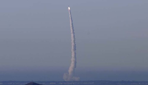
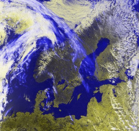
Satellites are keeping tabs too. This site has satellite images of some of the world’s largest volcanoes, including some very close to home.

But, of course, Volcanoes are not limited to Earth. Jupiter has some of the our galaxy’s more active volcanic activity:

Before the Voyager probes visited Jupiter, if you had described Io to a literary critic it would have been declared overwrought science fiction. Jupiter’s strange moon is literally bursting with volcanoes. Dozens of active vents pepper the landscape with volcanic rings the size of California. The volcanoes themselves are the hottest spots in the solar system with temperatures exceeding 1800 K (1527 C) about 1/3 the temperature of the surface of the Sun. The plumes which rise as much as 500 kilometers into space are so large they can be seen from Earth by the Hubble Space Telescope. Confounding common sense, these high-rising ejecta seem to be made up of, not blisteringly hot lava, but frozen sulfur dioxide. For a world dominated by fiery volcanoes, it’s curious that Io is also very, very cold. The ground just around the volcanic vents is literally sizzling, but most of Io’s surface is 150 degrees or more below 0 C.

What powers the tremendous volcanic activity? Tides! But the tides on Io are not like ocean tides we’re familiar with on Earth. The gravitational fields of Jupiter and its large moons Europa and Ganymede cause tidal bulges in the solid crust of Io that are as high as 100 meters (330 feet). As Io orbits the giant planet, the bulge moves, flexes the crust, and heats Io’s interior like a paper clip bent rapidly back and forth. Infrared observations have shown that the thermal energy released by Io’s hot spots is on the order of 125 trillion watts which is about 2.5 W/m2. By contrast the moon’s outward heat flow is 0.02 W/m2 and the Earth’s average heat flow is 0.06 W/m2.

A year ago, NASA’s New Horizons probe captured a number of amazing images, showing massive plumes of ash, believed to be a result of Volcanic activity.

Britain – a space power?

Monday, March 3rd, 2008

Well, sort of. With a little investment, the Brits could be an important player in space exploration and business:

Britain can play an important role in space exploration by exploiting its skills in the satellite sector rather than joining the competition in manned space flights, according to David Williams, head of Avanti, a satellite communications company. "There aren’t unlimited resources – we have to prioritise in areas where we have an economic advantage," he said.

Britain should be creating the communications infrastructure that will be needed as exploration expands deeper into space, he said. Countries such as the US, China, India and Russia, as well as the European Space Agency, are working on deep-space exploration. "If mankind is going to exploit the resources of the solar system, you are going to have to travel over very long distances and you are going to have to communicate over very long distances and you will need a network of data-relay satellites. The UK has a big advantage. We have the opportunity to control the space internet, which is going to be this network of data-relay satellites."

As The Guardian explains, these hopes are part of the government’s space strategy, drawn up by the British National Space Centre, which aims to double the number of British companies involved in the space business by 2012. Unfortunately, a trip to the moon is NOT part of the plan:

However, many space enthusiasts will be disappointed to learn that the plan has little to say about long-held aspirations for a British astronaut, though officials are to launch a review of the costs and possible benefits of human spaceflight.

In the 1960s ministers opted out of all crewed space missions, a stance governments have maintained since, but last year several key groups of experts, including the Commons science committee and a panel commissioned by the BNSC, warned that Britain risked being left behind if it did not end its long-standing opposition.

The failure to back a British astronaut dismayed some experts who believe Britain has missed any chance of being involved in European and Nasa plans to send humans back to the moon.

"There’s no commitment at all from this strategy. We’re the only developed nation that doesn’t have an astronaut, despite the fact that we’re the fifth largest economy," said Nick Spall of the British Interplanetary Society, who has been leading a campaign for a British astronaut.

"The government has missed a huge trick in terms of being able to offer inspiration to young people. In particular the chances of the UK contributing to a return to the moon, from a human spaceflight point of view, are very limited now. If we don’t have an astronaut with spaceflight experience we won’t get a look in on either of those missions."

Instead of "catching up" with other national manned space programs, Britain is going to try to conquer what it beleives to be an emerging focus of space research – climate change and disaster warning/relief:

The threat of climate change to planet Earth is to become the cornerstone of Britain’s role in the heavens, following an extensive review of space policy. British experts will develop satellites and other sophisticated technology capable of gazing back at Earth and taking the pulse of the planet from orbit, by monitoring melting ice sheets, dying rainforests and violent storms, under plans to be published by the government today.

The satellites will help create an early warning system for natural disasters, including hurricanes and tsunamis, and help to police international carbon-cutting agreements, such as pledges to avoid deforestation in some of the world’s environmental hotspots.

The move is at the heart of the government’s space strategy, drawn up by the British National Space Centre, which aims to double the number of British companies involved in the space business by 2012.

Under the plans Britain will become home to a major new European Space Agency facility based at Harwell in Oxfordshire. It will be dedicated to understanding climate change from space and developing robotics for space exploration. Britain is the only major contributor to the ESA that does not yet have its own facility.

According to BNSC officials, Earth observation from space is prioritised to help Britain become a hub for expertise in environmental science and disaster relief. During the 1990s natural disasters killed half a million people and caused £380bn of damage. Some 80% of those disasters were weather related, the report states.

It says: "Global satellite-based monitoring systems underpin our understanding of the health of the planet, alert us to dangers and speed up our responses. Satellites have a significant role in accurately assessing changes in sea [level] and temperature, the melting ice caps, and the effects of solar activity on the Earth and its environment."

Host My Payload

Wednesday, February 27th, 2008


Very interesting news from California this morning about Space Systems/Loral and Northrop Grumman’s Space Technology division getting together to go after U.S. government business. Building spacecraft for fully-funded government projects can be more profitable than going after commercial projects. Sounds like a simple agreement:

"The agreement with Northrop Grumman will allow SS/L to cost-effectively add capacity to address increased near-term commercial satellite opportunities," said Pat DeWitt, chief executive officer, Space Systems/Loral. "The agreement will also streamline the process for our companies to collaborate on providing the world’s best satellites for both civil and defense applications."

"The resulting strategic agreement will be important to increasing our competitiveness. These initiatives will present win-win opportunities for both companies and our U.S. government customers," said Alexis Livanos, corporate vice president and president of the company’s Space Technology sector. "For some of our mission areas, we believe that assured access to SS/L’s 1300 bus and bus subsystems would improve our cost and delivery schedule competitiveness. In addition, hosted payloads hold the promise of providing us greater ability and flexibility to rapidly respond to our government customers’ evolving needs."

Some of these new opportunities included "hosted payloads" where specialized instruments or entire subsystems can be added on to a satellite bus whose primary mission is paying most of the build cost. Given the importance of the role space plays in today’s C4ISR systems (Command, Control, Communications, Computers, Intelligence, Surveillance and Reconnaissance), and the expected ends-of-life of the spacecraft currently in orbit, we’ll need a bunch of new launches in the short term. Factor in programs being behind schedule — with some going way over budget —  and you might conclude we have a problem, Houston. Intelsat General is going after this market, too.

Northrop Grumman is involved in a new moon mission for NASA, the LCROSS (Lunar CRater Observation and Sensing Satellite):


Ready, Aim

Tuesday, February 19th, 2008

usa-193_notam_plot

We’ve been following this story for a few weeks now, and it is astounding how much attention has been paid to it. A top-secret U.S. observation satellite that’s out of control is set to be shot out of the sky precisely so it brings no harm to the public. Over the Pacific Ocean, for example, would be a good location. Now the U.S. Navy has issued a "notice to airmen," signaling just that:

02/062 (A0038/08) – AIRSPACE CARF NR. 90 ON EVELYN STATIONARY RESERVATION WITHIN AN AREA BNDD BY 3145N 17012W 2824N 16642W 2352N 16317W 1909N 16129W 1241N 16129W 1239N 16532W 1842N 17057W 2031N 17230W 2703N 17206W SFC-UNL. 21 FEB 02:30 2008 UNTIL 21 FEB 05:00 2008. CREATED: 18 FEB 12:51 2008

The Register explains what this means:

A "CARF" (Central Altitude Reservation Function) designation indicates a NOTAM intended to keep commercial and private flights clear of military operations, and SFC-UNL means the height band of this warning zone reaches from the surface to "unlimited" altitude – in other words all the way into space. The UTC time referred to is the same as UK time, so the zone exists from 0230 to 0500 on Thursday morning for British readers.

As will be evident, the barred area is a cool 1,400 miles long and nearly 700 miles wide at the surface, giving the US Navy plenty of elbow room to fire their interceptor missiles up into the descending spacecraft’s path.

Reports have it that three US Aegis air-defence warships, the cruiser Lake Erie and the destroyers Decatur and Russell, will be waiting for the satellite west of Hawaii. Each ship carries a specially modified Standard SM-3 interceptor, originally intended for defence against lower-flying ballistic missile warheads. The three interceptors are on separate ships in case of a technical issue with the Aegis radar and fire-control system.

As it passes over the firing area, the satellite will be approximately 3,000 miles and ten minutes out from the western coast of Canada, the next land it will pass over. The satellite has much more mass than the soaring "exo-atmospheric kill vehicle" it will smack into, so this gives some idea of the onward track the wreckage might follow in the event of a hit.

Google Earth kmz file by Alan Clegg is worth a look.

What can we expect on Thursday? Take a look at this Japanese test from last December:


Uncontrolled Re-entry by Spy Satellite

Sunday, January 27th, 2008

Apparently, a spy satellite is no longer in control and could crash to earth very soon. Today’s New York Times has some detail:

Specialists who follow spy satellite operations suspect it is an experimental imagery satellite built by Lockheed Martin and launched from Vandenberg Air Force Base in California in December 2006 aboard a Delta II rocket. Shortly after the satellite reached orbit, ground controllers lost the ability to control it and were never able to regain communication.

Of course, somebody has to think of the worst. This report from Canadian TV picks up on the hydrazine threat:

Gordon Johndroe, a spokesman for the U.S. National Security Council, said appropriate government agencies are monitoring the situation.

"Numerous satellites over the years have come out of orbit and fallen harmlessly," he said. "We are looking at potential options to mitigate any possible damage this satellite may cause."

It’s unknown whether the U.S. may attempt to destroy the spy satellite before it re-enters the atmosphere.

"It’s not all that easy," said Atwood. "You’re not going to shoot it down, you’re just going to explode it into a million pieces that are ultimately going to fall on the Earth."

An anonymous government source told AP that the satellite contains a rocket fuel called hydrazine, which is a toxic chemical and can be harmful to anyone exposed to it.


One of the news "sources" cited a launch out of Vandenburgh AFB on a Delta II rocket. Probably the NROL-21, a classified NRO spacecraft. Judging from its orbit (353 km x 380 km, 58.5°), it’s probably an experimental radar, according to Gunther:

NROL 21 is the cover-name for one-off classified satellite. Although nothing is known about the mission, the orbit hints for an experimental radar reconnaisance satellite.

A few weeks after launch reports emerged, that grond stations were unable to communicate with an expensive experimental U.S. spy satellite launched last year by the U.S. National Reconnaissance Office (NRO). Efforts were said to be continuing to reestablish communication with the classified satellite, which cost hundreds of millions of dollars, but "the prognosis is not great at this point," said the defense official, who asked not to be identified.The official said the problems were substantial and involved multiple systems, adding that U.S. officials were working to reestablish contact with the satellite because of the importance of the new technology it was meant to test and demonstrate. An other source said the satellite had been described to him as "a comprehensive failure."

In August 2007 the satellite has been declared a complete loss and will be allowed to decay from orbit.

I doubt the re-entry will be as pretty as the launch was…

It certainly will not have an on-board camera like the launch did (fast forward to 2:35 — that’s when the action begins):


The Sky is Failling!!!….well, part of it anyways….

Saturday, January 26th, 2008

AP report

Disabled spy satellite threatens Earth

By EILEEN SULLIVAN, Associated Press Writer

WASHINGTON – A large U.S. spy satellite has lost power and could hit the Earth in late February or March, government officials said Saturday. 

The satellite, which no longer can be controlled, could contain hazardous materials, and it is unknown where on the planet it might come down, they said. The officials spoke on condition of anonymity because the information is classified as secret.

"Appropriate government agencies are monitoring the situation," said Gordon Johndroe, a spokesman for the National Security Council, when asked about the situation after it was disclosed by other officials. "Numerous satellites over the years have come out of orbit and fallen harmlessly. We are looking at potential options to mitigate any possible damage this satellite may cause."

He would not comment on whether it is possible for the satellite to be perhaps shot down by a missile. He said it would be inappropriate to discuss any specifics at this time.

A senior government official said that lawmakers and other nations are being kept apprised of the situation.

Such an uncontrolled re-entry could risk exposure of U.S. secrets, said John Pike, a defense and intelligence expert. Spy satellites typically are disposed of through a controlled re-entry into the ocean so that no one else can access the spacecraft, he said.

Pike also said it’s not likely the threat from the satellite could be eliminated by shooting it down with a missile, because that would create debris that would then re-enter the atmosphere and burn up or hit the ground.

Pike, director of the defense research group GlobalSecurity.org, estimated that the spacecraft weighs about 20,000 pounds and is the size of a small bus. He said the satellite would create 10 times less debris than the Columbia space shuttle crash in 2003.

As for possible hazardous material in the spacecraft, Pike said it might contain beryllium, a light metal with a high melting point that is used in the defense and aerospace industries. Breathing beryllium can lead to chronic, incurable respiratory problems.

Jeffrey Richelson, a senior fellow with the National Security Archive, said the spacecraft likely is a photo reconnaissance satellite. Such eyes in the sky are used to gather visual information from space about adversarial governments and terror groups, including construction at suspected nuclear sites or militant training camps. The satellites also can be used to survey damage from hurricanes, fires and other natural disasters.

The largest uncontrolled re-entry by a NASA spacecraft was Skylab, the 78-ton abandoned space station that fell from orbit in 1979. Its debris dropped harmlessly into the Indian Ocean and across a remote section of western Australia.

In 2000, NASA engineers successfully directed a safe de-orbit of the 17-ton Compton Gamma Ray Observatory, using rockets aboard the satellite to bring it down in a remote part of the Pacific Ocean.

In 2002, officials believe debris from a 7,000-pound science satellite smacked into the Earth’s atmosphere and rained down over the Persian Gulf, a few thousand miles from where they first predicted it would plummet.

Intrigue in India: Iran Interfered with Israeli Satellite Launch

Wednesday, January 23rd, 2008

On a cloudy day when the mist hung heavily in the air, India’s Polar Satellite Launch Vehicle, PSLV-C10, successfully put the Israeli satellite Tecsar into orbit. It was a textbook launch with the “core-alone” configuration of the PSLV lifting off on time from the first launch pad at Sriharikota at 9.15 a.m. on Monday and injecting Tecsar into its precise orbit 19 minutes and 45 seconds after the lift-off. Tecsar, weighing 300 kg, is a remote-sensing satellite that can take pictures of the earth 365 days of the year, 24 hours of the day, through rain, clouds, day and night. It has a one-metre resolution. It was earlier known as Polaris.

Top Indian Space Research Organization (ISRO) engineers called this one "one of the very best launches" of the PSLV and "an excellent performance with a perfect injection of the satellite into orbit." But the road to launch wasn’t so smooth. Iran gave sabatoge a shot:

The successful launch on Monday of an advanced Israeli satellite was delayed in recent months by Iranian sabotage, The Jerusalem Post has learned from Western sources.

The TecSar satellite – developed and manufactured by Israel Aerospace Industries (IAI) – was supposed to be launched in September, on the heels of the June launch of the Ofek-7 spy satellite.

Its deployment will dramatically increase Israel’s intelligence-gathering capabilities regarding the Islamic Republic’s nuclear program, since the satellite can transmit images in all weather conditions, a capability that Israel’s existing satellites lacked.

According to assessments recently received, Iran learned of the TecSar’s planned deployment from the media and has since applied heavy pressure through Indian opposition parties – particularly the Muslim and Communist political factions – to prevent the launch.

Teheran’s attempts to sabotage the operation may demonstrate concerns over Israel’s advancing intelligence capabilities. "The Iranians are scared of the potential this new satellite will bring Israel," a Western defense official had said earlier. "They are doing everything they can to prevent its launch."

IAI, the Israeli manufacturer of TECSAR, has more information on the aircraft here (and in the YouTube video, below). And, the ISRO engineers shouldn’t party too long – they’ve got a busy launch schedule this year.

DIY Friday: Weather Satellite Station

Friday, January 11th, 2008

Sick of weather.com’s pop-up ads?

Setting-up a weather satellite station is remarkably simple: Connect a discone antenna ($50-100) to a PC-controlled receiver (HobbySpace used a ICOM – PCR1000 – now a 1500). The receiver includes software to receive the audio signal. You will need software to decode the audio to obtain the weather image. HobbySpace used WXSat (freeware). More advanced station designs are available here.

You can use WinOrbit to track when and where a polar satellite will pass. By the way, these polar satellites work a little different than your typical weather satellites that show weather patterns moving across the country on your local news:

The NOAA polar satellites orbit at 850km and pass within view of all areas on earth at least twice day. The satellite carries a number of instruments including cameras for both visible and Infrared light.

The cameras scan back and forth at right angles to the ground path, like a broom sweeping side-to-side as you walk forward, taking picture strips that cover an area 3000km wide. The satellite thus makes a continuous picture as if it was a tape reeling out from an endless roll.

The image, however, is not recorded on the satellite. Each image strip is immediately broadcast to the ground at a frequency just above 137MHz. The satellite will be in range for up to 12min as the satellite passes from horizon to horizon.

The broadcast uses the APT (Automatic Picture Transmission) analog format for the imagery. (A digital format – High Resolution Picture Transmission (HRPT ) signal is also transmitted but it is more difficult to receive and decode and we did not try to receive it in this project.)

Want the whole shebang? Build an ethernet weather station to collect temperature and air pressure readings, then feed the data through its very own web server.

And, if you’re looking for a location for your new venture, consider my old stomping grounds – southern Wisconsin. Among the bizarre events in the past few weeks: first Severe Thunderstorm Warning in 14 years during the month of January; numerous rivers exceeding flood stage…in JANUARY; and record high January temperatures throughout the area. Crazy. We’ll save the global warming debate for a different day. Let me just say I’m glad I did my cross-country skiing in December and not January.


Space Bump

Wednesday, December 26th, 2007

With all the space debris out there, especially in the lower orbits, its a wonder we don’t hear about this type of news more often. Big news a year ago was the Chinese missile taking out one of its own weather satellites, causing a space junk controversy (watch the video simulation here). You can track this debris yourself.

But I reckon it’s called "space" for a reason — there lots of it up there.

The news, via the Daily Press in Virginia:

An unknown object apparently collided with a satellite with NASA Langley Research Center connections in November, sending several broken pieces flying into orbit.

The satellite was decommissioned in December 2005, but was one of NASA’s largest and brightest in low-Earth orbit, and popular among amateur sky watchers. Called UARS, Upper Atmosphere Research Satellite, it was launched in 1991 and carried a NASA Langley instrument called HALOE that captured data about the chemistry of the atmosphere.

On Nov. 10, something apparently hit the school bus-sized orbiter. It could have been one of the many pieces in a growing field of "space junk." It could have been a meteoroid. Space debris often leaves pings and dents in satellites and even the space shuttle, and aging satellites decay over time. But a collision that actually creates new pieces of debris is more rare.

"When I heard this, I was shocked," said Jim Russell, a Hampton University professor who was the project lead for HALOE. "This is very unexpected. That’s not normal decay."

Nicholas L. Johnson, chief scientist for NASA’s Orbital Debris Program, said it remains unclear what happened to UARS. Four pieces bigger than 4 inches in diameter — roughly the size of a trackable piece of space junk — were sent into orbit, but it is unclear how large those pieces are.

A collision from a meteoroid or another piece of debris is the best hypothesis, Johnson said. The core of the spacecraft appears to still be intact.

"Unfortunately, we might not ever learn what caused the event," Johnson said.

Mark Matney, who works with Johnson in the Orbital Debris Program, said satellites with still-functioning pressurized systems sometimes eject new debris if a tank explodes. But UARS had no such systems, so a collision is the best explanation.

Only three known collisions between two satellites have ever occurred, Matney said. But these "anomalous" events, where it’s not clear what one of the colliding objects was, do happen occasionally, he said.

"It’s very hard to determine," what might have hit UARS, Matney said.

Decommissioned satellites typically continue to orbit for years before losing energy and falling toward Earth, usually to burn up. UARS was expected to fall out of orbit around 2011, Russell said.

UARS weighed about 13,000 pounds and measured 35 feet long and 15 feet wide, perhaps making it a better target than most.

The U.S. Space Surveillance Network, run by the Air Force, estimates there are about 10,000 objects in low-Earth orbit that are larger than 4 inches. The network’s sensitive ground-based instruments can track those objects. The objects range from communication satellites to the International Space Station to junk — pieces of decaying satellites and the remnants of rocket boosters.

The field of debris has become an increasing concern as the number of pieces continues to increase. The debris field was also significantly expanded in January of this year, when China angered the U.S. and other nations by testing an anti-satellite missile. The Chinese destroyed their FY-1C satellite, an aging weather observer.

The missile test exploded the satellite into more than 1,000 pieces of debris, and U.S. intelligence and defense analysts almost immediately deduced what had happened, before the Chinese government admitted it a few weeks later.

The UARS collision created only a handful of new pieces of debris, but still, "You hope it’s not anything sinister," said Ellis Remsberg, a Langley scientist who worked on HALOE with Russell.

Two of the "large" pieces that broke off UARS have apparently already burned up in the atmosphere, Johnson said. The other two pieces will likely do the same.

What remains of the craft’s core will continue to orbit for some time — barring another collision.


German Eye in the Sky

Thursday, November 1st, 2007

The SAR-Lupe satellite was launched via a Kosmos-3M rocket from the Plesetsk Cosmodrome in Russia earlier this morning. Built by OHB-System AG in Germany ("lupe" is German for magnifying glass; SAR = synthetic aperture radar), the satellite will be used for earth observation, day or night, in any weather condition — according to Wikipedia:

They use an X-band radar with a three-metre dish, providing a resolution of about 50 centimetres over a frame size of 5.5km on a side (‘spotlight mode’, in which the satellite rotates to keep the dish pointed at a single target) or about one metre over a frame size of 8km x 60km (‘stripmap mode’, in which the satellite maintains a fixed orientation over the earth and the radar image is formed simply by the satellite’s motion along its orbit). Response time for imaging of a given area is 10 hours or less.

The Bundesamt für Wehrtechnik und Beschaffung (German Federal Office of Defense Technology and Procurement) runs this program. Here’s what they like best about this system:

Satellites as carriers of optical or radar sensors can, unlike aircraft or unmanned aerial vehicles, carry out reconnaissance operations without infringing sovereign rights. They are thus particularly suited to gather information – without escalating effect – about early crisis detection and prevention and about effective crisis management.