Archive for the ‘Observation’ Category

WiMAX is Easy as ABC

Friday, September 21st, 2007


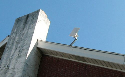
We’ve been writing about "wifi on steroids" — or WiMAX — since the earliest days of the Really Rocket Science blog, when it was but a dream on the technological horizon.

These days, understanding the deployment and growth of WiMAX  is as easy as A-B-C.

A is for Alaska, where AT&T Alascom, which has been using satellites to deliver telecom across Alaska since 1974, is rolling out WiMAX using  Alvarion Ltd.’s BreezeMAX 2.3 GHz TDD equipment:

 Alvarion’s solution is capable of delivering flexible and enhanced coverage even in difficult terrain, such as the hilly and wooded areas. In addition, Alvarion’s nomadic self-install Si CPE can incorporate a patent-pending fast-switching algorithm with six integrated antennas. The Si can is available with a wide variety of options, from multiple POTS interfaces to built-in Wi-Fi.

To deliver WiMAX, AT&T Alascom utilizes SES-Americom’s AMC-8 satellite (also known as Aurora III) exclusively.

Rumors also have AT&T deploying WiMAX in the South soon:

AT&T Inc. is preparing to launch WiMax services during the second quarter of 2008, Unstrung has learned from an industry source. The services will likely be in the South of the U.S. where the operator has suitable licenses for broadband wireless services.

The cellular giant is planning to deploy limited WiMax services in the 2.3 GHz band that could be used as a fixed-wireless alternative to DSL or cable offerings, the source says. AT&T is said to have its suppliers for the service lined up now.


B is for Breezemax; Alvarion of Israel is making real progress in selling their BreezeMAX system for WiMAX apps:


Commercially available since mid 2004, deployed by over 150 operators in more than 30 countries, BreezeMAX is the most advanced, field proven commercial WiMAX solution and the first to offer CPE powered with Intel PRO/Wireless 5116 broadband interface WiMAX chip.


Built from the ground up based on the IEEE 802.16-2004 standard, BreezeMAX supports fixed, nomadic and portable services with a clear path for the emerging WiMAX mobile industry based on the IEEE 802.16e standard. BreezeMAX is designed for a variety of frequencies in both licensed and license-exempt bands from 2GHz to 6GHz spectrum, and operates in both FDD and TDD duplex modes.

Check out this long list of PDF case studies to see how Breezemax is deployed worldwide.

But C isn’t for "check out" — it’s for the Caribbean, where Digicell is rolling out WiMAX using Alvarion products, most recently in Cayman Islands using AMC-6.

Given the continuing rapid growth in WiMAX deployment, we could probably go all the way to Z….

Work on Warp Drive

Friday, September 21st, 2007


We blogged about getting a space job before, but now it looks like a few hundred can call their new business address "Warp Drive." That’s right: Warp Drive is an "inside" street name on the corporate campus Orbital Sciences, a company that’s about to expand in Northern Virginia, according to the Washington Post:

Orbital Sciences, a rocket and space technology manufacturer for the government and military, is embarking on a major expansion of its headquarters in Dulles, adding as many as four buildings and about 600 jobs to its campus.

The company’s 77-acre campus along Route 28 employs 1,500 workers. More than 100 employees work at leased office space a few miles down the road, and Orbital continues to grow. To date, the company said it has $4 billion worth of backlogged contracts.

"Orbital’s business is doing extremely well and growing quite rapidly," said Barron Beneski, a company spokesman.

The buildings — totaling 140,000 square feet — will house office, engineering and manufacturing space on an undeveloped tract of land adjacent to the campus. Construction on the first building has been approved by Loudoun County and is scheduled to begin in early 2008. The first new employees could occupy the space in 2009.

"The next several years we will build buildings as the need arises," Beneski said.

The federal government is Orbital Sciences’ biggest customer. The satellite company has contracts with the Defense Department and military intelligence agencies.

Space flight, in particular, is fueling much of Orbital Sciences’ growth, Beneski said. In 2010 NASA plans to retire the Space Shuttle. The company is part of a team led by Lockheed Martin that is producing the next generation of manned spacecraft to launch astronauts to the moon and beyond. The company stands to make $450 million to $500 million over the next 12 years from its role in the program.

Orbital also manufactures commercial communication satellites for companies such as Intelsat and SES Global.
"In the Washington area, there’s not a whole lot of manufacturing going on," Beneski said. "Consultants and IT people produce a lot of paper and gigabytes. We actually produce real stuff." 


Brazilian Observation Satellite Launched by Chinese

Thursday, September 20th, 2007


There are a lot of happy rocket scientists in Brazil today: 

CBERS-2B é lançado com sucesso da base chinesa de Taiyuan 

Exatamente às 00h26min desta quarta-feira (19) foi lançado com sucesso o CBERS-2B, terceiro satélite da parceria entre Brasil e China. O evento foi comemorado tanto no Centro de Controle de Satélites do INPE, em São José dos Campos (SP), como no Centro de Lançamento de Satélites de Taiyuan. O diretor do INPE, Gilberto Câmara, assistiu ao lançamento na base chinesa e, junto com os engenheiros Ricardo Cartaxo e Jânio Kono, respectivamente coordenador geral e coordenador do Segmento Espacial do Programa CBERS, transmitiu todas as informações aos técnicos e convidados que acompanharam da sede do Instituto.

“É uma emoção muito grande. É o resultado de um grande trabalho feito por brasileiros e chineses. Estamos todos muito orgulhosos”, disse o diretor Gilberto Câmara.

Chefe do Centro de Controle de Satélites do INPE, Pawel Rosenfeld manteve contato constante com Jânio Kono, coordenador do Segmento Espacial do Programa CBERS, que da base comandou as operações junto com os técnicos chineses.

O foguete Longa Marcha 4B cumpriu perfeitamente todas as etapas previstas para colocação do satélite em órbita. O tempo total de vôo até a injeção do CBERS em órbita foi de 12,5 minutos. O CBERS-2B é lançado com seus transmissores ligados permitindo assim que a estação de rastreio de Nanning, na China, mantenha contato com o satélite desde antes de sua separação do último estágio do veículo lançador, até aproximadamente um minuto e meio após a abertura dos painéis solares, que aconteceu cerca de 14 minutos após o lançamento.

The spacecraft is capable of producing images such as this beauty of Manaus:

Here’s the explanation, in English, via SpaceFlightNow.com:

A joint mission developed by China and Brazil was shot into an orbit circling Earth’s poles to snap detailed images of the globe during an early Wednesday launch from China’s northeastern space base.

A Long March 4B rocket launched with the international satellite at 0326 GMT Wednesday (11:26 p.m. EDT Tuesday) from the Taiyuan space center in China’s Shanxi province, according to the state-run Xinhua news agency.

The booster’s three liquid-fueled stages accurately deposited the third China-Brazil Earth Resources Satellite into a Sun-synchronous orbit about 12 minutes after liftoff.

CBERS 2B was left in a nearly circular orbit with an average altitude of approximately 462 miles, Xinhua reported. The Long March 4B was shooting for an orbital inclination of 98.5 degrees.

Wednesday’s launch marked the 60th consecutive success for China’s Long March rocket fleet. It was also the 8th space launch for China so far this year.

CBERS 2B will spend the next few weeks undergoing systems tests and preparations for an operational mission expected to last at least two years.

The 3,200-pound satellite was ordered by Chinese and Brazilian officials in 2004 to bridge the gap between older spacecraft and next-generation satellites, which should begin launching in 2009.

The craft’s predecessors, CBERS 1 and CBERS 2, were launched by Chinese rockets in 1999 and 2003, respectively. Both outlived their baselined two-year missions, according to Brazil’s National Institute for Space Research, a co-sponsor of the program.

The China Academy of Space Technology was in charge of the Chinese contribution to the mission, Xinhua reported.

CBERS 2B carries three primary imaging cameras to take a wide range of pictures of locations scattered throughout the world.

A low-resolution camera with a 60-degree field of view will specialize in capturing images of large swaths of the planet. Another camera will be capable of taking pictures with a resolution of about 65 feet.

Unlike its forerunners, CBERS 2B includes a high-resolution black-and-white camera able to produce images showing objects as small as 2.5 meters, or about eight feet. CBERS 1 and CBERS 2 each carried an infrared scanning instrument instead.

Scientists expect to use data from the project in environmental monitoring, crop planning and managing water resources. Images can also be used to identify types of vegetation and in soil surveys. Pictures could also end up in geography textbooks, according to Brazilian space officials.

Images from the new high-resolution camera will also be useful in urban planning and military intelligence applications for China and Brazil.

China has a 70 percent stake in the 19-year-old program, while Brazil controls about 30 percent of the project. Users in both nations have access to the satellite imagery.

Pictures from the spacecraft have been distributed online since 2004, and more than 15,000 users have downloaded about 320,000 images since the Internet campaign began, according to Brazilian officials.

Two more satellites with four cameras each will be launched in 2009 and 2011. The program extension was approved in 2002, and China and Brazil will equally split responsibility for the new project.

Here’s a video about the Brazilian Space Agency:

And here’s a little Brazilian space center tribute video set to Brazilian metal (mind the volume):


SeaMobile Testing VSAT Over Atlantic

Wednesday, September 19th, 2007

We’ve written before about the growing market for maritime satcom for large ships. Now, SES NEW SKIES is teaming up with SeaMobile’s Maritime Telecommunications Network (MTN) product group for extensive field tests of new miniaturized VSAT antennas, which will enable an array of satellite-based communications services for small vessels:

SeaMobile and SES NEW SKIES will test two new 60cm VSAT antennas, that set new standards with respect to size and weight of VSAT installations: the heavy-duty “Ruggidized” for fishing, work boats and oceangoing support vessels, and the lighter “Sure Lock”, which at less than 90lbs addresses more specifically the sailing, yachting and power boat markets. Both antennas use iDirect Spread Spectrum technology, allowing for small-sized, lightweight antennas which are effectively shielded against adjacent satellite interference. SES NEW SKIES is providing Ku-band capacity for the Spread Spectrum Technology demonstrations on its NSS-7 satellite at the orbital location of 338° East….

States Scott Sprague, Senior Vice President Global Sales of SES NEW SKIES: “Small-sized and light-weight VSAT antennas open up completely new markets for small vessel broadband connectivity, be it for professional use, navigation support, safety services or pure leisure/entertainment. The SES NEW SKIES global satellite fleet is particularly well positioned to support communications on the move, be it maritime, land- or air-based.”


As you can see from this map, SeaMobile currently has extensive MTN satellite coverage, and they’ve just signed their first commercial shipping customer:

SeaMobile Enterprises, a provider of at-sea communications and connectivity, announced Tuesday that it has reached a service agreement with Global Marine Systems, an independent, undersea cable installation and maintenance company. Terms of the three-year contract were not disclosed. SeaMobile said it will provide its Maritime Telecommunications Network satellite services aboard three Global Marine vessels. SeaMobile said it has already installed its MTN VSAT satellite services on two of the ships and expects to address the third later this month. Global Marine Systems is based in Chelmsford, England. SeaMobile is headquartered in Seattle and provides broadband and satellite services for more than 300 maritime vessels.

Stratos has also recently entered the maritime satcom marketplace, while Schlumberger is working to build a model that integrates land and sea.  


Delta Launches WorldView-1

Wednesday, September 19th, 2007

Google Earth users may soon be enjoying higher-resolution images of our little blue planet, thanks to yesterday’s launch of the Worldview 1 satellite.


The AP gives a summary: 

The WorldView 1 satellite, built for DigitalGlobe, which supplies much of Google Earth’s imagery, was lofted into space aboard a Delta 2 rocket [from Vandenberg Air Force Base]. The satellite separated from the rocket about an hour after liftoff and was circling 300 miles (480 kilometers) above Earth.

WorldView 1 was designed to collect up to 290,000 square miles’ (750,000 square kilometers’) worth of imagery a day — an area about the size of Texas. Information gathered by the 5,000-pound (2,270-kilogram) probe can be used by governments and companies to assess damage after a natural disaster or plan escape routes before a catastrophe, the company said.

Images and details about the bird can be found on the DigitalGlobe website. Features include an "ultra-stable platform, high-precision attitude sensors and GPS" that "allows the creation of accurate maps in remote areas, maximizing the utility of whatever resources are available," as well as the "highest commercially available" resolution, with direct downlink of those images available to customer sites using a high-speed 800 Mbps X-band downlink.


The Worldview 1 satellites was built by Ball Aerospace. Check out their online media kit, including high-resolution photos of the satellite.

Worldview 2, also being built by Ball Aerospace, is slated for completion in late 2008. 

Com in Africa: A Changing Marketplace

Wednesday, September 12th, 2007

Here at the Americom Business Network Blog, we’ve written about expanding telecom needs in Africa and about the role satcom plays in furthering the development of Africa’s oil reserves.

African development continues to be a hot topic in the world of sat- and tele-com, with a debate currently taking place about Telkom’s SAT-3 undersea cable and the countries it does (and doesn’t) serve: 

The biggest problem with Telkom’s SAT-3 undersea cable is that it never went bankrupt, said Johan Meyer, Telkom’s group executive for global capacity service.

Meyer, who has been intimately involved in the SAT-3 West Coast cable, which is SA’s primary undersea link for telecommunications and Internet connectivity with the rest of the world, said: “If SAT-3 had gone bankrupt, then we would have had a very different scenario to what we have today, and may even have found ourselves in a similar position to the North Atlantic cables.”

He was responding yesterday to comments made during a debate on pan-African connectivity at the Capacity Africa 2007 Conference, in Cape Town.

Wessel van der Vyver, GM of international business for Telecom Namibia, opened the discussion by saying that Telkom was one of the key impediments to his company lowering its own broadband and interconnectivity costs.

“Essentially, Nambia is a landlocked country in terms of undersea cable because SAT-3 lands in Angola and in SA. We were hoping to get a landing in Namibia, but this hasn’t happened.”

Later, Van der Vyver said Telecom Namibia was also “disappointed” that the proposed undersea cables being planned by the South African government’s new broadband infrastructure supplier, Infraco, was also ignoring his country.

“It would be a pity if another cable is built and it leaves us in the same situation.”

During the discussion, the lack of satellite capacity came under the spotlight.

Pedro Camacho, CEO and owner of Blue Sky Satellite Communications, said satellite capacity was at a premium, with a long waiting list.

Need some background on the SAT-3 cable? Look here:

SAT3/WASC/SAFE is a historic Achievement made possible by the participation of 36 nations, the majority of the landings are in African states. Together they have fully funded the undersea cable system costing more than US$600 million and will own and operate it for the next 25 years. This results in much of the revenue it generates being ploughed back into the continent. This is a major departure from the current scenario, where many African countries rely on foreign operators to route their international traffic which results in revenue generated in Africa, leaving Africa. 

Meanwhile, Telkom and HCI are expanding South Africa’s pay TV market:

South Africa’s communications authority granted fixed-line operator Telkom’s media unit, Telkom Media, and leisure and media group Hosken Consolidated Investments licences along with two smaller operators — On Digital Media and Walking on Water.

Entry of new operators is expected to stimulate the market, with more money being pushed to marketing pay-TV services, portfolio manager Khulekani Dlamini at Renaissance Specialist Fund Managers said.

Chief Executive Officer Nolo Letele of Naspers’ local pay-TV operation MultiChoice SA said the unit had been gearing up for competition.

"We will have to fight that much harder for the disposable rand in people’s pockets," Letele said after the announcement of the winning bidders.

With increasing demand continent-wide for better broadband, television, and voice connections, the communications landscape in Africa is sure to remain fluid for many years. We’ll keep you updated on the latest developments. 

Télécoms Sans Frontières Reconnects Areas Affected by Disaster

Tuesday, September 11th, 2007

Last month’s devastating magnitude-8 earthquake in Peru killed more than 500 people and knocked down or damaged thousands of buildings in Peru’s southern desert cities of Ica and Pisco.

In the midst of such devastation, conditions are exacerbated by lack of communications with the outside world, as landlines are inevitably severed by falling debris.

That’s why satcom plays such a critical role in disaster recovery. In the days following the earthquake in Peru, engineers from Télécoms Sans Frontières leaped into action. The BBC reported on August 17th: 

The five-strong team will deploy satellite telephone and internet access in three centres – at Pisco, where the quake hit hardest, Ica and Chincha.

Julie Cazenave, who is leading the team, said: "There is a lot of confusion right now because there is little information from the areas hit."

The priority will be to establish telecoms at the airport in Pisco.

Telecoms Sans Frontieres (TSF) is charity that works with the United Nations and the European Commission’s Humanitarian Aid Office (ECHO) to restore communications in disaster-hit areas and the developing world.

"There are no power lines to charge phones. In the affected areas there are no landlines, no internet," said Ms Cazenave.

TSF was critical in reconnecting families that had lost track of each other following the quake:

The relief team from TSF’s Americas base, composed of 5 specialist in emergency communications transports satellite communication equipment (Inmarsat BGan terminals, RBGan, GAN M4 and Mini M) as well as computer equipment to provide internet connections, telephone lines and fax….

During a calling operation on Tuesday, Carmen Hernandez called her son who lives in Spain and testified on the violence of the quake:

"- Mom, where are you calling from? Your voice is trembling, are you sure everything is alright?

"Don’t worry, please keep talking, it’s so good to hear your voice. We’re lacking everything here but we’re alive. When you come back, you won’t recognize Pisco. I’m calling from a satellite phone, a free called offered by an international NGO. Don’t worry son, stay where you are."

The Peruvian earthquake isn’t the only recent natural disaster where TSF has lent a hand:

Still in operation in Pisco following the earthquake which stroke Peru, Télécoms Sans Frontières intervenes in the area of the RAAN (North Atlantic Autonomous Region) from its Latin America base taking care of the victims of the Felix Hurricane.

Tuesday, the Felix cyclone (category 5) devastated Northern Nicaragua, involving the increase of human losses and the number of disaster victims which could exceed 500 000 people. Facing this disaster, the President of Nicaragua invited the international community to provide a humanitarian aid for the victims.

From their base in Managua, 5 logisticians of Telecoms Sans Frontieres arrived on the ground by helicopter, providing assistance to the relief organizations and United Nations agencies by deploying communication centers in Puerto Cabezas. These installations include Inmarsat terminals, BGan, Gan M4, Minis M  and laptops. Efficient telecommunications infrastructure plays a crucial role ensuring the success of emergency coordination. Additional TSF centers will be installed in Sandy Bay and Waspan from today.

At the same time, the TSF teams will offer to each disaster affected family a free call to a relative, which could provide them psychological assistance as well as immediate response to their needs.

ITU has also played a critical role in restoring vital communications to Peru, deploying 50 satellite terminals in remote and underserved areas.

For more information on Télécoms Sans Frontières, click here

DIY Friday: Military Satellite Hacking

Friday, September 7th, 2007

Relax. We are not designing instructions on how to take-down U.S. military satellites. But the U.S. Space Countermeasures Hands On Program (Space CHOP, for short) is trying to do just that — using store bought, DIY gear to disrupt or take-down U.S. military satellites. The goal: if we can discover our own vulnerabilities first, we can protect ourselves from the real enemies. Popular Mechanics chronicles Space CHOP’s activities:

Space CHOP was formed in 1999, and one of its earliest experiments used a UHF generator and a small amplifier purchased from an electronics store. The team pieced together an antenna out of copper wire, PVC piping and other easily obtained materials. (The Air Force won’t elaborate on Space CHOP hardware or targets.) By aiming the antenna at the sky and turning on just a few milliwatts of power, the team showed it could block signals from a military communications satellite.

"We demonstrated that a few unsophisticated guys with a few thousand dollars’ worth of equipment could interfere with a seriously sophisticated satellite system," says John Holbrook, Space CHOP’s program manager. "If we had turned on full power, we would’ve knocked [the system] out."

And it is not just DIY, technological experimentation. This team uses good, old-fashioned intelligence and face-to-face investigating:

More often than not, the Space CHOP team doesn’t need any equipment to uncover a vulnerability. They scour the Internet for potentially damaging information. They case out Air Force bases. Or, posing as graduate students, they pump defense contractors and military officers for information until they’ve figured out a way to take down a satellite or its link on the ground.

As the author of this Popular Mechanics article, Noah Shachtman, notes on his blog, this is not a fantasy threat. From the AP:

The Bush administration warned Wednesday against threats by terrorist groups and other nations against U.S. commercial and military satellites, and discounted the need for a treaty aimed at preventing an arms race in space.

Undersecretary of State Robert G. Joseph also reasserted U.S. policy that it has a right to use force against hostile nations or terror groups that might try to attack American satellites or ground installations that support space programs. President Bush adopted a new U.S. space policy earlier this year.

"We reserve the right to defend ourselves against hostile attacks and interference with our space assets," Joseph said in prepared remarks to the George C. Marshall Institute.

Joseph, the senior arms control official at the State Department, said nations cannot all be counted on to use space purely for peaceful purposes.

"A number of countries are exploring and acquiring capabilities to counter, attack, and defeat U.S. space systems," Joseph said

He also said terrorists "understand our vulnerabilities and have targeted our economy in the past, as they did on 9/11." He said terrorists and enemy states might view the U.S. space program as "a highly lucrative target," while sophisticated technologies could improve their ability to interfere with U.S. space systems and services.

Not a member of Space CHOP but still want to hack satellites? Try grabbing free satellite signals.

JCSAT-11 Set to Launch Tonight

Wednesday, September 5th, 2007

The Japanese telecommunications satellite JCSAT-11 was rolled out over the weekend to launch pad No.200 at the Baikonur cosmodrome. Liftoff of the Proton-M launch vehicle with a Briz-M upper stage is scheduled for 6:43 p.m. EDT tonight.

Built by Lockheed Martin, JCSAT-11 is a hybrid satellite, equipped with Ku-band high-power transponders and C-band medium-power transponders. For the time being, JCSAT-11 will be reserved entirely in orbit as a back up satellite for other JCSAT satellites as part of JSAT’s efforts to build a seamless global network.

ILS is lifting the bird. They’ve set up a launch blog, though the most recent post is a few days old:

 Bright and early Friday morning (well, not that bright, as the sun was just rising), the entire launch vehicle was rolled out to the Breeze M fueling station, where its propellants (fuel and oxidizer) were loaded into the upper stage over a two-day span. These operations are entirely in the hands of our partners at Krunichev and the Russian Space Forces, so our team had a little bit of time to catch up on administrative tasks. In the meantime, the Russian state commission arrived on the second day of fueling and gave the go-ahead for the integrated launch vehicle to roll to the pad with the JCSAT-11 satellite.

During these two fueling days, our team had a chance to sneak in a quick tour of the launch pad, which was used for the Russian N-2 Moon Booster and Energia boosters in years past. These were truly massive rockets, with a lift capability of over 100 metric tons (220,000 pounds) to Low Earth Orbit! The sheer scale of the pad was equally large and impressive.

On a related note, JSAT is helping the Widely Integrated Distributed Environment (WIDE) Project, which is seeking to produce the next generation of communications and broadcasting based on the IPv4 and IPv6 multicast technology. WIDE recently announced an IPTV partnership with the Open Student Television Network (OSTN), which we recently blogged about here.

As always, we’ll update you on the launch in the comments below. 

Go India, Go!

Monday, September 3rd, 2007


India’s ISRO had a great launch yesterday, via Hindustan Times:

After more than two hours of tension, space launcher GSLV on Sunday successfully placed in orbit the communication satellite INSAT-4CR. Weighing 2,130 kg, it is the heaviest payload to be placed in orbit by an Indian launcher.

With the failure of the last GSLV mission in July 2006 on their minds, Indian Space Research Organisation scientists had readied the present launch in a record 13 months. But the GSLV-F04 kept them on their toes well beyond the planned schedule time. The launch was delayed by a day due to a sudden change in weather. On Sunday, 15 seconds before lift-off at 4.21 p.m., the launch was once again put on hold. It wasn’t till two hours later that the problem—a failed communication link between the third cryogenic stage and ground link — was rectified and the space vehicle soared in a darkening sky.

The drama wasn’t over yet. Thirteen minutes into the flight path, mission control lost contact with the vehicle. Thankfully, it came back on and a hugely relieved ISRO chairman G. Madhavan Nair was heard muttering “thank god”.

Seventeen minutes after blast-off, as the satellite injected into the slotted transfer orbit, the smiles were back on the faces of the ISRO brass. “It was a dramatic mission with a lot of anxiety but something that gave us immense satisfaction when everything went off successfully. Team ISRO has done it,” said Nair.

B.N. Suresh, director of Vikram Sarabhai Space Centre, which designed the vehicle, said: “It was a small communication glitch.”

Nair said that though mission control had the option of postponing the launch by 48 hours, they were confident the launch sequence was in place. “The perfect and precise launch confirmed our confidence in the system and our team.”

This launch marks the third by ISRO in 2007 with two more scheduled.

Here’s the quick CNN/IBN report:


And here’s the full 5+ minute highlight reel: