Archive for the ‘Observation’ Category

Taxi!

Monday, August 27th, 2007

We’ve written before about plans to use satellite tracking technology to follow the progress of New York City Transit buses.

No one seemed to complain about that idea, since being able to see exactly where the bus you’re waiting for is on its route is of undeniable benefit to the riders, and at worst makes no difference to a bus driver.


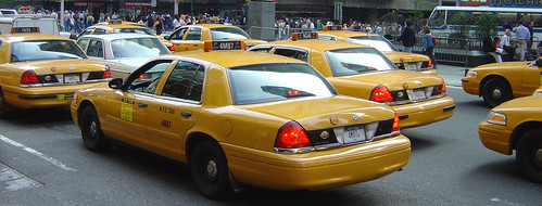
But a plan to put GPS in New York City taxis has cabbies screaming and honking like — well, like New York City cabbies:

The New York Taxi Workers Alliance — which accounts for more than 8,000 city drivers — is threatening to curb their cabs on Sept. 5 if the Taxi and Limousine Commission does not get rid of their GPS system, which the union says invades a driver’s privacy….

The issue over a driver’s privacy is the driving issue in the debate, with a driver’s location being tracked no matter where he or she goes.

"The Taxi & Limousine Commission wants to spy on drivers and they want drivers to pay for it," argues Desai.

Both sides agree the TLC uses satellite GPS technology to track everywhere a taxi cab goes and keeps a log of that information. The dispute is over how that information will be used and just who will have access to it.

Mateo says it’s understandable that the taxis are fitted with the technology and adds it’s even advantageous to each driver. "It indicates where you’re located, you can see where you’re going," he says.

But Desai says there is a different motive for the TLC to install the satellite. "They will use this information to decide on drivers’ incomes," she says.

Sources within the TLC and individual taxi drivers tell CBS 2 that the GPS fears have nothing to do with privacy and everything to do with money. Many drivers fear the IRS will use the data to audit drivers and alert the INS about illegal immigrants driving cabs.

Could this be the first strike ever started by GPS? 

Satcom Success at WildBlue

Thursday, August 23rd, 2007

"Dude, I can’t handle dial-up anymore," is probably what people without broadband are saying. I know I can’t. For me, it’s either broadband or nothing at all.

And the number of broadband subscribers keeps growing. According to the OECD (Organization for Economic and Co-operative Development), the U.S. has the most households with broadband, but doesn’t rank in the top 10 in terms of penetration:


Seems the battle is being waged between cable and DSL providers. But what about people who are rural or ex-urban? Yes, WiMAX is building a following, notably via Clearwire. But satcom remains a viable option, with Hughes (HughesNet) and Spacenet (Starband) grabbing the early lead in providing national service. Now here comes WildBlue. Since launching their own spot-beam Ka-band satellite, they’ve been booking 1,000 and 1,500 new subscribers every week.


They’ve been so successful, in fact, that they’ve been turning away business in some coverage areas. Check this out, via SkyREPORT.com:

Satellite broadband provider WildBlue Communications is suspending sales across several beams due to capacity constraints. In a letter written to dealers this week, the company said it would begin to halt sales on three spot beams beginning Sept. 1.

According to the WildBlue’s Beam Sales Suspension Notice, sales of the company’s satellite broadband product have continued at a "record-breaking pace" since the launch of its new satellite, WildBlue-1. As a result, the company said, WildBlue is experiencing new capacity constraints in certain areas of the U.S.

The beams in question are 131, 132 and 133, which, the company said, are 85 percent full. "Because of this overwhelming demand for WildBlue broadband service, and in order to maintain maximum performance for all of our customers, we are unfortunately left with no choice but to begin our first WildBlue-1 beam suspensions," the company said. The beams in question cover much of eastern Texas and the majority of both Louisiana and Alabama.

WildBlue told its dealers that beginning Sept. 1 the company will suspend all marketing and will not take any new orders in these particular beams. The company also said it has prioritized the portion of the country served by these beams for the next software and hardware upgrades, and it would notify dealers in advance of any additional capacity as it becomes available.

"In an effort to continue to provide the highest quality service for all of our valued WildBlue customers, we carefully monitor and manage the capacity on each of our spot beams throughout the country," the company told SkyREPORT. "As a normal course of business we may from time to time decide to suspend new sales in certain areas of the country, again, so that we can maintain the high quality service that our customers have come to expect from WildBlue."


Wow. Even before the launch, I heard they were selling out some capacity on Anik-F2 over the Ohio River Valley. Now new capacity is being sold out. Good for WildBlue, I say.

Googling the Universe

Wednesday, August 22nd, 2007

Without a doubt, Google Earth has put the functional utility of satellite imaging at the fingertips of millions, rekindling for many the shear wonder of what satellites can do to improve our lives.

Now Google’s virtual "satellites" (which aren’t really satellites, of course, but rather "the superimposition of images obtained from satellite imagery, aerial photography and GIS 3D") are doing what no single satellite has yet been designed to do: they’re turning their gaze from the Earth to the Heavens with today’s release of Google Sky:


With Sky, users can now float through the skies via Google Earth. This easy-to-use tool enables all Earth users to view and navigate through 100 million individual stars and 200 million galaxies. High resolution imagery and informative overlays create a unique playground for visualizing and learning about space.

To access Sky, users need only click "Switch to Sky" from the "view" drop-down menu in Google Earth, or click the Sky button on the Google Earth toolbar. The interface and navigation are similar to that of standard Google Earth steering, including dragging, zooming, search, "My Places," and layer selection….

"Never before has a roadmap of the entire sky been made so readily available. Anyone interested in exploring the wonders of our universe can quickly see where the stunning objects photographed by Hubble actually dwell in the heavens. Sky in Google Earth will foster and initiate new understanding of the universe by bringing it to everyone’s home computer," said Dr. Carol Christian of STScI, who co-led the organization’s Sky team with Dr. Alberto Conti.

Google Sky features seven layers, including Hubble Space Telescope Imagery, Constellations, the Moon and Planets, a "Users Guide to Galaxies" and a "Life of a Star" layer, as well "The Backyard Astronomer," which "is useful for the amateur astronomer who may benefit from a comprehensive, organized way to reference fragments of the night sky."

"The Sky imagery was stitched together from more than one million photographs from scientific and academic sources, including the Sloan Digital Sky Survey, the Palomar Observatory at the California Institute of Technology and the NASA-financed Hubble," according to the New York Times.

The BBC also has some good video of the new release. 

To get Google Sky, simply download the latest version of Google Earth.

Satellite VoIP

Monday, August 20th, 2007

In remote areas with no reliable wired telephone services, deploying a voice over internet protocol system over satellite may be the best voice option. This can be problematic, however, mainly because of satellite latency:

Latency is the term that describes the time it takes to get a packet to its destination. It is usually expressed in milliseconds, or ms. Since the satellites are located 23,000 miles above the equator, and satellite signals travel at the speed of light, this journey takes approximately 540 ms. You then add on the latency of the various Internet hops and servers plus the VoIP provider’s network to end with a total latency in the range of 650 ms to 700ms or more depending on the state of the Internet itself. Another contributing factor could be the quality of your satellite signal which may cause packets to be resent. This latency is heard as a delay between the sender and the receiving ear. Users of VoIP over satellite need to learn how to communicate with this inherent latency much like the older press-to-talk radio phones. Further, the delay requires the users to be patient and refrain from interrupting the caller.

This excerpt comes from an informative white paper produced by Galaxy Broadband (below).

The recently released, DTECH WHISPER V0IP System hopes to solve some of these latency issues:

The integration of the WHISPER system with the iDirect line of satellite hubs and remotes can provide end users with up to a 600 percent increase in V0IP call capacity over a single remote iDirect satellite link. The system can also reduce the amount of bandwidth required to support standard V0IP traffic by more than 30 percent.

With its reliance on large numbers of small, delay sensitive packets, V0IP traffic can quickly stress the resources of a remote satellite link. The WHISPER V0IP System, based on DTECH’s small-footprint, high-performance integrated hardware platform, is powered by VX Software from Network Equipment Technologies to deliver greater network efficiency through packet consolidation, header compression, and call consolidation.

This feature set reduces the number of packets and overhead required to support a V0IP call. A 1.5 Mbps iDirect satellite link can support more than 150 simultaneous V0IP calls, while a 3 Mbps remote link can support more than 250 simultaneous V0IP calls. The combined increase in calls per packet with the reduced bandwidth required allows network operators to utilize the same space segment they currently lease to provide a more robust voice network and greater capacity for data traffic.

DIY Friday: Satellite Gazebo

Friday, August 17th, 2007

Have an old, extra satellite dish? We’ve put them to good use in the past, consructing a wifi directional antenna and, better yet, a solar cooker. But where are you going to point the antenna and enjoy the BBQ (if that’s what you call a solar-baked entree)?

How about a satellite gazebo? These DIY’ers converted a vintage satellite dish (or a "BUD," big-ugly-dish, as they described it) into a surprisingly attractive gazebo.

The plan: Remove the satellite base, dig 2ft holes for six (or four or eight) 4×4 uprights, secure with concrete, mount dish with nails and wire, then nail lattice sides. The result:

Not bad. Not bad, at all.


SNG Costs Less With BGAN

Thursday, August 16th, 2007

We’ve seen live or near-live video news reports on CNN or the BBC where a journalist uses an inexpensive terminal to uplink to a satellite — alone. No truck, camera operator, teleprompter or boom microphone. At first the frame rate was less than perfect, but hey, it’s live and very cheap. Packs up quickly, too.

Inmarsat’s BGAN service is getting better now. Upgraded equipment on the ground, and in orbit. Traditionally, they’ve promoted themselves by helping extremely remote locations connect, like this Polish expedition on Mt. Everest.


As with the Slingbox Traffic Web Cam in San Francisco, TV news people are getting more creative in using this new technology. We read in Broadcasting & Cable last week how WDIV in Detroit covered the Bayview-Mackinac Yacht Race from Lake Huron:

When WDIV Detroit covered the Bayview-Mackinac yacht race last month, it didn’t rely on traditional microwave or satellite equipment to pull live video from the middle of Lake Huron.

Instead, the Post-Newsweek NBC affiliate used a combination of IP-based streaming technology and wireless EVDO and broadband satellite transmitters to provide live broadcast and Website coverage of the four-day race, which drew more than 250 competing yachts.

WDIV is one of a growing number of news organizations to use the Streambox from Seattle-based Streambox Inc., an IP-based streaming device designed with broadcasters in mind. Costing around $20,000, the system includes a laptop loaded with proprietary compression software that is used to encode and stream images and a rack-mounted receive device that features professional video connections and is designed to interface with conventional broadcast equipment.


$20,000? Even the smallest SNG Trucks cost much more than that. How long before Streambox and NewTek’s "truck-in-a-box" change the game? Probably sooner than we think.

Yahsat Means Billions

Wednesday, August 8th, 2007


First, Dubai rises from the desert seemingly overnight to become a first-class economic center. Haliburton’s CEO is moving his office there. It’s becoming a major airline hub. It’s building huge, jaw-dropping buildings and developments. Today we learned they’re ready to spend $1.66 billion to get into the satellite business.


$1.66 billion.  That’s a nice big bag of money. And a consortium of Thales Alenia Space and EADS Astrium are getting it. Abu Dhabi’s Al Yah Satellite Communications Company (Yahsat) announced a contract for the consotium to build a new satellite system, via Gulf News:

Two satellites and an earth station will comprise the system that will serve military and commercial communication purposes, providing broadcasting, tele-communication and broadband services.

"The system initially will serve the Middle East, Africa, most of Europe, and South East Asia regions," Jasem Mohammad Al Za’abi, Yahsat’s chief executive officer, said.

Sixty-five per cent of the financing will be through a syndicated loan, and the remaining 35 per cent will be through Yahsat, 100 per cent owned by Abu Dhabi’s Mubadala Development Company, according to Waleed Ahmad Al Mokarrab, Yahsat’s chairman, and Mubadala’s chief operating officer.


Not a bad idea, considering how the oil market is behaving. Take the money and invest it in something that will last for generations: satcom, baby!  The people who run Yahsat-backers Mubadala seem to know what they’re doing.


Dropping the SpookSat

Tuesday, August 7th, 2007

If you don’t like that headline, try The Register’s leader: "Cheesed-off spooks give up on duff spy-sat."

Reuters explains:

The National Reconnaissance Office has deemed an experimental U.S. spy satellite a total loss and will allow it to slowly drop from orbit and burn up in the atmosphere, two defense officials told Reuters this week.

The classified L-21, built by Lockheed Martin Corp at a cost of hundreds of millions of dollars, was launched on December 14 but has been out of touch since reaching its low-earth orbit, put by satellite watchers at about 220 miles above the earth.

It will now gradually fall out of orbit over the coming decades, said the officials, who asked not to be named. At some later date, it will burn up as it enters the earth’s atmosphere, posing no danger to people below, they said.

We discussed these technology failures earlier in June. Now that the L-21 is a loss, what’s next?

Meanwhile, the Pentagon will likely now have to test aspects of new technologies that were on the L-21 by piggybacking them onto other satellites over the next four to five years, the officials said.

For instance, the military could put the new sensors aboard TacSat 3, the latest in a series of smaller satellites, when it launches later this year.

The NRO could still try to build a new spacecraft to test the technology, but it would take several years to get the funding for such a satellite and build it, one official said.

The U.S. may be lagging behind in this technology race:

The two officials declined to identify what exactly the experimental Lockheed satellite was meant to test, but said its failure was troubling, given that other countries were rapidly plowing ahead with development and launch of new capabilities, especially in the area of synthetic aperture radars.

Synthetic aperture radars offer high-resolution and can pierce darkness and thick clouds to identify targets, even peering below the surface of the ground or peeking into foliage that might obstruct the view of photo-based sensors.

One official said Germany in June launched TerraSAR-X, a sophisticated new satellite armed with a synthetic aperture radar that analysts say marks the start of a new level of quality in the mapping of the earth.

Canada is also working on this technology.

Ukraine Announces New Space Program

Thursday, August 2nd, 2007

Politically, Ukraine is somewhat at a cross-roads, being pulled in one direction by its Russian-Soviet past and in the other direction by its Western EU-NATO neighbors. The 2004 "Orange revolution," which discarded the Kremlin’s favoured candidate, may have been the turning point.

Ukraine’s space program reflects Russia’s declining influence. First it was Ukraine’s agreement to participate in EU’s Galileo System (a system similar to GPS), not joining Russia’s developing Glonass system.

Now, Ukraine has announced an ambitious new 4-year independent space program. An English translation of a Ukranian news report explains:

The Cabinet of Ministers today at the session has affirmed the national target scientific and technical space program of Ukraine for 2008-2012. General Director of National space agency Yuriy Alekseev told journalists.

According to him, financing of the State program amounts UAH 1,5 milliard.

According to the program, in particular, Ukraine should launch two satellites of remote sensing of the Earth, to create a satellite of connection and to participate in tenders of satellites creation for the other countries.

“The satellite has been already made for Egypt, and in autumn it can be given to the customer,” Alekseev noted.

Also, according to Alekseev, the program foresees the training of Ukrainian specialists at the European space enterprises, “UNIAN” reports.

Russia’s WPS news agency (subscription only) has more on the satellites:

Two of the satellites are intended for remote Earth probing and the third is a communication satellite. General Director of the National Space Agency, Yury Alexeev, announced this after approval of the draft space program of the country for the next five years at a meeting of the government. The document makes provisions for active international cooperation including cooperation with Russia, European Union and the US. The costs of the program exceed $400 million and state financing will account for about $300 million of this amount.

Sirius/XM Merger Update

Tuesday, July 31st, 2007

It has been while since we’ve discussed the XM-Sirius merger announced in February. For two companies that had combined losses nearing two billion last year, they are understandably anxious for action.

Whether you favor the merger or not, there has been progress. On the most recent XM earnings call, it was noted that four out of every five comments filed with the Federal Communications Commission (FCC) were in favor of the merger. Twice elaborates:

XM chairman Gary Parsons said that overall the company “feels pretty good” that the merger will pass regulatory hurdles. “We didn’t go to great lengths to generate [public comments to the FCC] and it was 4 to 1 for the merger. And a strong constituency of groups who felt underserved by radio came out positively for this and that’s pretty impactful. And the announcement of the various pricing plans is by any measure a bold and pioneering move” that will add support for the merger, he added.

Sirius adds their take in today’s second-quarter report (link):

"Momentum for the pending merger with XM continues to build," said CEO Mel Karmazin. "Support from our customers, suppliers and other groups representing a diverse cross-section of Americans clearly demonstrates the public interest benefits and enhanced competition that will come from the merger. We continue to work with the [Federal Communications Commission] and the [Department of Justice] to make the case that the merger offers more choices, including a la carte offerings, and lower prices for subscribers, and we continue to expect that the merger will be completed by year-end."

Recognizing this momentum, XM’s CEO, Hugh Panero, has announced he will leave XM, apparently to make room for the merged company:

Noting that Sirius CEO Mel Karmazin would lead the proposed merged Sirius/XM, and that Nate Davis, XM, president and COO had taken over much of the day-to-day operations at XM, he added, “My role was to do strategy and work with bigger partners and I’ve helped with the merger. I felt the merger had progressed and was hitting a number of milestones … And understanding there would be one CEO at the end of it, I felt it was time to move on.”

The 10-year XM veteran told analysts, “When I first came to XM it was merely a PowerPoint presentation and many were skeptical that anyone would pay for radio,” Panero said, noting that now satellite radio has 14 million subscribers.

The companies also laid out their plans for future subscription plans, mimicking content tiers offered by cable and satellite television providers:

Satellite radio providers Sirius and XM said Monday they could offer a variety of subscription packages that cost as much as 46% less than current plans if their merger is approved.

In a bid to allay concerns among lawmakers that their merger would raise prices and limit programming choices, the companies announced several new packages that they say offer subscribers more choice than they can individually.

Under one package, customers could pick 50 channels on either Washington-based XM Satellite Radio Holdings Inc.’s or New York-based Sirius Satellite Radio Inc.’s systems for $6.99 a month. Additional channels could be added for 25 cents apiece. Currently, subscribers of either system pay about $13 a month for more than 100 stations.

"We need to build the subscription business base of satellite radio to strengthen our business and better leverage our high fixed costs," Sirius Chief Executive Mel Karmazin said in Washington. "We are confident that a lower price point [and] more programming choices will help us do just that."