Archive for the ‘Space Business’ Category

GAO on GPS to USAF: WTF?

Wednesday, May 20th, 2009
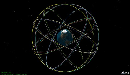
 

The GAO’s report on the state of the GPS system is causing some alarm among those in the satellite navigation and geolocation community:

 It is uncertain whether the Air Force will be able to acquire new satellites in time to maintain current GPS service without interruption. If not, some military operations and some civilian users could be adversely affected. (1) In recent years, the Air Force has struggled to successfully build GPS satellites within cost and schedule goals; it encountered significant technical problems that still threaten its delivery schedule; and it struggled with a different contractor. As a result, the current IIF satellite program has overrun its original cost estimate by about $870 million and the launch of its first satellite has been delayed to November 2009–almost 3 years late. (2) Further, while the Air Force is structuring the new GPS IIIA program to prevent mistakes made on the IIF program, the Air Force is aiming to deploy the next generation of GPS satellites 3 years faster than the IIF satellites. GAO’s analysis found that this schedule is optimistic, given the program’s late start, past trends in space acquisitions, and challenges facing the new contractor. Of particular concern is leadership for GPS acquisition, as GAO and other studies have found the lack of a single point of authority for space programs and frequent turnover in program managers have hampered requirements setting, funding stability, and resource allocation. (3) If the Air Force does not meet its schedule goals for development of GPS IIIA satellites, there will be an increased likelihood that in 2010, as old satellites begin to fail, the overall GPS constellation will fall below the number of satellites required to provide the level of GPS service that the U.S. government commits to. Such a gap in capability could have wide-ranging impacts on all GPS users, though there are measures the Air Force and others can take to plan for and minimize these impacts. In addition to risks facing the acquisition of new GPS satellites, the Air Force has not been fully successful in synchronizing the acquisition and development of the next generation of GPS satellites with the ground control and user equipment, thereby delaying the ability of military users to fully utilize new GPS satellite capabilities. Diffuse leadership has been a contributing factor, given that there is no single authority responsible for synchronizing all procurements and fielding related to GPS, and funding has been diverted from ground programs to pay for problems in the space segment. DOD and others involved in ensuring GPS can serve communities beyond the military have taken prudent steps to manage requirements and coordinate among the many organizations involved with GPS. However, GAO identified challenges to ensuring civilian requirements and ensuring GPS compatibility with other new, potentially competing global space-based positioning, navigation, and timing systems.

Cost overruns and a diminishing number of spacecraft engineers are likely the root causes.

Elliptical C-band Uplink Antennas

Friday, October 24th, 2008

Via Doug Lung’s RF Report:

In some cases, it isn’t possible to install an uplink dish that meets the FCC off-axis antenna pattern envelope. In the past, the FCC allowed operation of uplinks with non-compliant antennas upon a showing by the licensee that the effective isotropic radiated power (EIRP) would be reduced enough to keep the energy in side lobes below the level that would have existed using an uplink with a compliant dish at maximum power. This required a detailed engineering showing that often slowed FCC processing.

In the Eighth Report and Order and Order on Reconsideration (FCC 08-246), the FCC adopted an off-axis EIRP envelope approach as one method for applicants to apply for fixed satellite service (FSS) Earth stations using small antennas operating on conventional C and Ku-band frequencies.

It states, "This off-axis EIRP approach gives earth station applicants the flexibility to reduce their power levels to compensate for a small antenna diameter. Thus, using these envelopes as criteria for licensing should enable us to license more earth station applications routinely, expediting the provision of satellite services to consumers and enhancing the types of services available, without increasing the likelihood of harmful interference to adjacent satellite operators or to terrestrial wireless operators."

The Order adopts rules that facilitate the use of elliptical C-band uplink antennas. While the new rules do not specifically state that the major axis of the elliptical antenna be aligned with the geo-stationary orbit plane, the Order notes that "that starting the off-axis EIRP envelope at 1.5 degrees off-axis within the GSO orbital plane, and at 3.0 degrees outside that plane, has the same effect as requiring elliptical antennas to be aligned with the GSO plane in most cases."

The Satellite Industry Association (SIA) claimed that it is not possible to develop an off-axis EIRP envelope for analog video signals because the power density of such signals fluctuates. SES Americom opposed new analog regulations because the current rules are working well. The FCC decided to retain the current regulatory framework for analog services at this time. It dropped plans for eliminating analog video transmission over satellite entirely, noting, "The record in this proceeding has shown convincingly that requiring the transition from analog to digital video transmissions proposed in the Third Further Notice would be unreasonably expensive and burdensome."


GPS Beats Speeding Ticket

Friday, July 18th, 2008


Rocky Mountain Tracking‘s device is accurate. So good, in fact, it beat a police radar in court:

Eighteen-year-old Shaun Malone has a few people to thank for being able to plead "Not Guilty" to a speeding offence – his parents, who installed a GPS device in his car, and Rocky Mountain Tracking, the service provider of that device.
 
"Because of our GPS tracking data, Malone and his parents can protest the imposition of an unfair speeding ticket," says Brad Borst, Founder and President of Rocky Mountain Tracking, and who is also a former Police Officer.

A police radar had found Malone driving at 62 mph in a 45-mph zone. However, Malone’s parents, who had installed the Rocky Mountain Tracking GPS device in his car to monitor his driving, found that the device tracked him driving at, and not above, the speed limit.

The most telling testament to the accuracy of the Rocky Mountain Tracking Rover GPS tracking device came, ironically, from a GPS expert who originally helped find Malone guilty in a trial-by-affidavit. Dr. Stephen Heppe, the expert, had written a report affirming that, going by the GPS data, Malone had to have been traveling faster than 45 mph.

Read their blog for more detail. And Hot Hardware gets more from the expert:

While the police clocked him going 62-mph, the GPS’s data in fact showed him driving at the 45-mph speed limit. In an initial trial-by-affidavit, Malone was found guilty of speeding. GPS expert, Dr. Stephen Heppe wrote a report that essentially said that the GPS data was not accurate enough to contest the accuracy of the radar gun. Malone appealed the decision and had his day in court. At trial, things played out differently:

"However, when he took the stand to begin his testimony, Dr. Heppe corrected that written report, saying that the Rocky Mountain Tracking device was "very" accurate, to within a couple of meters on location and to within 1 mph on speed. Dr. Heppe also pointed out that the GPS device released instantaneous data, and not data averaged over a distance."

Needless to say, with Dr. Heppe’s revised testimony, Malone was found innocent of speeding.


Teenagers. Some learn about the danger of speeding the hard way, some know better before they start driving. Check out this kid in Kentucky:

Landon Wilburn, 11, grew tired of speeders zipping through his subdivision, so after growing hoarse shouting at them, he decided to take matters into his own hands.

The youngster, who used to shout at speeders to slow down as they drove through the Stone Lakes subdivision in Louisville, now has taken matters into his own hands.

Dressed in a reflective vest, wearing a bicycle helmet and armed with an orange Hot Wheels brand radar gun, he points and records the actual speed of passing traffic.

Landon also carries a flashlight with a built-in siren.

"When I saw it happening, I got the biggest kick out of it," said resident George Ayers, 61. "People were locking up their brakes when they saw him."


You can hack these toy radar guns, or you could really have some fun as-is.

Pool Hopping

Monday, June 23rd, 2008

It’s officially summer, and I’m feeling a bit nostaligic.

Like many kids who grew up in the suburbs, my memories are filled with ice-cream trucks, slip-and-slides, and…oh yeah…petty crime. Before images of vandalism start running through your mind, let me explain. My misdemeanors were of a more innocuous variety, namely pool-hopping:

pool hopping
Hoping from pool to pool; usually done at night, or during the day when people (pool owners) are working. It is the act of running to one neighbours pool jumping in, then running to another pool to jump in,, and continue the cycle.This is all done without getting caught(hopefully).

We all knew which houses in the neighborhood had the best pools, and, after some fence-scaling and other secret-agent-worthy tactics, we’d be cannon-balling into the deep end.

But these days the childhood pasttime is going high-tech. Groups of kids are using Google Earth to find pools and organizing their outings on Facebook.

Call me old-fashioned, but I agree with this guy. Between creating facebook groups and dodging motion detectors, all the technology has taken the fun out of it.

Atlas Launches ICO G1 Satellite

Tuesday, April 15th, 2008

Yesterday at 4:12 pm at Cape Canaveral, an Atlas 5 rocket successfully lifted ICO Global Communications‘ ICO G1 North American geosynchronous satellite, "a mobile communications satellite to assist and entertain Americans on the go."

The launch marked the first commercial flight in two years of an Atlast 5, and the carrying of its heaviest payload ever

 Weighing 14,625 pounds, the ICO G1 spacecraft was the heftiest payload ever launched by an Atlas rocket. Built by Space Systems/Loral, the craft stands over 27 feet tall, features a 39-foot-diameter mesh reflector antenna that will be unfurled in space and a pair of power-generating solar wings to span over 100 feet tip-to-tip once extended in orbit.

It’s a pretty bird, the G1:


 The ICO G 1 satellite belongs to the 2-GHz mobile systems, which are driving a growing segment of today’s satellite manufacturing industry.

ICO’s G 1 satellite is based on SS/L’s space-proven LS-1300 platform, which has an excellent record of reliable operation. Its high efficiency solar arrays and lightweight batteries are designed to provide uninterrupted electrical power. In all, SS/L satellites have amassed almost 1,200 years of reliable on-orbit service.

ICO G1 is a next-generation satellite designed to deliver a wide variety of interactive services to mobile and portable devices using ICO’s Mobile Interactive Media (ICO mim™).

The launch marks the first deployment of DVB-SH service in North America. DVB-SH is short for Digital Video Broadcasting – Satellite services to Handhelds; it’s "a physical layer standard for delivering IP based media content and data to handheld terminals such as mobile phones or PDAs, based on a hybrid satellite/terrestrial downlink."

ICO mim addresses a wide variety of consumers’ entertainment, information and two-way communication needs, including live and stored mobile TV in vehicles, interactive navigation, and roadside assistance, all with nationwide coverage.

ICO mim will also initially provide 10-15 channels of premium television content to portable, larger-screen (4.5- to 10-inch) user devices. Initial partners for the trial phase of ICO mim include Alcatel-Lucent.

For a demo video of ICO mim click here. To see the current state of DVB-H reployments, click here.

Here’s the launch video…

Host My Payload

Wednesday, February 27th, 2008


Very interesting news from California this morning about Space Systems/Loral and Northrop Grumman’s Space Technology division getting together to go after U.S. government business. Building spacecraft for fully-funded government projects can be more profitable than going after commercial projects. Sounds like a simple agreement:

"The agreement with Northrop Grumman will allow SS/L to cost-effectively add capacity to address increased near-term commercial satellite opportunities," said Pat DeWitt, chief executive officer, Space Systems/Loral. "The agreement will also streamline the process for our companies to collaborate on providing the world’s best satellites for both civil and defense applications."

"The resulting strategic agreement will be important to increasing our competitiveness. These initiatives will present win-win opportunities for both companies and our U.S. government customers," said Alexis Livanos, corporate vice president and president of the company’s Space Technology sector. "For some of our mission areas, we believe that assured access to SS/L’s 1300 bus and bus subsystems would improve our cost and delivery schedule competitiveness. In addition, hosted payloads hold the promise of providing us greater ability and flexibility to rapidly respond to our government customers’ evolving needs."

Some of these new opportunities included "hosted payloads" where specialized instruments or entire subsystems can be added on to a satellite bus whose primary mission is paying most of the build cost. Given the importance of the role space plays in today’s C4ISR systems (Command, Control, Communications, Computers, Intelligence, Surveillance and Reconnaissance), and the expected ends-of-life of the spacecraft currently in orbit, we’ll need a bunch of new launches in the short term. Factor in programs being behind schedule — with some going way over budget —  and you might conclude we have a problem, Houston. Intelsat General is going after this market, too.

Northrop Grumman is involved in a new moon mission for NASA, the LCROSS (Lunar CRater Observation and Sensing Satellite):


DIY Friday: GPS Tracking

Friday, February 22nd, 2008

GPS systems appear to be the newest must-have gadget. They were flying off the shelves in December:

Personal navigation devices are a hot gift to give this holiday season. Unit sales of GPS systems rose 488% over last year, according to the latest point-of-sale information from market research firm NPD Group.

And GPS providers are not planning to sit on this past year’s successes. Forbes.com list GPS chipsets as one of five "emerging technologies" of 2008:

GPS chipset provider, SiRF Technology Holdings is the company to beat in the personal navigation device space, with over 50% market share. The company is one of several gearing to battle it out for a piece of the next-generation cellular handset market.

Mobile phones are only starting to emerge as a high-growth market for GPS chipsets, which include the basic radio-frequency (RF) and GPS base-band chips. True, most handsets already incorporate the technology, but it goes largely unused because most network operators have been slow to roll out location-based services with broad consumer appeal.

The other reason GPS chipset suppliers have ignored the current generation of mobile handsets is Qualcomm, which has been packaging GPS capability into its mobile phone chips for the last seven years. The industry, however, is shifting from today’s global system for mobile communications and CDMA network standards toward 3G, or W-CDMA standards, and next generation-compatible handsets are forecast to see a compound annual growth rate of 22% over the next five years.

But you don’t need to wait for the market to marry GPS and cell-phone handsets. Turn your cell-phone into a GPS tracking device:

DIY GPS tracking with "disposable" phones – Mod a GPS enabled Nextel and fauxjack yourself…or your car, or your kid, or a big dog, or an elephant. We really, really want to track an elephant. Mologogo is a free service that will track a "friends" GPS enabled cell phone from another phone(gps not required) or on the web. It currently works on pretty much any Nextel phone with Java and GPS – even a $60 no-contract Boost Mobile phone.

Using any GPS-enabled phone with java and a supported provider (Nextel, Sprint, or Boost), you can install a free service called Mologogo and turn your phone into a tracking device.

What can Mologogo do?

From your phone or the web, Mologogo shows you where you and your friends are at any moment. If you are on the go, Mologogo can alert you when friends are close, search around for points of interest, and keep you updated with local traffic and weather. Mologogo even supports mobile chat, so you can reach out to your nearby friends instantly. If you are on your PC, you can see all of your friends – locations, sign up new friends, bookmark locations, and show your Mologogo location on your own web page or blog.

You control who can see your location – anything from the entire Mologogo community to a few select friends. The applications for this are endless: track your kid; use an old phone and a prepaid data plan to track your car or a package; see where friends are in a city; or track mobile employees. (I’m smelling a good marketing opportunity for a quick-delivery pizza chain.)

If you don’t have a Mologogo-capable phone, you can buy one for $80 bucks, maybe less. And, unlike some stand-alone commercial tracking solutions, the service is free (as long as your cell-phone has a data plan).

And the locator works very, very fast, as one MAKE commenter explains:

As for the phones: The reason you get GPS lock so quickly (which might make you think it’s fake) is that the tower gives the phone a breath-of-life packet, containing the current satellite almanac and possibly even the position of the PRN sequences, so the GPS chip can achieve lock almost instantly.

You can test this by taking the phone to an area with no Nextel towers (Montana and Mississippi work well) and telling it to acquire a GPS fix. It’ll take much longer (30-50 seconds typically), just like your Garmin, because it’s not getting help from a tower. But even in the complete absence of towers and service, the phone’s GPS chip does work just fine, and will happily feed NMEA 0183 data over the serial cable for your laptop’s mapping software.

Big GPS Gift

Wednesday, December 26th, 2007

Gorgeous day at the Cape last week, punctuated by a spectacular Delta launch for the USAF by the United Launch Alliance:

United Launch Alliance successfully launched a Delta II expendable launch vehicle today from Space Launch Complex 17-A at 3:04 p.m., EST carrying the Air Force’s GPS IIR-18(M) satellite. This launch marks the fifth mission for the Air Force this year and the 13th and final mission for ULA in 2007.

Following a nominal 1 hour and 8 minute flight, the rocket deployed the GPS IIR-18(M) spacecraft, the fifth modernized NAVSTAR Global Positioning System Block II R-M military navigation satellite. GPS is a space-based radio-positioning system nominally consisting of a minimum of 24-satellite constellation that provides navigation and timing information to military and civilian users worldwide.

"With the launch of GPS IIR-18(M), ULA completes a tremendously successful first year of operation and demonstrates its commitment to 100 percent mission success," said Mark Wilkins, vice president of Delta Programs. "As we continue to provide safe, cost-effective, reliable access to space, we are privileged to serve an important role in critical missions, such as GPS, which are force multipliers for our men and women in uniform serving our country throughout the world."

Designed to operate for 10 years, GPS satellites orbit the Earth every 12 hours, emitting continuous navigation signals. With the proper equipment, users can receive these signals to calculate time, location and velocity. In addition to its military use, GPS satellites provide directional assistance to civilian users around the world.

The ULA Delta II 7925-9.5 configuration vehicle featured an ULA first stage booster powered by a Pratt & Whitney Rocketdyne RS-27A main engine and nine Alliant Techsystems (ATK) strap-on solid rocket motors. An Aerojet AJ10-118K engine powered the second stage. A spin-stabilized Star-48B solid-rocket motor built by ATK boosted the third stage. The payload was encased by a 9.5-foot-diameter metallic payload fairing.

ULA began processing the Delta II launch vehicle in Decatur, Ala., nearly two years ago. In August 2007, the first stage arrived at Cape Canaveral Air Force Station from Decatur, followed by the second stage Sept. 19. The vehicle was erected on the stand at Pad 17-A, Nov. 5, with solid rocket motor installation completed by mid-November. Hundreds of ULA technicians, engineers and management worked to prepare the vehicle for the GPS IIR-18(M) mission.


Here’s the video: 

Where the heck am I?

Thursday, November 29th, 2007


Wow, now I know. Thanks to a new "killer app" from Google called My Location. The folks at AppleInsider see it:

New Google Maps feature could simulate GPS on iPhones

By Slash Lane

A new version of Google Maps introduced this week includes a beta feature dubbed My Location that was designed to simulate the GPS experience on mobile phones and handheld devices that do not include GPS hardware, like Apple’s iPhone.

Essentially, the My Location feature takes information broadcast from mobile towers near non-GPS equipped mobile phones to approximate the device’s current location on the map down to about 10 city blocks.

"It’s not GPS, but it comes pretty close (approximately 1000m close, on average)," the Mountain View, Calif.-based search giant explained on its website. "We’re still in beta, but we’re excited to launch this feature and are constantly working to improve our coverage and accuracy."

The My Location feature is currently available for most web-enabled mobile phones, including Java, BlackBerry, Windows Mobile, and Nokia/Symbian devices. However, it is not yet compatible with Apple’s iPhone.

Still, Apple has promised to continuously update and improve upon the feature set of its inaugural mobile handset, making it more than likely that the feature will turn up once it emerges from the beta stage.

For a more detailed explanation of My Location and a visual demonstration, please see the video below.


Just downloaded it on a BlackBerry and it works. Amazing.

“Breakthrough” Map of Antarctica

Wednesday, November 28th, 2007

When we blogged about the Vanco Arctic Survey—a detailed survey about the health of the North Pole cap in a climate of rapid melting—we had no idea that we’re in the middle of the International Polar Year. In that spirit, let’s head south and check-in on Antarctica:


The Landsat Image Mosaic of Antarctica (LIMA) brings "the coldest continent on Earth alive in greater detail than ever before through [a] virtually cloudless, seamless, and high resolution satellite view of Antarctica." According to NASA, by piecing together more than a thousand images from three years of Landsat satellite observations, the new map provides a realistic look at the continent in 10 times greater detail than ever before and offers the most geographically accurate, true-color, and high-resolution views of the continent possible." NASA is so excited that they argue the map will "revolutionize research of the continent’s frozen landscape."

These four frames show the evolution from the old imagery (MODIS) to the new (LIMA):

You can view the interactive image here.

Pan to view the continent and zoom in to see the stunning detail of this Natural-Color, Pan-Sharpened LIMA (bands 3, 2, 1). LIMA covers the entire continent except from the South Pole at 90 degrees south to 82.5 degrees south latitude, where Landsat has no coverage because of its near-polar orbit. To provide a continental view, the image above has LIMA 3, 2, 1 overlaying the MODIS Mosaic of Antarctica (MOA).

The opening view includes McMurdo Station, the largest research base in Antarctica. Located at the tip of Hut Point Peninsula on Ross Island, McMurdo has been continually operated by the United States of America since 1956. Ross Island is roughly 45 miles across. The flat, white areas are the Ross Ice Shelf and other sea ice off the coast of Antarctica. Also visible are the Erebus Glacier Tongue, Koettlitz and Ferrar Glaciers, and the Royal Society Range.

If your browser is giving you troubles, download the poster to view an overview map and detailed, up-close panels. Or, better yet, watch the pretty amazing HD fly-over videos that are available here.