Canadians Help Pakistan Buy Chinese Satellite

Pakistan just bought a shiny new satellite from China, with the help of Canadian company Telesat.

Pakistan says the satellite, called PakSat-1R, for Pakistan in 2011, will be used for domestic telecommunication and broadcast services. Contracts for the deal were signed last week with both the Pakistani President Asif Ali Zardari and Chinese President Hu Jintao present.

The satellite’s chief contractor is the China Great Wall Industry Corp. This is the third time that the corporation has launched a satellite for another country. In 2007, two satellites were launched for Nigeria.

China has also signed a deal to launch a communications satellite for Venezuela. Venezuelan President Hugo Chavez praised the project on a recent visit to China:

Venezuela’s Presidential Office also issued a statement in praise of the upcoming launch of the VENESAT-1 satellite, that will transmit telephone, Internet, video conferencing and other signals throughout the region from the Caribbean to Paraguay on South America’s southern tip.

More than 100 Venezuelans have been trained in China to operate the satellite, the office said.

"We will have a tool allowing us to say that there are no borders, or places in our region we cannot reach," the statement quoted Science and Technology Minister Nuris Orihuela, who was accompanying Chavez on his visit, as saying.

The satellite, also known as the Simon Bolivar after the Venezuelan-born South American independence hero, will be launched on Nov. 1 from western China’s Xichang launch site aboard a Chinese Long March 3B rocket.

The U.S. sees cause for concern in the rise of China’s satellite industry. The Defense Secretary has been charged with reviewing whether allowing companies with US defense contracts to launch satellites in China poses a national security threat. At the center of the debate is a bill signed into law just last week, the "Duncan Hunter National Defense Authorization Act for Fiscal Year 2009".

Satellite manufacturer Thales Alenia Space of Europe has built satellites that are free of U.S. parts, which are effectively barred from being shipped to China under U.S. International Traffic in Arms Regulations (ITAR) rules. Another company, OHB Technology of Germany, is designing a new satellite line with European Space Agency funds that is intended to include a so-called ITAR-free option for customers wanting to launch from China.

Space Systems/Loral, a major U.S. commercial satellite builder, has complained to U.S. government authorities that the ITAR-free option gives these European contractors an advantage because China’s rockets are less expensive to use than U.S., European or Japanese rockets.


DIY Friday: Drones/UAVs

Bear with me for a bit of childhood nostalgia: When I was little, I had this great toy plane. I used to go to the park with my dad on the weekends and fly it around. As I got a bit older and bolder, I’d try new maneuvers, often careening way too close to the trees. Well, inevitably I got a bit too careless and broke it. But this weekend, I’m bringing back the toy plane. And this time it’s gonna be bigger, badder, and well, just plain awesome.

First of all, the word “toy” doesn’t really apply to this week’s DIY project. It’s more like…special ops tool.

This site provides a wide range of options for your DIY drone, with prices to match your budget. Fellow DIY-ers post helpful tips and videos.

PBS’s “Wired Science” did a segment on the site last year:

If helicopters are more your style, check out the ARCHA project (automated remote control helicopter assistant).

Once your DIY drone is done, you can see how it compares to the versions the military really uses in the field. The AE Puma is the latest and greatest in military-grade technology.

The Puma is an upgrade from the RQ-11 Raven, which we posted about in August after it won the Commando Olympics in Afghanistan.

FCC to Open White Space Spectrum

Daily Wireless has the news that is sure to please advocates such as Google, Microsoft, and Motorola:

FCC Chairman Kevin Martin said today that he will support allowing conditional unlicensed use of the so-called “white spaces” television spectrum. During a press conference, Martin said that he was proposing to let carriers and other vendors deploy devices in white space spectrum which operates unlicensed at powers of 100 milliwatts.

His proposal would also permit use of white space on channels adjacent to existing television stations at powers of up to 40 milliwatts. The FCC is planning to officially vote on whether to allow unlicensed white space use during its Nov. 4 meeting pdf..

Martin said portable devices must have sensing technologies as well as a geo-location database. This would make sure the devices would be able to detect nearby broadcasts in order to avoid those frequencies.

Companies such as Google that are part of the Wireless Innovation Alliance are asking for the white spaces to be unlicensed and open to all.

Here’s a video from the Washington Post on testing mobile devices that use the white space spectrum:

So what exactly is white space?

White space in telecommunications refers to unused frequencies in the radio waves portion of the electromagnetic spectrum.

National and international bodies assign differing frequencies for specific uses, and in some cases license the rights to these. This frequency allocation process creates a bandplan which in some cases for technical reasons assigns white space between used bands to avoid interference. In this case, while the frequencies are unused they have been specifically assigned for a purpose.

In an opinion piece over at TVTechnology,  Frank Beacham argues that white space is an incredibly valuable public resource that could provide wireless broadband access for as little as $10 a month:

 Vacant space in TV Channels 5-51 is perfectly suited for cheap WiFi and other unlicensed wireless services. Failure to take advantage of this publicly owned resource would not only be an enormous waste, but eventually allow the spectrum to be tied up for far less noble purposes.

NAB lobbyists would have you believe that the use of wireless devices in these vacant slices of spectrum would cause interference and threaten the transition to terrestrial digital broadcasting. Sports leagues think the devices might cause static on wireless microphones and coaches’ headsets.

Perhaps they are right about the interference, at least at this early stage of the technology. But what doesn’t work now can be made to work. Sensors can detect which frequencies in an area have no usable TV signals and a device’s transmission can be limited to prevent it from interfering with occupied channels….

THE OTHER SIDE

The NAB, [Ben Scott, policy director of FreePress, a nonpartisan group advocating an open, independent media] said, is engaged in “a campaign of misinformation” to persuade Congress and regulators to ignore the huge potential of unused public airwaves. “In some communities, more than three-quarters of these ‘white spaces’ are vacant,” he said. “The social and economic benefits of utilizing these unused airwaves far outweigh the shortsighted fears of the broadcast industry.”

By using “false assumptions and twisted facts,” Scott said, the NAB is attempting to collapse the entire white spaces debate into a single test of prototype devices at the FCC.

Scott, as well as the high-tech companies advocating the unlicensed use of white space, argues that the FCC’s initial tests actually demonstrated the viability of the smart sensing technology to reduce interference. The tests are being used as a bogeyman in the public lobbying campaign.

It is dangerous, Beacham writes, to allow technical obstacles to cloud the big picture—which is setting important policy as to how a valuable public resource is to be used.

What do you think?


Bread & Satellites

If you’ve spent some time in Ann Arbor, Michigan, you may have come across a Zingerman’s — a host of specialty foods delis, restaurants and related businesses. They’re known for having one of the best mail-order breads in the U.S.


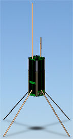
The University of Michigan’s Student Space Systems Fabrication Laboratory is working on a micro-satellite about the size of a loaf of bread. The story, via Space Daily, gives us more:

U.S. scientists say they are developing a satellite about the size of a loaf of bread that will be deployed to study space weather.

The National Science Foundation-funded project called Radio Explorer, or RAX, is being led by the University of Michigan and the SRI International Corp., a California independent research and technology development organization.

The satellite, called CubeSat, is to be the first free-flying spacecraft, and will be built, in part, by members of the university’s Student Space Systems Fabrication Laboratory.

CubeSats are approximately 4-inch cube-shaped devices that launch from inside a P-Pod — a special rocket attachment developed by California Polytechnic State University and Stanford University.

The RAX satellite will essentially be made of three CubeSats and will measure the energy flow in the Earth’s ionosphere, where solar radiation turns regular atoms into charged particles.

"This project will help us better understand space weather processes, how the Earth and sun interact and how this weather produces noise in space communication signals — noise that translates to lower quality telecommunications capabilities and error in GPS signals," said Assistant Professor James Cutler, a co-principal investigator with physicist Hasan Bahcivan of SRI.

The grants from the National Science Foundation, who use a less-imaginative "half gallon carton of milk" metaphor, hopes to develop more student interest in space, too:

The National Science Foundation (NSF) has awarded a grant to SRI International, an independent non-profit research and development organization based in Menlo Park, Calif., to carry out the first space weather CubeSat mission.

CubeSats are tiny satellites with dimensions of 10��10��10 centimeters, weighing about 1 kilogram, and typically using commercial off-the-shelf electronics components.

Developed through joint efforts, California Polytechnic State University and Stanford University introduced CubeSats to academia as a way for universities throughout the world to enter the realm of space science and exploration.

According to atmospheric scientists, CubeSats have the potential to be excellent platforms for technology development and small science missions, and promote student involvement in design, fabrication and flight missions.

"One of the goals is to help train future space scientists and aerospace engineers," said Therese Moretto Jorgensen, program director in NSF’s Division of Atmospheric Sciences. "CubeSats will also help answer questions in space weather such as the cause of disturbances in the ionosphere, and the rise and decay of the Earth’s radiation belts during geomagnetic storms."


SRI International’s team will include many, including support from NASA:

“SRI is excited about the NSF contract, and working in collaboration with the University of Michigan,” said Hasan Bahcivan, research physicist at SRI International. “This program provides a cost effective way to support space weather and atmospheric research. It is also well positioned to provide excellent training opportunities for students that hope to become engineers or scientists. We expect 20 to 30 students to take significant roles in the design, development, and science operations of the satellite.”

The project’s mission is designed to remotely explore small-scale ionization structures in the form of plasma turbulence that occurs in response to intense electrical currents in the space environment. The structures can adversely impact communication and navigation signals by perturbing the refractive index along the signal propagation paths. By utilizing signals from powerful transmitters on the ground and receiving the scattered signals in space, researchers are achieving effective and powerful space-based radar to probe these structures, which would be expensive to accomplish via a stand-alone satellite radar. 

"We have a multidisciplinary, cross-departmental team working on the project, that includes several engineers and faculty, and a large number of undergraduate and graduate students," said James Cutler, an assistant professor in the Aerospace Engineering Department at the University of Michigan. "My research laboratory will be partnering with several space-related classes and the Student Space Systems Fabrication Laboratory (S3FL) to build and fly RAX."   

The first launch opportunity for the NSF satellite program will be with the Department of Defense Space Test Program, and is scheduled for December 2009 aboard a Minotaur-4 launch vehicle out of Kodiak, Alaska. Commissioning and launch support for the mission will be provided by NASA Goddard Space Flight Center Wallops Flight Facility.

This is the kind of government support we need to develop the future of rocket science.


Solar Power From Space

The Washington Post had an intriguing article on Sunday, titled An Energy Fix Written in the Stars:

 Solar energy is a favorite of environmentalists, but it works only when the sun is shining. But that’s the trick. There is a place where the sun never sets, and a way to use solar energy for power generation 24 hours a day, 365 days a year: Put the solar cells in space, in high orbits where they’d be in sunshine all the time.

You do it with the solar power satellite (SPS), a concept invented by Peter Glaser in 1968. The idea is simple: You build large assemblages of solar cells in space, where they convert sunlight into electricity and beam it to receiving stations on the ground.

The solar power satellite is the ultimate clean energy source. It doesn’t burn an ounce of fuel. And a single SPS could deliver five to 10 gigawatts of energy to the ground continually. Consider that the total electrical-generation capacity of the entire state of California is 4.4 gigawatts.

Conservative estimates have shown that an SPS could deliver electricity at a cost to the consumer of eight to 10 cents per kilowatt hour. That’s about the same as costs associated with conventional power generation stations. And operating costs would drop as more orbital platforms are constructed and the price of components, such as solar voltaic cells, is reduced. Solar power satellites could lower the average taxpayer’s electric bills while providing vastly more electricity.

They would be big — a mile or more across. Building them in space would be a challenge, but not an insurmountable one: We already know how to construct the International Space Station, which is about the size of a football field. And the SPS doesn’t require any new inventions. We have the technology at hand.


The SPS was granted a pantent in 1973, according to Wikipedia:

In 1973 Peter Glaser was granted U.S. patent number 3,781,647 for his method of transmitting power over long distances (eg, from an SPS to the Earth’s surface) using microwaves from a very large (up to one square kilometer) antenna on the satellite to a much larger one on the ground, now known as a rectenna.

What’s a rectenna, you ask?

A rectenna is a rectifying antenna, a special type of antenna that is used to directly convert microwave energy into DC electricity. Its elements are usually arranged in a multi element phased array with a mesh pattern reflector element to make it directional.

A simple rectenna can be constructed from a Schottky diode placed between antenna dipoles. The diode rectifies the current induced in the antenna by the microwaves. Schottky diodes are used because they have the lowest voltage drop and highest speed and therefore waste the least amount of power due to conduction and switching.

Rectennas are highly efficient at converting microwave energy to electricity. In laboratory environments, efficiencies above 90% have been observed with regularity. Some experimentation has been done with inverse rectennas, converting electricity into microwave energy, but efficiencies are much lower—only in the area of 1%.

Here’s a good article from last July’s Scientific American on SPS in Japan, which also cites the Japanese animated series "Mobile Suit Gundam," which has humanity turning to space-based solar power in the year 2307:


Want to learn more? Check out the Citizens for Space Based Power blog.

The Far Side of the Moon

The Japanese Lunar Explorer, KAGUYA, has found a clear difference between the gravity on the far side of the moon and the near side. The discovery is significant because it is evidence of the different interior and thermal history of the two sides.

The lunar gravity field is estimated from radiowave tracking of spacecraft orbiting over the lunar surface. Since the far side of the Moon cannot be observed from the Earth, spacecraft over the far side of the Moon cannot be tracked directly.

Previously the far side gravity of the Moon was obtained basically from the extrapolation of the spacecraft orbit over the near side. KAGUYA has two subsatellites (the relay subsatellite OKINA and VLBI subsatellite OUNA) for the far side gravity measurement.

Since OKINA relays and transmits Doppler tracking signals of radiowave between the main satellite over the far side and the ground radio antenna, the orbits of the main satellite can be determined precisely. Thus we can obtain the accurate far side gravity field of the Moon.

So, what exactly is the “far side of the moon” anyway?

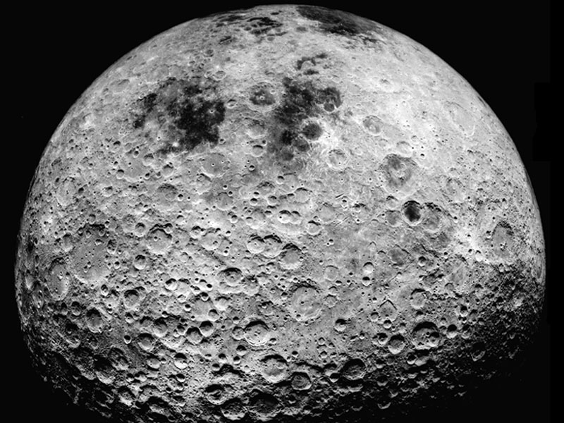
The far side of the Moon is the lunar hemisphere that is permanently turned away from the Earth. The far hemisphere was first photographed by the Soviet Luna 3 probe in 1959, and was first directly observed by human eyes when the Apollo 8 mission orbited the Moon in 1968. The rugged terrain is distinguished by a multitude of crater impacts, as well as relatively few lunar maria. It includes the largest known impact feature in the Solar System: the South Pole-Aitken basin.

The findings from the KAGUYA explorer were presented by Dr. Sho Sasaki of National Astronomical Observatory of Japan at the 40th annual meeting of the Division for Planetary Sciences of the American Astronomical Society.

KAGUYA was the same explorer that brought us the first High-Def images of Earth last year.

DIY Friday: Get a Space Prize

Taking a break from the usual how-to entries, today will be an inspirational DIY-Friday. If high-schooler can create devices launched into space, you can do anything, right?

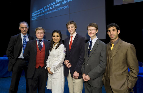
A team of students from UK’s Shrewsbury school won a contest to design a device that will be launched on a British-built satellite in 2010:

The competition, launched earlier this year, challenged teams of 14-19-year-olds to design and build a small, compact satellite instrument.

The experiment will be flown as an additional payload on a low-Earth orbiting satellite being built by SSTL.

Conceived by Dr Stuart Eves, from the satellite company, it was set up as an initiative to boost interest in space science among young people.

The winning entry will be given a developmental budget of up to £100,000.

The winning decice is called POISE, “which will measure variations in the ionosphere – the outermost layer of the atmosphere.” It could have a pretty big impact (especially for a few teenagers):

Dr Eves praised all the finalists. He said of the winning entry: “We’re very excited about the potential for the experiment, since, in addition to supporting navigation safety, some scientists in the US and Taiwan think variations in the ionosphere might also help provide indications of impending earthquakes”.

The prize was announced by Soyeon Yi, the Korean astronaut, who you may remember from this post.

Inspired? If so, get to work. There are lots of other space prizes out there – for both high schoolers and adults. This site puts together the list, or follow a blog dedicated to these micro-space-races here. The Moonbuggy race may be the coolest. Yes, even cooler than an ionosphere variation measurer.

Looks Like Kutztown


Copyright © 2008 GeoEye


GeoEye-1’s first image released of Kutztown University in Pennsylvania:

GeoEye, Inc. (NASDAQ: GEOY), a premier provider of satellite, aerial and geospatial information, released today the first, color half-meter ground resolution image taken from its GeoEye-1 satellite. The satellite has been undergoing calibration and check-out since it was launched on Sept. 6 from Vandenberg Air Force Base in Calif. The Company will begin selling GeoEye-1 imagery products later this fall.

The Kutztown University image shows the campus, which includes academic buildings, parking lots, roads, athletic fields and the track-and-field facility. The image was collected at 12:00 p.m. EDT on Oct. 7, 2008 while GeoEye-1 was moving north to south in a 423-mile-high (681 km) orbit over the eastern seaboard of the U.S. at a speed of four-and-one-half miles per second. GeoEye-1 was built by General Dynamics Advanced Information Systems in Gilbert, Ariz. The imaging system was built by ITT in Rochester, NY.


I Want My MobileTV

Let’s talk about Solaris.

No, we don’t mean the Sun Microsystems operating system for Web servers (for which there is now OpenSolaris anyhow), nor the solar-powered roadway studs that go by the same name.

We’re talking about Solaris Mobile, the joint venture between ASTRA and Eutelsat — competitors in providing satellite TV in Europe who are now partners in launching an S-band based service.


TerreStar, it turns out, is after the same spectrum:

Following the Oct 6 announcement that the Solaris Mobile SES Astra/Eutelsat joint-venture is seeking to win access to the 2GHz S-Band for DVB-H transmission over Europe comes news that TerreStar Europe is also bidding for the same capacity.

TerreStar Europe is a subsidiary of TerreStar Networks, a Virginia-based business (and NASDAQ registered) that is seeking to operate integrated satellite and terrestrial telecoms systems. The business was originally called Motient, and it is a direct successor to American Mobile Satellite Ventures. A couple of weeks ago TerreStar sold off its stake in rival SkyTerra for $123m. TerreStar already has a nationwide roaming agreement with AT&T throughout the USA, for example.

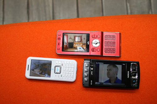
Here’s the pitch for Solaris (opens in PDF). It’s similar to satellite radio in the U.S., such as the now- combined Sirius XM, which offers Backseat TV — one of a half-dozen ways of getting mobile TV in the U.S.

Solaris Mobile will use Eutelsat’s W2A satellite, scheduled for early 2009, and a very large spacecraft:

Based on the Alcatel Alenia Space Spacebus 4000C4 platform, W2A’s missions also comprise up to 46 transponders in Ku-band and a C-band payload of 10 transponders. Designed with a lifetime of more than 15 years, W2A has a maximum launch mass of 5.7 tonnes and will deliver 11 kW of payload power. 

Eutelsat has also just announced they will have two spacecraft as Arianespace’s payload at the end of November — one of many launches over the next three months worldwide.

(Check out our previous posts on Mobile TV here, here and here.)

Sirius Radio on an iPhone


Sirius Satellite Radio subscribers have the priviledge to listen via Internet audio streams. It was only a matter of time before an iPhone app was created: uSirius.

Follow the discussion on Sirius Backstage.